Győr-Pér Airport is a public commercial airport near Győr, Hungary.
The Markaziy Stadium Qarshi is a multi-use football stadium in Qarshi, Uzbekistan. It is currently used mostly for football matches and serves as the home for Nasaf Qarshi

Čakanovce is a village and municipality in the Lučenec District in the Banská Bystrica Region of Slovakia.
Clam is an unincorporated community of about 57 residents in Accomack County, Virginia, United States. Clam is located at 37°48′49″N75°40′13″W.

Boston is a census-designated place (CDP) in Accomack County, Virginia, United States. The population as of the 2010 Census was 504.

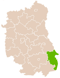
Cyncynopol is a village in the administrative district of Gmina Biłgoraj, within Biłgoraj County, Lublin Voivodeship, in eastern Poland. It lies approximately 8 kilometres (5 mi) north-east of Biłgoraj and 73 km (45 mi) south of the regional capital Lublin.
Białogorce is a village in the administrative district of Gmina Krynki, within Sokółka County, Podlaskie Voivodeship, in north-eastern Poland, close to the border with Belarus.

İkinci Şordəhnə is a village in the Agdash Rayon of Azerbaijan.

Jakubów is a village in the administrative district of Gmina Rawa Mazowiecka, within Rawa County, Łódź Voivodeship, in central Poland. It lies approximately 7 kilometres (4 mi) north-east of Rawa Mazowiecka and 59 km (37 mi) east of the regional capital Łódź.
Stare Zakole is a village in the administrative district of Gmina Mińsk Mazowiecki, within Mińsk County, Masovian Voivodeship, in east-central Poland.
Dębsko-Ostoja is a village in the administrative district of Gmina Koźminek, within Kalisz County, Greater Poland Voivodeship, in west-central Poland.
Łopiszewo is a village in the administrative district of Gmina Ryczywół, within Oborniki County, Greater Poland Voivodeship, in west-central Poland.

Ryczywół is a village in Oborniki County, Greater Poland Voivodeship, in west-central Poland. It is the seat of the gmina called Gmina Ryczywół. It lies approximately 19 kilometres (12 mi) north of Oborniki and 47 km (29 mi) north of the regional capital Poznań.

Pospólno is a village in the administrative district of Gmina Strzałkowo, within Słupca County, Greater Poland Voivodeship, in west-central Poland. It lies approximately 2 kilometres (1 mi) north of Strzałkowo, 5 km (3 mi) north-west of Słupca, and 62 km (39 mi) east of the regional capital Poznań.
Pusztaapáti is a village in Zala County, Hungary.

Archaeological site in Oman.
Vareslaid is an island belonging to the country of Estonia.
Porter Springs, also known as Porter's Springs, is an unincorporated community in Houston County, Texas, United States. It was settled before the Civil War. In the 1870s, a school and Bethlehem Baptist Church were established. In the 1930s, it had three churches, two segregated schools, and a population of 50. The population in 2000 was 50.

Erasmus Hospital is a hospital in the Anderlecht municipality of Brussels, Belgium. It is a teaching hospital associated with the Université libre de Bruxelles (ULB), and was opened in 1977. It has 858 beds and 3000 staff, treating 26,000 inpatients and 260,000 outpatients each year.
Retreat Passage is a short strait and marine waterway between Gilford Island (E) and Bonwick Island (W) in the Broughton Archipelago of the eastern Queen Charlotte Strait region of the Central Coast of British Columbia, Canada.


