
Blorenge, also called The Blorenge, is a prominent hill overlooking the valley of the River Usk near Abergavenny, Monmouthshire, southeast Wales. It is situated in the southeastern corner of the Brecon Beacons National Park. The summit plateau reaches a height of 1,841 feet (561 m).
Dinas Rock is a high promontory of Carboniferous Limestone which rises between the Afon Mellte and its left-bank tributary, the Afon Sychryd on the border between the county of Powys and the county borough of Neath Port Talbot in south Wales. It can be found near the village of Pontneddfechan near Glyn Neath at the head of the Vale of Neath. It derives its name from the presence of Iron Age earthworks on its summit, dinas in Welsh signifying a defensive site or "city".

Cefn yr Ystrad is a mountain in the Brecon Beacons National Park in Wales. It is an outlier of the Central Beacons group.
The Nedd Fechan is a river almost wholly within the county of Powys, Wales, currently administered as part of the unitary authority of Powys. It rises on the eastern slopes of Fan Gyhirych in the Fforest Fawr section of the Brecon Beacons National Park and flows south for 7 miles (12 km) to join with the Afon Mellte at Pontneddfechan, their combined waters continuing as the River Neath to the sea near Swansea. The only significant tributary of the Nedd Fechan is the Afon Pyrddin which joins it at Pwll Du ar Byrddin. Downstream of this confluence it forms the boundary between Powys to its east and Neath Port Talbot to its west.

Cribarth, sometimes referred to as the Sleeping Giant, is a hill in the Brecon Beacons National Park, Powys, Wales, in the traditional county of Brecknockshire. The summit lies on the broken ridge at an elevation of 428 m (1,404 ft) at OS grid reference SN 831143. To its west is a 426-metre-high (1,398 ft) rounded top at SN 829144 which lies just to the northwest of a mile-long ridge that forms the main bulk of the hill. The ridge attains a height of 423 m (1,388 ft) at its southwest end and this spot is marked by a trig point. Both of these latter high points are adorned by Bronze Age burial cairns.

Mynydd Llangatwg or Llangattock Mountain is a hill in the Brecon Beacons National Park in the county of Powys, south Wales. It is named from the village of Llangatwg which sits in the valley of the River Usk to the north of it. It is essentially an undulating plateau rising in the west to a height of 530 metres (1,740 ft) at grid reference SO171157 and in the east to a height of 529 metres (1,736 ft) at Hen Dy-aderyn / Twr Pen-cyrn. This spot is marked by a trig point. The shallow pool of Pwll Gwy-rhoc sits in a broad depression towards the northern edge of the plateau whilst a smaller pool frequently occupies a large shakehole a few hundred metres to its west. The hill forms an impressive northern scarp overlooking the Usk valley and commonly referred to as the Llangattock Escarpment. Its southern margins are more subdued. Its eastern end is defined by the drops into the Clydach Gorge. Beyond the B4560 to the west the hill merges with Mynydd Llangynidr which has a similar character.
Mynydd Llangynidr is a mountain in the Brecon Beacons National Park largely in the county of Powys, south Wales. Its southern slopes extend into the northernmost parts of the county borough of Blaenau Gwent. It is named from the village of Llangynidr which sits in the valley of the River Usk to the north of it. It is essentially an undulating plateau rising in the west to a height of 557m at Garn Fawr at OS grid ref SO 123151. A secondary high point is achieved at a point marked by a trig point at SO 147159. To the north the hill overlooks the valleys of Dyffryn Crawnon and Cwm Claisfer, themselves tributary valleys of the Usk. The shallow upper valley of the Ebbw River reaches into the plateau in the southeast whilst the upper reaches of the Sirhowy Valley and its tributary the Nant Trefil define its western margins. A further tributary, the Nant Milgatw, reaches in from the south whilst the sharp edge of Rassau Industrial Estate also defines a part of its southern margin. Passing east across the B4560, the hill merges with Mynydd Llangatwg which has a similar character.

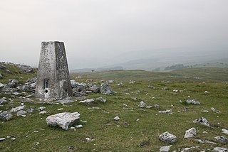
Tair Carn Uchaf is a hill in the Brecon Beacons National Park in the county of Carmarthenshire, Wales. Its summit sits atop a plateau-like ridge at 482 metres (1,580 ft) above sea level and is marked by one of the three huge cairns which give the mountain its name.

Garreg Las is a subsidiary summit of Fan Brycheiniog in the Brecon Beacons National Park in Carmarthenshire, southern Wales. Its summit sits towards the northern end of a broad north-south ridge, Esgair Hir, at 635 metres (2,083 ft) above sea level. The hill is sometimes referred to as Twyn Swnd.

Foel Fraith is a hill in the Black Mountain in the county of Carmarthenshire, southwest Wales. It lies within the Brecon Beacons National Park and Fforest Fawr Geopark. Its plateau-like summit attains a height of 602 metres (1,975 ft) above sea level. To the north the subsidiary summit of Cefn y Cylchau reaches 556 feet (169 m), and to the southeast is the subsidiary summit of Carn Fadog or Cefn Carn Fadog, which reaches a height of 512 metres (1,680 ft).
Cefn Cil Sanws is a hill in the Brecon Beacons National Park within the county borough of Merthyr Tydfil in south Wales. The summit at 460m above sea level is crowned by a trig point. The steep cliffs of Darren Fawr and Darren Fach defend its western side which drops down into Cwm Taf. A major limestone quarry is worked on the southeastern side of the hill. An unexpected feature at this altitude is Merthyr Tydfil Golf Course which extends high onto the eastern and southern slopes of the hill.
Cadair Fawr is a hill in the northern corner of the county borough of Rhondda Cynon Taf, Wales. It lies within the Brecon Beacons National Park and Fforest Fawr Geopark. The 485m high summit at OS grid ref SN 978123 is marked by a trig point. Cadair Fawr is the highest point of a broad ridge known as Cefn Cadlan which forms the northern edge of Cwm Cadlan, a valley which itself runs east-northeastwards from the village of Penderyn. The name Cadair Fawr signifies the 'big chair' whilst Cefn Cadlan signifies the 'ridge of the battlefield'.

Mynydd-y-glog is a hill just east of the village of Penderyn in the northern corner of the county borough of Rhondda Cynon Taff in south Wales. It lies within the Brecon Beacons National Park and Fforest Fawr Geopark. Its summit plateau rises to a height of 389m / 1277 ft at OS grid ref SN 982088, a spot marked by a trig point. To its north lies the partly dry valley of Pant Sychbant which forms the eastern extension of Cwm Cadlan. Its southern slopes are drained by various streams which feed into the Afon Cynon.

Carreg Dwfn is a hill four miles southeast of Llandeilo and just to the south of the village of Trap in the county of Carmarthenshire, south Wales. It lies at the western extremity of the Brecon Beacons National Park and Fforest Fawr Geopark. Its summit at 283 metres (928 ft) is towards the eastern end of a rocky east-west-aligned ridge.

Carreg Cadno is a hill five miles northeast of Abercraf in the county of Powys, south Wales. It lies within the Brecon Beacons National Park and Fforest Fawr Geopark. Its summit at OS grid ref SN 874161 reaches a height of 538m / 1763 ft above sea level. The hill is within the Ogof Ffynnon Ddu National Nature Reserve which is owned and managed by the Countryside Council for Wales.

Mynydd Llangorse is a hill on the western edge of the Black Mountains in the Brecon Beacons National Park in Powys, south Wales. It lies two miles east of Llangors and its lake and 5 miles south of Talgarth. Its summit at 515m overtops the location 600m to the south at which a trig point is sited by 9m. The broad spur of Cefn Moel extends south towards the village of Bwlch whilst a spur to the southeast forms Pen Tir which reaches just over 450m above sea level. It is a Marilyn with a prominence of 161 metres.

Gilwern Hill is a 441 m high hill in the Brecon Beacons National Park, south of the village of Gilwern in Monmouthshire, Wales. It lies west of the Blorenge. The hill is a Site of Special Scientific Interest.
This article describes the geology of the Brecon Beacons National Park in mid/south Wales. The area gained national park status in 1957 with the designated area of 1,344 km2 (519 sq mi) including mountain massifs to both the east and west of the Brecon Beacons proper. The geology of the national park consists of a thick succession of sedimentary rocks laid down from the late Ordovician through the Silurian and Devonian to the late Carboniferous period. The rock sequence most closely associated with the park is the Old Red Sandstone from which most of its mountains are formed. The older parts of the succession, in the northwest, were folded and faulted during the Caledonian orogeny. Further faulting and folding, particularly in the south of the park is associated with the Variscan orogeny.
Mynydd Garnclochdy is a gentle summit on the long moorland ridge which extends south from Blorenge towards Pontypool and which defines the boundary between the modern county of Monmouthshire to the east and the county borough of Torfaen to the west though historically it was entirely within the traditional county of Monmouthshire. Its summit, at a height of 448 m (1407 ft), is marked by a small cairn. The summit and the eastern slopes of the hill fall within the Brecon Beacons National Park. A southern top of the hill, Mynydd Garn-wen achieves a height of 436m, and carries a trig point further south again at an elevation of 425m. To the north the broad moorland ridge runs via a poorly defined 425m top and a col at 404m elevation just south of a minor east–west road, into Mynydd y Garn-fawr, east of Blaenavon.
