Mogome

Last updated

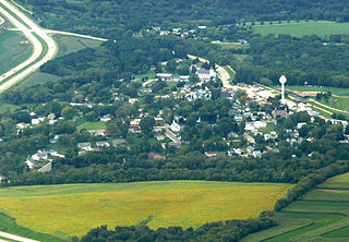
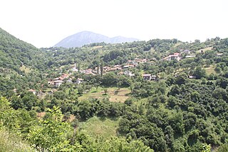
Mogome is a village in Central District of Botswana. The village is located locate along the road connecting Palapye and Mahalapye, approximately at a distance of 50 km from either town. Mogome has a primary school, and the population was 371 in 2001 census. [1]

Central District (Botswana) District in Botswana

Central is the largest of Botswana's districts in terms of area and population. It encompasses the traditional homeland of the Bamangwato people. Some of the most politically connected Batswana have come from the Central District, including former President Sir Seretse Khama, former President Festus Mogae, and current President Lt. General Seretse Ian Khama. The district borders the Botswanan districts of Chobe in the north, North-West in the northwest, Ghanzi in the west, Kweneng in southwest, Kgatleng in the south and North-East in the northeast, as well as Zimbabwe also in the northeast and South Africa in the southeast.

Botswana republic in southern Africa

Botswana, officially the Republic of Botswana, is a landlocked country in Southern Africa. Formerly the British protectorate of Bechuanaland, Botswana adopted its new name after becoming independent within the Commonwealth on 30 September 1966. Since then, it has been a representative republic, with a consistent record of uninterrupted democratic elections and the best perceived corruption ranking in Africa since at least 1998. It is currently Africa's oldest continuous democracy.

Palapye Place in Central District, Botswana

Palapye is becoming a large town in Botswana, situated about halfway between Francistown and Gaborone. Over the years its position has made it a convenient stopover on one of Southern Africa's principal north–south rail and road routes.

Related Research Articles

Nilwood, Illinois Town in Illinois, United States

Nilwood is an incorporated town in Macoupin County, Illinois, United States. The population was 284 at the 2000 census.

Eagle, Michigan Village in Michigan, United States

Eagle is a village in Clinton County in the U.S. state of Michigan. The population was 123 at the 2010 census.

Nakaibito, New Mexico CDP in New Mexico, United States

Nakaibito is a census-designated place (CDP) in McKinley County, New Mexico, United States. The population was 455 at the 2000 census.

Glen Park, New York Village in New York, United States

Glen Park is a village in Jefferson County, New York, United States. The population was 502 at the 2010 census. The village is on the border of the towns of Brownville and Pamelia and is immediately northwest of Watertown.

Robbinsville, North Carolina Town in North Carolina, United States

Robbinsville is a town in Graham County, North Carolina, United States. The population was 620 at the 2010 census. It is the county seat of Graham County.

Middleport, Ohio Village in Ohio, United States

Middleport is a village in Meigs County, Ohio, United States, along the Ohio River. The population was 2,530 at the 2010 census.

Caledonia, Wisconsin Village in Wisconsin, United States

Caledonia is a village in Racine County, Wisconsin, United States. The population was 24,705 at the 2010 census. The residential community of Franksville is located within the village. Franksville was a former census-designated place. The residential neighborhood of Husher is also located within the village.

Ridgeway, Wisconsin Village in Wisconsin, United States

Ridgeway is a village in Iowa County, Wisconsin, United States. The population was 653 at the 2010 census. The village is adjacent to the Town of Ridgeway. It is part of the Madison Metropolitan Statistical Area.

Hukuntsi Place in Kgalagadi District, Botswana

Hukuntsi is a village in Kgalagadi District (Kalahari) in Botswana.

Mathabhanga City in West Bengal, India

Mathabhanga is a city and a municipality in Cooch Behar district in the Indian state of West Bengal. It is the headquarters of the Mathabhanga subdivision.

Rudniki, Lublin Voivodeship Village in Lublin, Poland

Rudniki is a village in the administrative district of Gmina Międzyrzec Podlaski, within Biała Podlaska County, Lublin Voivodeship, in eastern Poland.

Włynkówko Village in Pomeranian, Poland

Włynkówko is a village in the administrative district of Gmina Słupsk, within Słupsk County, Pomeranian Voivodeship, in northern Poland. It lies approximately 5 kilometres (3 mi) north-west of Słupsk and 107 km (66 mi) west of the regional capital Gdańsk.

Karasuwa LGA in Yobe State, Nigeria

Karasuwa is a Local Government Area in Yobe State, Nigeria. Its headquarters are in the town of Jajimaji on the Hadejia River at 12°53′57″N10°48′28″E.

Lukavica (Dimitrovgrad) Village in Pirot District, Serbia

Lukavica is a village in the municipality of Dimitrovgrad, Serbia. According to the 2002 census, the village has a population of 429 people.

Ljiljance Village in Pčinja District, Serbia

Ljiljance is a village in the municipality of Bujanovac, Serbia. According to the 2002 census, the town has a population of 535 people.

Stanovi (Brčko) Village in Brčko, Bosnia and Herzegovina

Stanovi is a village in the municipality of Brčko, Bosnia and Herzegovina.

Prevrać Village in Republika Srpska, Bosnia and Herzegovina

Prevrać is a village in the municipality of Foča, Republika Srpska, Bosnia and Herzegovina.

Gornja Vratna Gora Village in Konjic, Bosnia and Herzegovina

Gornja Vratna Gora is a village in the municipality of Konjic, Bosnia and Herzegovina.

Donje Gire Village in Republika Srpska, Bosnia and Herzegovina

Donje Gire is a village in the municipality of Sokolac, Bosnia and Herzegovina.

Zukići (Konjic) Village in Federation of Bosnia and Herzegovina, Bosnia and Herzegovina

Zukići is a village in the municipality of Konjic, Bosnia and Herzegovina.

References

Coordinates: 22°48′28″S26°59′56″E / 22.80778°S 26.99889°E / -22.80778; 26.99889

Geographic coordinate system Coordinate system

A geographic coordinate system is a coordinate system that enables every location on Earth to be specified by a set of numbers, letters or symbols. The coordinates are often chosen such that one of the numbers represents a vertical position and two or three of the numbers represent a horizontal position; alternatively, a geographic position may be expressed in a combined three-dimensional Cartesian vector. A common choice of coordinates is latitude, longitude and elevation. To specify a location on a plane requires a map projection.