
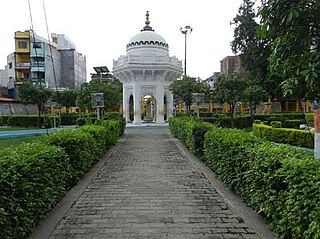
Ghazipur is a city in the state of Uttar Pradesh, India. Ghazipur city is the administrative headquarters of the Ghazipur district, one of the four districts that form the Varanasi division of Uttar Pradesh. The city of Ghazipur also constitutes one of the seven distinct tehsils, or subdivisions, of the Ghazipur district.
Ballia is a city with a municipal board in the Indian state of Uttar Pradesh. The eastern boundary of the city lies at the junction of two major rivers, the Ganges and the Ghaghara.The city is situated 140 km (87 mi) east of Varanasi and about 380 km from the state capital Lucknow. It has a protected area, the Jai Prakash Narayan bird sanctuary. Ballia is also around 4 km (2.5 mi) away from Bihar.

Etah district is one of the districts of Uttar Pradesh, India, since 1854. Etah City is the district headquarters. Etah district is a part of Aligarh Division.
Bilariaganj is the second largest city and a Nagar Palika Parishad in Azamgarh division after its capital city Azamgarh in the state of Uttar Pradesh, India.
Kerakat or Kirakat is a town and nagar panchayat in Jaunpur district of the Indian state of Uttar Pradesh with a population of approximately 13,500. It is situated near the Gomati River, which helps the land around the town stay very fertile. Kerakat or Kirakat forms a part of Varanasi Division. It is located 30 km east of the city of Jaunpur and 279 km from Lucknow, the capital of Uttar Pradesh.
Rabupura is a town and a nagar panchayat in Jewar Tehsil, Gautam Buddha Nagar district in the Indian state of Uttar Pradesh. It is situated on Yamuna Expressway. A new Film City is planned at Rabupura by the Yamuna Expressway Industrial Development Authority (YEIDA).
Saidpur is a town and a nagar panchayat in the Ghazipur district of the Indian state of Uttar Pradesh with the pin code 233304. The nearest railway station is in Aunrihar Junction. Aunrihar is a main hub for travelling, business, politicians and the site of the Temple of Varah-Bhagwan.
The Great Sherpur is a region or a pargana of 'Shankarwar Vansh' in the Mohammadabad tehsil of Ghazipur district in Uttar Pradesh. It consists of Sherpur Kalan, Sherpur Khurd, Semra, Firozpur, villages which were established by the descendants of Dullah Rai. It has population of 31322 as per 2011 Census.

Yusufpur and Mohammadabad is a Twin Town/Qasba in Mohammadabad Tahsil of the Ghazipur district of Uttar Pradesh, India.It belongs to Varanasi Division. Coordinates: 25°37′22″N 83°45′27″E It is located 21 km East of District head quarters Ghazipur and 347 km from the state capital, Lucknow. It borders the Ballia District, Mau District and Buxar District of Bihar. Yusufpur has a railway station which lies on the railway line linking Varanasi to Chhapra via Ghazipur and Ballia in the North Eastern Railway Zone. Yusufpur was founded by Qazi Ahmed Ansari in 1593.
Khardiha is a village in the Karail area of the Mohammadabad tehsil in Ghazipur district, Uttar Pradesh, India. It has population of 1896 as per 2011 Census. It has its own local administration under Panchayati Raj system, with Gram Pradhan as head of local administration. Since the very beginning this village has been an important center of education and cultural activities.
Bhimapar is a village and a Gram panchayat in Ghazipur district of Uttar Pradesh, India. Bhimapar is a developing and new face town. It is 57 km from Varanasi and 57 km from Ghazipur.
Ratanpura is a census town in the Mau district of Uttar Pradesh. It is located about 25 kilometres east of the district headquarters, Mau, and 47 Kilometres west of Ballia. It is a development block headquarter, which comes under the Mau Sadar Tehsil. The town is situated between the middle of Mau and Ballia. The State Highway 34 passes through Ratanpura. Earlier it was a part of Ballia district, but since 19 November 1988 it became the part of newly constituted Mau District. The town has its own Railway station managed by North Eastern Railway (India) in its name which has connecting trains to Mau, Varanasi, Ballia, Lucknow, Kanpur, Azamgarh, Chhapra and Dhanbad stations to name a few.
Joga Musahib is a village located in the Karail area of Mohammadabad tehsil in Ghazipur district in the Indian state of Uttar Pradesh. It had a population of 3,612 in the 2011 Census. Its local administration follows the Panchayati Raj system.
Kundesar is a village in Ghazipur district, Uttar Pradesh. It has a population of 4602 per the 2011 Census. Having a history of five hundred years, this village has rich heritage of the Kinwar clan. Kundesar has got special mention in the gazetteers of Ghazipur since 1781. Kundesar is situated on the Ghazipur–Patna National Highway 19.

Karimuddinpur is a village located in Mohammadabad tehsil of Ghazipur district, Uttar Pradesh, India with a total of 1,738 families residing. The Karimuddinpur village has a population of 10,161 as per Population Census 2011.
Rajapur is a village in Mohammadabad Tehsil in Ghazipur District of Uttar Pradesh State, India. It belongs to Varanasi Division. It is located 28 km towards east from District headquarters Ghazipur. Rajapur has total 835 families residing. The Rajapur village has population of 4872 of which 2487 are males while 2385 are females as per Population Census 2011.
Firozpur Kalan is a village located in Mohammadabad tehsil of Ghazipur district, Uttar Pradesh. It has total 316 families residing. Firozpur has population of 2167 as per Population Census 2011. This village belongs to Varanasi Division. It is located at distance of 13 km towards East from District headquarters Ghazipur, 6 km towards west from Mohammadabad tehsil and at a distance of 357 km towards east from State capital Lucknow.

Bisauri is a village of the Jaunpur district, Uttar Pradesh, Northern India. Bisauri's Postal Index Number is 222129 and its post office is at Patrahi. The village is also a Gram Panchayat, comprising itself and the village of Tiwaripur.
Mohammadabad is a constituency of the Uttar Pradesh Legislative Assembly, and a segment of Ballia Lok Sabha constituency, covering the city of Mohammadabad in the Ghazipur district of Uttar Pradesh, India. It should not be confused with the assembly segment Muhammadabad-Gohna which falls under Ghosi Lok Sabha seat in Mau district.
Semra is a village in Ghazipur district. Rampur village is located across the Ganges opposite Semra. Both these villages are jointly called Rampur-Semra by the locals. Semra village comes under Sherpur gram panchayat of Mohammadabad tehsil. The population of this village is around 5500 while the number of voters is 3800.
