
Barmer District is a district in Rajasthan state of India. It is located in the western part of Rajasthan state forming a part of the Thar Desert. Barmer is the third largest district by area in Rajasthan and fifth largest district in India, occupying an area of 28,387 km2. Being in the western part of the state, it includes a part of the Thar Desert. Jaisalmer is to the north of this district while Jalore is in its south. Pali and Jodhpur form its eastern border and it shares a border with Pakistan in the west. Partially being a desert, this district has a large variation in temperature. The temperature in summer can rise up to 51 °C and falls near to 0 °C in winter. Luni is the longest river in Barmer district. After travelling a length of almost 500 km, it passes through Jalore and merges in the marshy land of Runn of Kutch. District headquarters is in the town of Barmer. The other major towns in the district are: Balotra, Guda Malani, Baytoo, Siwana, and Chohatan. Recently, a large onshore oil field has been discovered and made functional in Barmer district. Barmer is also famous for pomegranate.

Jodhpur district is a district in the State of Rajasthan in western India. The city of Jodhpur is the administrative headquarters of the district.
Karauli District is a district of the state of Rajasthan in western India. It is located in the Braj Bhoomi region. The town of Karauli serves as the administrative headquarters of the district. Karauli district also comes under the Bharatpur Divisional Commissionerate.
Sirohi District is a district of Rajasthan state in western India. The town of Sirohi is the district headquarters. Abu Road is the largest city in Sirohi District in terms of area and population.

Jaisalmer district is the largest district in the Indian state of Rajasthan, and the third largest district in India. Located in Marwar, the city of Jaisalmer is the administrative headquarters of the district. It is around 289 km (180 mi) from the city of Jodhpur, and around 559 km (347 mi) from Jaipur, the capital of Rajasthan. As of the 2011 population census, it is the least populous district out of all 50 districts in Rajasthan.
Bhaniyana village is located in Pokaran tehsil of Jaisalmer district in Rajasthan, India. It is situated 36 km away from sub-district headquarter Pokaran and 146 km away from district headquarter Jaisalmer. As per 2009 stats, Bhaniyana village is also a gram panchayat.

Pratapgarh district is the 33rd district of Rajasthan, created on 26 January 2008. It is a part of Udaipur Division and has been carved out from the erstwhile tehsils of Chittorgarh, Udaipur and Banswara districts. Pratapgarh town is the administrative headquarters of the district.
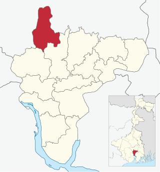
Udaynarayanpur is a community development block that forms an administrative division in Uluberia subdivision of Howrah district in the Indian state of West Bengal.
Antana is a village in the Hadoti region of Rajasthan, India. It serves as a Gram panchayat for two nearby villages: Musen Mata and Ummedganj. The nearest town is Atru, which is 8 km away. It is located 32 km from the district headquarters, Baran.
Jagdishpura is a bustling agricultural community and a small village in Jawahar Nagar Gram Panchayat and Mohangarh Panchayat Samiti (Block), located in Jaisalmer District, Rajasthan, India. It is approximately 25 km from the Panchayat Samiti headquarters in Mohangarh and about 10 km from the Gram Panchayat headquarters in Jawahar Nagar. Jagdishpura is primarily known for its agricultural landscape, supported by a branch distributary of the Indira Gandhi Nahar Project. Suthar Mandi, the nearest market town for regional farmers, is located about 7 km from Jagdishpura.
Kheri Leela is a small village in Makrana tehsil, Nagaur district, Rajasthan, India.

Uluberia I is a community development block that forms an administrative division in Uluberia subdivision of Howrah district in the Indian state of West Bengal.

Uluberia II is a community development block that forms an administrative division in Uluberia subdivision of Howrah district in the Indian state of West Bengal.

Bagnan II is a community development block that forms an administrative division in Uluberia subdivision of Howrah district in the Indian state of West Bengal.

Shyampur II is a community development block that forms an administrative division in Uluberia subdivision of Howrah district in the Indian state of West Bengal.
Bhoodha Ka Bas is a village in the Laxmangarh administrative region of the Sikar district of Indian state Rajasthan. Bhoodha Ka Bas village is separated from the Beerodi Bari village and situated in the north-east side of the Sikar district. Village is situated approximately 22 kilometres (14 mi) east of Laxmangarh town and 4 kilometres (2.5 mi) west of Nawalgarh town.
Mahtawas is a village in Neemrana tehsil, Alwar district, Rajasthan state, India. It is a part of the National Capital Region.
Saloli is a large village located in Reni Tehsil of Alwar district, Rajasthan with total 550 families residing. The Saloli village has population of 2807 of which 1488 are males while 1319 are females as per Population Census 2011.
Majursahi (Odia: ମଜୁରସାହି) is a village of Koksara Block in Dharmagarh Sub-Division in Kalahandi District of Odisha State. This village comes under Phupagaon Panchayat of Koksara Tahasil in Kalahandi District. It also comes under Kasibahal RI circle. Majursahi is 6.5 km distance from Koksara and 60 km distance from its District Headquarters Bhawanipatna. And about 500 km away from its State Capital Bhubaneswar.Many hundred years ago, majur or mayur (peacock) were seen in this village, so it is named Majursahi.
Jawahar Nagar is a Gram Panchayat in Mohangarh Panchayat Samiti (Block) in Jaisalmer District, Rajasthan, India. It is located approximately 35 km from the Panchayat Samiti headquarters in Mohangarh. Jawahar Nagar is primarily known for its agricultural landscape, supported by a branch distributary of the Indira Gandhi Nahar Project. Mohangarh is the nearest town to Jawahar Nagar, located around 35 km away.

