
The Voyage of the Beagle is the title most commonly given to the book written by Charles Darwin and published in 1839 as his Journal and Remarks, bringing him considerable fame and respect. This was the third volume of The Narrative of the Voyages of H.M. Ships Adventure and Beagle, the other volumes of which were written or edited by the commanders of the ships. Journal and Remarks covers Darwin's part in the second survey expedition of the ship HMS Beagle. Due to the popularity of Darwin's account, the publisher reissued it later in 1839 as Darwin's Journal of Researches, and the revised second edition published in 1845 used this title. A republication of the book in 1905 introduced the title The Voyage of the "Beagle", by which it is now best known.
Moka is a village in Mauritius located mainly in the Moka District. The western part of the village lies in the Plaines Wilhems District. Since 1967 it forms part of Constituency No. 8 Quartier Militaire and Moka. The village is administered by the Moka Village Council under the aegis of the Moka District Council. According to the census made by Statistics Mauritius in 2011, the population was at 8,846. The elevation is 203 meters and can be up to 425 meters in some places. Moka is directly on the other side of the Moka Range from Port Louis. The village is close to the mountain Le Pouce and the town Beau-Bassin Rose-Hill. Réduit is a suburb of the village where the State House and University of Mauritius is situated. The village is also home to the Mauritius Broadcasting Corporation and the Mahatma Gandhi Institute.

Isle de France was a French colony in the Indian Ocean from 1715 to 1810, comprising the island now known as Mauritius and its dependent territories. It was governed by the French East India Company and formed part of the French colonial empire. Under the French, the island witnessed major changes. The increasing importance of agriculture led to the "import" of slaves and the undertaking of vast infrastructural works that transformed the capital Port Louis into a major port, warehousing, and commercial centre.

Curepipe also known as La Ville-Lumière, is a town in Mauritius, located mainly in the Plaines Wilhems District. Its eastern part lies in the Moka District. The town is administered by the Municipal Council of Curepipe. Curepipe lies at a higher elevation, often referred to as the "Central Plateau". According to the census made by Statistics Mauritius in 2018, the population of the town was at 78,618.
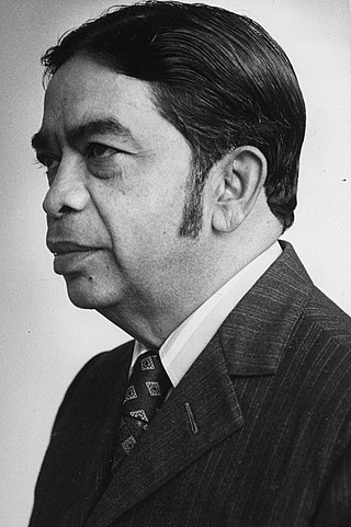
Sir Veerasamy Ringadoo, GCMG, GCSK, QC, was a Mauritian politician, minister, the sixth and last governor-general of Mauritius from 1986 to 1992, and then the first president of Mauritius from March to June 1992.

The Darwin Glacier is a large glacier in Antarctica. It flows from the polar plateau eastward between the Darwin Mountains and the Cook Mountains to the Ross Ice Shelf. The Darwin and its major tributary the Hatherton are often treated as one system, the Darwin–Hatherton.
The Districts of the Republic of Mauritius are the second-level administrative divisions after the Outer Islands of Mauritius.

Moka is a district of Mauritius, situated in the central plateau of the island. The district has an area of 230.5 km2. The population was estimated to be 83,664 at the end of 2019.
Moka is a village in Mauritius.
The National Assembly is Mauritius's unicameral legislature, which was called the Legislative Assembly from 1968 until 1992, when the country became a republic. Prior to 1968 and under British rule it was known as the Legislative Council. The Constitution of Mauritius provides for the parliament of Mauritius to consist of the President and the National Assembly. The parliament of Mauritius is modelled after the Westminster system of parliamentary democracy, where members of parliament are voted in at regular general elections, on the basis of a first past the post system. The working language of the National Assembly is English.

The Mauritian flying fox, also known as Greater Mascarene flying fox or Mauritius fruit bat is a large megabat species endemic to Mauritius and La Réunion.

Piton de la Petite Rivière Noire is the highest mountain on the island of Mauritius, in the Indian Ocean. Located in the Rivière Noire District and rising to a height of 828 m (2,717 ft) above sea level, it forms part of the Black River mountain range.

The following outline is provided as an overview of and topical guide to Mauritius:
The State House is the official residence of the President of Mauritius. Originally Le Réduit, it was built as a fortress for defence against attack by Pierre Félix Barthelemy David in 1749. The mansion is in Réduit, Moka, near of the University of Mauritius and the end of the Plaines Wilhems District. It used to serve as the residence for former governors of Mauritius, but now it is the residence of the President. It is built on 97 hectares of land. The château has a garden where a multitude of flowers grow, as well as exotic and native trees. The château is open to the public two days a year, in October and March. The house has persisted through history; it was destroyed by a cyclone, rebuilt, and has been renovated since. It is also used by the military.
Saint Pierre is a village in the district of Moka in Mauritius. It is considered to be found in the heart of Mauritius.The climatic conditions is cold and ideal especially during summer with cold breeze.
Queen Elizabeth College (QEC) is an academic institution for girls in Mauritius. As from 2021, it has now become a mixed school and accommodates girls and boys of age 15 to 18 years based on their academic performance at the National Certificate of Education (NCE) examinations. The school prepares its students for the O Level examinations, awarding the School Certificate; and the A Level examinations, awarding the Higher School Certificate.
Henrietta is found in the town of Vacoas-Phoenix, Mauritius. It is said to be the 'finishing part' of Vacoas as beyond it there is only forest.

Le Pouce is the third highest mountain in Mauritius, at 812 meters. Only Piton de la Petite Rivière Noire and Pieter Both are taller. It is named Le Pouce because of the thumb-shaped peak of the mountain. It can be viewed from the capital of Mauritius, Port Louis, and is a popular hike for the view of the city. The mountain is in the Moka Range and is closest to the village of La Laura-Malenga in the Moka District. Charles Darwin ascended the mountain on 2 May 1836.
La Laura-Malenga is a village in the Moka District in Mauritius. The population was 1,230 in 2000 and was estimated to be 1,336 in 2012. The village got its name "La Laura-Malenga" in 1859. The name came from a 19th-century sugar estate. Le Pouce, the third-highest mountain in Mauritius, is close to this village.
The Open University of Mauritius (OU) is a public university in Mauritius. It offer programmes leading to undergraduate, and postgraduate degrees through open distance learning. OU's headquarters are located in Réduit, Moka.
