Related Research Articles

Limpopo is the northernmost province of South Africa. It is named after the Limpopo River, which forms the province's western and northern borders. The capital and largest city in the province is Polokwane, while the provincial legislature is situated in Lebowakgomo.
Lephalale, also known as Ellisras, is a coal mining town in the Limpopo province of South Africa immediately east of the Waterberg Coalfield. The town was established as Ellisras in 1960 and named after Patrick Ellis and Piet Erasmus who settled on a farm there in the 1930s. In 2002, Ellisras was renamed Lephalale by the provincial government of Limpopo, after the main river that crosses the municipality. Lephalale is divided into three main subsections, Ellisras, Onverwacht and Marapong. Lephalale is derived from the setswana language meaning "to flow".

Vaalwater is a small town situated on the Mokolo River in the Limpopo province of South Africa.

The R33 is a provincial route in South Africa that connects Pietermaritzburg with Lephalale via Greytown, Paulpietersburg, Carolina, Belfast and Vaalwater. It is a very long road, passing through 3 provinces.

A provincial park is a park administered by one of the provinces of a country, as opposed to a national park. They are similar to state parks in other countries. They are typically open to the public for recreation. Their environment may be more or less strictly protected.

Concor Holdings (Proprietary) Limited. is a South African construction and mining services company. It is active throughout Southern Africa, involved in civil engineering, buildings, roads and mining projects. Concor returned as an independent brand in late 2016.

The Mokolo River is a major watercourse in Limpopo Province of South Africa. This river collects much of the drainage of the Waterberg Massif and discharges it to the Limpopo River. The river's catchment area comprises 8,387 square kilometres (3,238 sq mi).

Alma is a small town situated south of Vaalwater in the Limpopo province of South Africa. The area is surrounded by green-gray bushveld vegetation and a few private game reserves are located in the malaria free area.
Limpopo Tourism and Parks Board is a governmental organisation established in 2001 and responsible for maintaining wilderness areas and public nature reserves in Limpopo Province, South Africa.

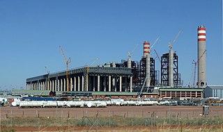
Medupi Power Station is a dry-cooled coal-fired power station built by Eskom near Lephalale in Limpopo province, South Africa. The station consists of 6 generating units with a nameplate capacity of 800 MW each bringing the total installed capacity of 4,800 MW.

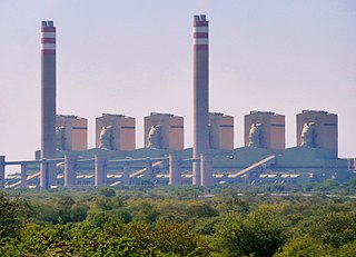
Matimba Power Station close to Ellisras, Limpopo Province, South Africa, is a dry-cooled coal-fired power plant operated by Eskom.
The Mokolo Dam Nature Reserve or Mokolo Dam Provincial Park is a protected area of bushveld in the Limpopo province, South Africa. It almost surrounds the Mokolo Dam on the Mokolo River. It is located 32 km south of Lephalale, just northeast of the Marakele National Park and not far from the Lapalala Game Reserve.
Limpopo WMA, or Limpopo Water Management Area(coded: 1), in South Africa includes the following major rivers: the Limpopo River, Matlabas River, Mokolo River, Lephalala River, Mogalakwena River, Sand River and Nzhelele River and covers the following dams.

The Motlatse River, Blyde River, or Umdhlazi River is a river in the Mpumalanga and Limpopo provinces of South Africa. It has a northwards course in steep-sided valleys and ravines of the Mpumalanga Drakensberg, before it enters the lowveld region of the Limpopo province. It has its ultimate origins at around 2,000 m altitude in the Hartebeesvlakte conservation area, to the north of Long Tom Pass. It runs through the Blyde River Canyon.

The Crocodile River is a river in South Africa. At its confluence with the Marico River, the Limpopo River is formed.

The Mogalakwena River is one of the main watercourses in Limpopo Province, South Africa. It is also a major tributary of the Limpopo River.
The Waterberg Coalfield is an extensive deposit of coal in the Ellisras Basin in South Africa, lying mostly in the Waterberg District Municipality of the Limpopo province. Mining is increasing, both for export and for local power production, and industry in the region is expected to expand. This may have significant impact on the dry and fragile Limpopo basin ecosystems.
The Grootegeluk Coal Mine is an open cast coal mine within the Waterberg Coalfield of the Limpopo province of South Africa. It is operated by Exxaro. The mine is 25 kilometres (16 mi) from Lephalale, and employs 2,000 people.
References
- ↑ List of South African Dams from the Department of Water Affairs and Forestry (South Africa)
- ↑ "Water supply ready for Medupi TCTA". Fin24. Retrieved 30 May 2016.
- ↑ "LETTER: Ample water available". Business Day Live. Retrieved 30 May 2016.
- ↑ State of Rivers Report: the Mokolo River