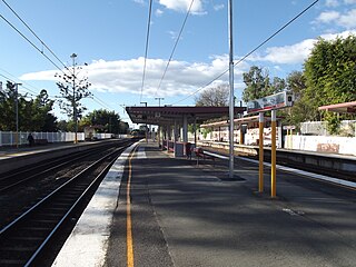
Wooloowin railway station is located on the North Coast line in Queensland, Australia. It serves the Brisbane suburb of Wooloowin.

The Cleveland railway line is a suburban railway line extending 37.3 kilometres (23.2 mi) east-southeast from Brisbane, the state capital of Queensland, Australia. It is part of the Queensland Rail Citytrain network.

Nobby is a rural town and locality on the Darling Downs in the Toowoomba Region, Queensland, Australia. It is located halfway between Toowoomba and Warwick. It is known for its association with Steele Rudd (author) and Sister Elizabeth Kenny.

Moorooka is a southern suburb in the City of Brisbane, Queensland, Australia. In the 2016 census, Moorooka had a population of 10,368 people.

Fairfield is a suburb of the City of Brisbane, Queensland, Australia. In the 2021 census, Fairfield had a population of 3,106 people.

Nundah is an inner suburb in the City of Brisbane, Queensland, Australia. It contains the neighbourhood of Toombul. In the 2016 census, Nundah had a population of 12,141 people.
Mooloolah Valley is a rural locality in the Sunshine Coast Region, Queensland, Australia. In the 2016 census, Mooloolah Valley had a population of 3,321 people.

Richmond is a rural town and locality in the Shire of Richmond, Queensland, Australia. In the 2016 census, the locality of Richmond had a population of 648 people.

Corinda is a suburb in the City of Brisbane, Queensland, Australia. In the 2016 census, Corinda had a population of 5,064 people.

Molendinar is a mixed-use suburb in the City of Gold Coast, Queensland, Australia. In the 2016 census, Molendinar had a population of 6,375 people.

The South Coast railway line was a railway from Brisbane, the capital city of Queensland, Australia. The route via the South Coast to Tweed Heads on the border of Queensland and New South Wales. The line operated from 1889 to 1964. The Gold Coast railway line re-opened in 1996 along a modified alignment in the north and a new route south but does not extend as far south yet as the South Coast line.

Banyo is a northern suburb in the City of Brisbane, Queensland, Australia. In the 2016 census, Banyo had a population of 5,868 people.

Graceville is a suburb in the City of Brisbane, Queensland, Australia. In the 2016 census, Graceville had a population of 4,634 people.

Enoggera is a north-western suburb in the City of Brisbane, Queensland, Australia. It is home to the Gallipoli Barracks.

Hemmant is a suburb of the City of Brisbane, Queensland, Australia. In the 2016 census, Hemmant had a population of 2,385 people.

Mirani is a rural town and locality in the Mackay Region, Queensland, Australia. In the 2016 census, the locality of Mirani had a population of 1,541 people.

The Beaudesert Shire Tramway was a narrow gauge tramway which operated from Beaudesert to Lamington and Rathdowney in the Scenic Rim Region, Queensland, Australia, It was one of 15 light railways built and operated by Divisional Boards and Shire Councils in Queensland. The line carried passengers and cargo. It operated from 1903 to 1944. It was initially profitable and seen as a great success for the local shire council. The tramway is credited with opening up the agricultural lands of the upper Logan River.

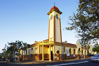
The Town of Sandgate is a former local government area of Queensland, Australia, located in northern Brisbane adjacent to Moreton Bay.

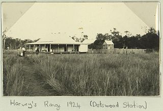
Dotswood is a rural locality in the Charters Towers Region, Queensland, Australia. In the 2016 census Dotswood had a population of 101 people.
Turbot Street runs parallel to Ann Street and is on the northern side of the Brisbane CBD in Queensland, Australia. It is a major thoroughfare, linking as a three-to-five lane one-way street with the Riverside Expressway in the southwest to the suburb of Fortitude Valley in the northeast; address numbers run the same direction. It is a one-way pair with Ann Street.


