The West Midlands conurbation is the large conurbation in the West Midlands region of England. The area consists of two cities and numerous towns: to the east, the city of Birmingham, along with adjacent towns of Solihull and Sutton Coldfield; and to the west, the city of Wolverhampton and the area called the Black Country, containing the towns of Dudley, Walsall, West Bromwich, Oldbury, Willenhall, Bilston, Darlaston, Tipton, Smethwick, Wednesbury, Rowley Regis, Stourbridge and Halesowen.

Penn is an area divided between the City of Wolverhampton and South Staffordshire district. The population of the Wolverhampton Ward taken at the 2011 census was 12,718. Originally, it was a village in the historic county of Staffordshire.

Merry Hill is a suburb of Wolverhampton, West Midlands and a ward of Wolverhampton City Council. It is situated in the south-west of the city, bordering South Staffordshire and the Tettenhall Wightwick, Park, Graiseley and Penn wards. It forms part of the Wolverhampton West constituency.

Bradmore is a suburb of Wolverhampton in the West Midlands of England. It lies at the meeting point of the Graiseley, Park and Merry Hill wards of Wolverhampton City Council.
Graiseley is both an inner-city area of Wolverhampton, situated immediately to the south-west of the city centre, and the name of a ward of Wolverhampton City Council.
St Peter's is a ward of Wolverhampton City Council, West Midlands. It has two parts: the city centre, and the inner-city areas immediately to the north and north-west, including Dunstall Hill and part of Whitmore Reans.
Tettenhall Regis is a ward of Wolverhampton City Council, West Midlands. The population of this ward at the 2011 census was 11,911.

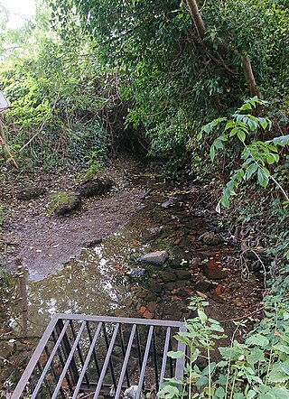
Tettenhall Wood is a suburb of Wolverhampton, West Midlands, England. It is west of Wolverhampton city centre, within the Tettenhall Wightwick ward. It sits high on a relatively steep hill and it is claimed that the Malvern Hills can be seen from some of the houses located in the area. To its west lies Wightwick, to its south Compton to its east Tettenhall. Also to its north lies the boundary of the West Midlands conurbation and also that of Wolverhampton metropolitan authority with South Staffordshire. The River Penk rises in the area, at Penk Rise Park.
Bilston North is a ward of City of Wolverhampton Council, West Midlands. As its name suggests, it covers the northern parts of the town of Bilston, such as Bunkers Hill, Portobello. It borders the Bilston South, Ettingshall North and East Park wards, and the Metropolitan Borough of Walsall. It forms part of the Wolverhampton South East constituency.

Ettingshall is an area of Wolverhampton, West Midlands, England. It lies within two wards of Wolverhampton City Council: Ettingshall North and Ettingshall South and Spring Vale. The population of Ettingshall taken at the 2011 census was 13,482.

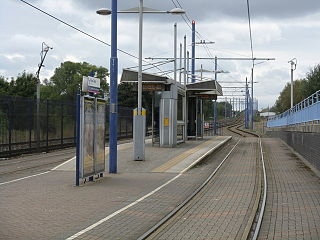
Soho Benson Road tram stop is a tram stop in Soho, Birmingham, England. It was opened on 31 May 1999 and is situated on West Midlands Metro Line 1. It is situated on the site of the old Soho and Winson Green railway station, which was closed in 1972.

Winson Green Outer Circle tram stop is a tram stop in Winson Green, Birmingham England. It was opened on 31 May 1999 and is situated on West Midlands Metro Line 1. Its name is derived from its connection with the Outer Circle bus route.

Tipton railway station is located in the industrial town of Tipton in the borough of Sandwell, West Midlands, England and was known as Tipton Owen Street until 1968. It is situated on the West Coast Main Line. The station is operated by West Midlands Railway, which also provides all services.

The A4123, is a major road in the West Midlands of the UK linking Wolverhampton with Birmingham via Dudley, also known as the Birmingham New Road and Wolverhampton Road. It was one of the first major new roads constructed for use by motor traffic, and was designed as an unemployment relief project. It runs roughly northwest to southeast from the Wolverhampton Ring Road via Dudley to Harborne, west Birmingham. Until the 1960s, the road continued along the former B4123 to the A441 near Kings Norton. This became part of the A4040 during the 1960s when the Outer Ring Road came into existence.
Monmore Green railway station was a railway station built by the London and North Western Railway on their Stour Valley Line in 1863. It served the Monmore Green area of Wolverhampton, and was located near to the junction of Bilston Road and Landport Road.

Swan Village is an area of West Bromwich, in the Metropolitan Borough of Sandwell in the West Midlands County of England.
Wolverhampton Steel Terminal is a small intermodal depot in the city of Wolverhampton, England. The depot is served by a spur of the Rugby-Birmingham-Stafford Line – the mainline through the West Midlands. It can also be accessed by road, which makes it a useful point for transferring steel between road and rail transport.
East Park is the name of a ward of Wolverhampton City Council, West Midlands, England. It lies to the east of Wolverhampton city centre, stretching to the city's boundary with the Metropolitan Borough of Walsall. It also borders the wards of Bilston North, Ettingshall, St Peter's, Heath Town and Wednesfield South. It forms part of the Wolverhampton South East constituency.

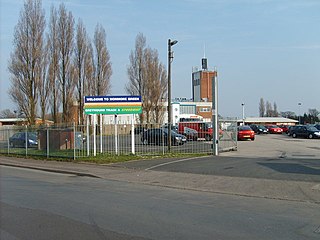
Monmore Green Stadium is a greyhound racing and former motorcycle speedway stadium located in Wolverhampton. The stadium has private suites, a restaurant and a number of bars. The venue is owned and operated by the Ladbrokes Coral group.

Willenhall Greyhound Stadium was a greyhound racing stadium and formerly a football ground known as Spring Bank Stadium situated in Willenhall, West Midlands, England.


