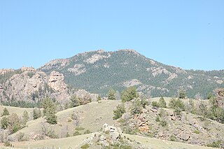
San Jacinto Peak is the highest peak of the San Jacinto Mountains, and of Riverside County, California. It lies within Mount San Jacinto State Park. Naturalist John Muir wrote of San Jacinto Peak, "The view from San Jacinto is the most sublime spectacle to be found anywhere on this earth!"

Penobscot Knob, also Penobscot Mountain, is a summit located in the western fringe of the Poconos nearest to Mountain Top, Pennsylvania which in the Solomon Gap pass below it lies an important multi-modal transportation corridor. At one time before incorporation, Mountain Top and the saddle of the pass was known by the Amerindian name Penobscot. Penobscot Mountain forms part of the drainage divide between the Lehigh Valley & greater Delaware River drainage basin and the Wyoming and Susquehanna Valley, part of the Potomac River drainage basin. The pass formed between Penobscot and Haystack Mountain a few thousand feet to the West was one of the few places a railroad could be envisioned in the 1830s when the fuel crises in eastern cities demanded easier transportation to the Northern Anthracite Coal Fields, which ironically, came to be exploited by the company with a near monopoly in providing coal from the Southern Anthracite region, Lehigh Coal & Navigation Company, which had built both the Lehigh Canal, but also the nation's second railway, the Summit Hill & Mauch Chunk Railroad. The whole uplands north and west faces over look the Wyoming Valley from the southeastern corner near Hazleton towards and through the greater south Wilkes-Barre area. The southern and eastern slopes just give peeks into portions of the Poconos and wider views of the Lehigh Valley descending down to White Haven, for the Poconos technically are left-bank bounded by the Lehigh.

Mount Wilson is a peak in the San Gabriel Mountains, located within the San Gabriel Mountains National Monument and Angeles National Forest in Los Angeles County, California. With only minor topographical prominence the peak is not naturally noticeable from a distance, although it is easily identifiable due to the large number of antennas near its summit. It is a subsidiary peak of nearby San Gabriel Peak.

The Ebright Azimuth is the point with the highest benchmark monument elevation in the U.S. state of Delaware. It is marked with a geodetic benchmark monument and has an elevation of 447.85 feet (136.50 m) above sea level. The only state high-point with a lower elevation is Britton Hill in the state of Florida at 345 feet (105 m) above sea level.

Mount Frissell, 2,454 feet (748 m), located on the border of southwest Massachusetts and northwest Connecticut, is a prominent peak of the Taconic Range.

Kippure is a granite mountain that straddles the county boundary from its peak in Wicklow into South Dublin. It is popular for hill walking and outdoor leisure activity owing to its proximity to Dublin city, with its fine views over Dublin Bay towards Howth Head. It has convenient access and easy terrain. At 757 metres, it is the 73rd highest in Ireland.

The mountains and hills of the British Isles are categorised into lists based on elevation, prominence, and other criteria. These lists are used for peak bagging, whereby hillwalkers attempt to reach all the summits on a list, the oldest and best-known, being the 282 § Munros in Scotland, which amongst other criteria, must be above 3,000 feet (914.4 m).

Miller Peak, at 9,470 feet (2,886 m), is the second-highest mountain in Cochise County, Arizona. Located approximately 10 miles south of Sierra Vista, Arizona, it is the highest mountain in the Huachuca mountain range and a popular local hiking destination. The peak is the highest point in the Miller Peak Wilderness on the Coronado National Forest. This is also the most southerly peak and land area to rise above 9,000 feet in the continental United States. The area was affected by the 2011 Monument fire and most of the pine trees seen in older photographs were burned and destroyed. Scrub oak are beginning to replace the areas that were previously covered by pine.

Mount Oglethorpe is a mountain located in Pickens County, Georgia, USA. The southernmost peak in the Blue Ridge Mountains, the mountain has an elevation of 3,288 feet (1,002 m), making it the highest point in Pickens County.

Holston Mountain is a mountain ridge in Upper East Tennessee and southwest Virginia, in the United States. It is in the Blue Ridge Mountains part of the Appalachian Mountains. Holston Mountain is a very prominent ridge-type mountain in Tennessee's Ridge and Valley Region, about 28 miles (45 km) long, running from southwest to northeast, covering about 268 square miles (694 km²). Its highest summit is Holston High Point, on which a Federal Aviation Administration (FAA) aircraft navigational beacon is located, at an elevation of 4,280 feet above mean sea level. The second highest point is Rye Patch Knob, at 4,260 feet above mean sea level. The third highest point is Holston High Knob where an old dismantled Cherokee National Forest fire tower marks the elevation at 4,136 feet above mean sea level.

Laramie Peak Is the highest and most prominent peak in the Laramie Range of Wyoming. With a peak elevation of 10,275 feet (3,132 m), it is the only peak in the Laramie Range to exceed an elevation of 10,000 feet (3,000 m). It can be seen from great distances from both sides of the Laramie Range including from around 100 miles (160 km) away at the top of the Scotts Bluff National Monument in Nebraska and in the Wyoming towns of Wheatland, Douglas, Rock River, and immediately outside the cities of Laramie and Cheyenne.

Brace Mountain is the peak of a ridge in the southern Taconic Mountains, near the tripoint of the U.S. states of New York, Connecticut and Massachusetts. Its 2,311-foot (704 m) main summit is located in New York; it is the highest point in that state's Dutchess County.

Bear Peak, at 9,525 feet (2,903 m) above sea level is a peak in the Smoky Mountains of Idaho. The peak is located in Sawtooth National Forest in Blaine County. It is located about 4.6 mi (7.4 km) east of Baker Peak. No roads or trails go to the summit.

Dollarhide Mountain, at 9,301 feet (2,835 m) above sea level is a peak in the Smoky Mountains of Idaho. The peak is located in Sawtooth National Forest on the border of Blaine and Camas counties. It is located about 4.2 mi (6.8 km) south of Baker Peak. Forest road 227 travels near the peak over a road pass known as Dollarhide Summit. No roads or trails go to the summit.

Mahoney Butte, at 7,904 feet (2,409 m) above sea level is a peak in the Smoky Mountains of Idaho. The peak is located in Sawtooth National Forest in Blaine County. It is located in the watershed of Greenhorn Creek, a tributary of the Big Wood River. It is about 4.6 mi (7.4 km) southwest of Bald Mountain. No roads or trails go to the summit, although the peak is most easily accessed from trails at the end of road 117.

Washington Peak at 10,519 feet (3,206 m) above sea level is a peak in the White Cloud Mountains of Idaho. The peak is located in Sawtooth National Recreation Area in Custer County 2.37 mi (3.81 km) from Fourth of July Peak, its line parent. It is the 264th highest peak in Idaho.

Gold Mountain is a 1,761-foot (537 m) summit in the Blue Hills on the Kitsap Peninsula of Washington state, in the United States' Pacific Northwest. It is the highest point on the Kitsap Peninsula and the highest point in Kitsap County, Washington, and nearby 1,639-foot (500 m) Green Mountain is the second-highest point.

Toe Jam Hill, 425 feet tall, is the high point on Bainbridge Island, Washington and one of the highest points in Kitsap County, Washington.

Mistake Peak is a summit in Gila County, in the U.S. state of Arizona. It has an elevation of 5,930 feet (1,807 m) and a prominence of 150 feet (46 m). Mistake Peak was likely so named because it was mistaken by surveyors for another summit. Mistake Peak has been noted for its unusual place name.


