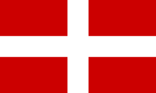
Savoy is a cultural-historical region in the Western Alps. Situated on the cultural boundary between Occitania and Piedmont, the area extends from Lake Geneva in the north to the Dauphiné in the south and west and to the Aosta Valley in the east.

The Rhône is a major river in France and Switzerland, rising in the Alps and flowing west and south through Lake Geneva and Southeastern France before discharging into the Mediterranean Sea. At Arles, near its mouth, the river divides into the Great Rhône and the Little Rhône. The resulting delta forms the Camargue region.

Haute-Savoie is a department in the Auvergne-Rhône-Alpes region of Southeastern France, bordering both Switzerland and Italy. Its prefecture is Annecy. To the north is Lake Geneva; to the south and southeast are Mont Blanc and the Aravis mountain range.

Lake Geneva is a deep lake on the north side of the Alps, shared between Switzerland and France. It is one of the largest lakes in Western Europe and the largest on the course of the Rhône. Sixty percent of the lake belongs to Switzerland and forty percent to France.

Valais, more formally, the Canton of Valais, is one of the 26 cantons forming the Swiss Confederation. It is composed of thirteen districts and its capital and largest city is Sion.
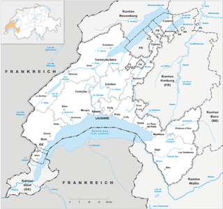
Vaud, more formally the Canton of Vaud, is one of the 26 cantons forming the Swiss Confederation. It is composed of ten districts; its capital city is Lausanne. Its coat of arms bears the motto "Liberté et patrie" on a white-green bicolour.
The Canton of Geneva, officially the Republic and Canton of Geneva, is one of the 26 cantons of the Swiss Confederation. It is composed of forty-five municipalities, and the seat of the government and parliament is in the city of Geneva.

Annemasse is a commune in the Haute-Savoie department in the Auvergne-Rhône-Alpes region in Eastern France. Even though it covers a relatively small territory, it is Haute-Savoie's second most populous commune after the prefecture Annecy, with 36,250 residents as of 2018.

Romandy is the French-speaking historical and cultural region of Switzerland. In 2020, about 2 million people, or 22.8% of the Swiss population, lived in Romandy. The majority of the romand population lives in the western part of the country, especially the Arc Lémanique region along Lake Geneva, connecting Geneva, Vaud, and the Lower Valais.

The Arve is a river in France, and Switzerland. A left tributary of the Rhône, it is 108 km (67 mi) long, of which 9 km in Switzerland. Its catchment area is 1,976 km2 (763 sq mi), of which 80 km2 in Switzerland. Its average discharge in Geneva is 79 m3/s (2,800 cu ft/s).

The Battle on the Planta, fought on 13 November 1475 around Conthey near Sion, Valais, Switzerland, was part of the Burgundian Wars.
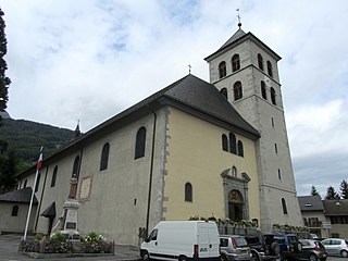
Sallanches is a commune in the Haute-Savoie department of the Auvergne-Rhône-Alpes region of France. Located close to the Mont Blanc massif, many visitors pass through the town en route to well-known alpine resorts such as Chamonix, Megève and Saint-Gervais-les-Bains. In 2018, the commune had a population of 16,508, and its urban area had 46,128 inhabitants.
Saint-Gingolph is a small town situated on the south bank of Lake Geneva. It sits at the France–Switzerland border and is administratively divided into Saint-Gingolph, Valais (Switzerland) and Saint-Gingolph, Haute-Savoie (France). Its name is derived from the eighth-century saint Gangulphus, who is said to have lived as a hermit in this region. Its division at the Morge dates from 1569: as the municipal Web site explains, it is one town consisting of a single parish with two municipal administrations and two distinct legal systems.
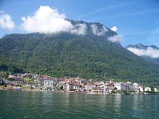
Saint-Gingolph is a municipality in the district of Monthey in the canton of Valais in Switzerland. In 2018, it had a population of 981.

Saint-Gingolph is a commune in the Haute-Savoie department in the Auvergne-Rhône-Alpes region in south-eastern France. It lies at the outflow of the river Morge into Lake Geneva. With the adjacent Swiss municipality Saint-Gingolph, it forms one built up area. The Morge forms the border with Switzerland.

The Hermance is a river in France and Switzerland, that discharges into Lake Geneva. It rises near Loisin in Haute-Savoie, France, at 563 m (1,847 ft) elevation. In its lower half, downstream from Veigy, it marks the Swiss-French border. It flows into Lake Geneva between the villages Hermance (Switzerland) and Chens-sur-Léman (France), at 372 m (1,220 ft) elevation. Its total length is 14 km (8.7 mi), of which 6.5 kilometres on the border. Its catchment area is 42.5 km2 (16.4 sq mi), of which 37 km2 in France.
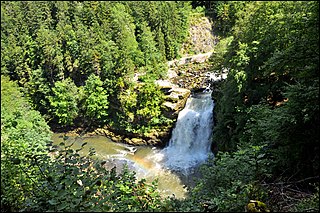
The France–Switzerland border is 572 km (355 mi) long. Its current path is mostly the product of the Congress of Vienna of 1815, with the accession of Geneva, Neuchâtel and Valais to the Swiss Confederation, but it has since been modified in detail, the last time being in 2002. Although most of the border, marked with border stones, is unguarded, several checkpoints remain staffed, most notably on busy roads.

Occupied since prehistoric times, the canton of Valais saw the rise of an exceptional civilization during the Bronze Age. From the 4th century BC, four Celtic tribes shared its territory, which was incorporated into the Roman Empire by Augustus. The Gallo-Roman Valais, located on the important Great St Bernard Pass, was prosperous. Christianity was first established in 377, and a bishopric was opened in Martigny by 381 at the latest.

The Tonkin Railway, or South Lake Geneva railway, is a partly disused line connecting the Swiss cities of Saint-Maurice and Geneva via the French communes of Évian-les-Bains, Thonon-les-Bains and Annemasse, crossing the France–Switzerland border twice.
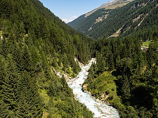
The Navizence is a 23-kilometer-long Swiss river located in the Anniviers Valley, in the canton of Valais. It is a left-bank tributary of the Rhône River, joining it at Chippis.


