Morningside, Minnesota

Last updated
The Como-Harriet Streetcar Line TCRT PCC streetcar.jpg
The Como-Harriet Streetcar Line

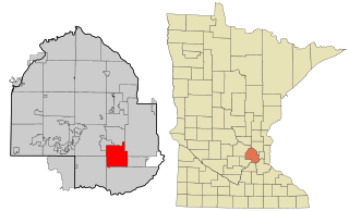
Morningside is a distinct geographical and architectural neighborhood in Edina, Minnesota. Morningside is an old streetcar suburb adjacent to Minneapolis' Linden Hills neighborhood.

Morningside, which is located along the old Como-Harriet Streetcar Line, grew faster than Edina, which was mostly rural. Morningside residents voted in 1920 to secede from Edina and form their own village in order to provide amenities more suited to a professional streetcar suburb.

Morningside's residential landscape reflects several important broad themes in the pattern of suburban development in the Twin Cities area: the relatively high population density per square mile within the platted subdivisions, the architectural similarity of the houses, and reliance on mass-transit. Morningside developers built several hundred new single–family homes, including many bungalows, on standard-sized suburban lots along straight-line streets between about 1905 and 1936, replacing land previously occupied by farm fields and orchards.

The Jonathan Taylor Grimes House Grimes House 3.jpg
The Jonathan Taylor Grimes House

The children of Jonathan Grimes, who inherited the Grimes farm and apple orchard in the village's northeast corner, platted the Morningside neighborhood for residential development in 1905. Grimes Avenue cuts through the neighborhood in a north-south direction. The Jonathan Taylor Grimes House on West 44th Street was added to the National Register of Historic Places in 1976.

George Weber was a well-known figure in the village early on. In 1929, the mayor of Morningside asked the school janitor, 55-year-old George Weber, to be the village marshal. He initially turned down the job, but the council voted him in anyway. Weber remained in charge of Morningside for the next 27 years. With the retirement of Weber in 1956, the Edina Village Police began providing police protection to the Village of Morningside. It wasn't until 1960 that the first black family moved into the Morningside neighborhood, where they were met with an anti-immigrant campaign. The family was supported by a fairness petition signed by 251 Morningside residents, demonstrating that the majority of the community was not prejudiced.

Morningside's police station was located at 4400 Branson Street and was run by Weber's wife. His responsibilities also included water meter reading and census taking. On the first and third Monday evenings of each month, court was held in the Edina Grange Hall. Weber is commemorated by a park in the Morningside neighborhood.

Morningside remained a separate village for 46 years, until 1966, when it was reincorporated into the larger City of Edina in response to state pressure. Citizens of Morningside voted to rejoin Edina, owing in part to the impracticality of building a sewage infrastructure for such a small municipality. Morningside's previous autonomy is still visible in the 55416 Zip Code that it shares with neighboring Minneapolis and St. Louis Park, as well as in the water system, which is linked to the City of Minneapolis water department.

Even today, Morningside has a distinct personality from the rest of Edina. When comparing the Morningside/Minneapolis intersection at 44th and France to the Edina/Minneapolis intersection at 50th and France, such a contrast can be seen in less than six blocks. The Morningside name can still be found in community organizations, roads, and businesses today.

Though the neighborhood is part of Edina, one of its distinguishing features is its independence. It has approximately 750 homes. That independence is fostered in part by the neighborhood's cohesive relationships, which are formed as a result of the many events and organizations that are endemic to the area. The Morningside Babysitting Cooperative has been around for nearly a century and still keeps track of its members' shared hours of child care. The Morningside Woman's Club, formerly known as the Morningside Literary Club, was founded in 1937. Morningside has an active Neighborhood Association that provides a voice at City Hall to represent the neighborhood's unique needs and values. A Morningside men's group called, the Morningside Athletic Club (MAC), meets every Saturday morning at Weber Park for sports activity, such as soccer, football and ice boot hockey.

Historical population
CensusPop.Note
1930 903
1940 1,28242.0%
1950 1,69932.5%
1960 1,98116.6%
U.S. Decennial Census [1]

Politics

Presidential election results
Precinct General Election Results [2]
Year Republican Democratic Third parties
1964 62.6%70137.3% 4170.1% 1
1960 71.6%81028.4% 3210.0% 0
1956 82.7%80917.3% 1690.0% 0


Related Research Articles

<span class="mw-page-title-main">Edina, Minnesota</span> City in Minnesota, United States

Edina is a city in Hennepin County, Minnesota, United States and a first-ring suburb of Minneapolis. The population was 53,494 at the 2020 census, making it the 18th most populous city in Minnesota.

<span class="mw-page-title-main">Richfield, Minnesota</span> City in Minnesota, United States

Richfield is a city in Hennepin County, Minnesota. An inner-ring suburb of Minneapolis, Richfield is bordered by Minneapolis to the north, Minneapolis–Saint Paul International Airport and Fort Snelling to the east, Bloomington to the south, and Edina to the west. The population was 36,994 at the 2020 census.

<span class="mw-page-title-main">St. Louis Park, Minnesota</span> City in Minnesota, United States

St. Louis Park is a city in Hennepin County, Minnesota, United States. The population was 50,010 at the 2020 census. It is a first-ring suburb immediately west of Minneapolis. Other adjacent cities include Edina, Golden Valley, Minnetonka, Plymouth, and Hopkins.

Carmody Hills is an unincorporated community in Prince George's County in the U.S. state of Maryland. Because it is not formally incorporated, it has no official boundaries, but the United States Census Bureau has defined a census-designated place consisting of Carmody Hills and the adjacent community of Pepper Mill Village, together designated "Peppermill Village", for statistical purposes. Carmody Hills is located on the south side of Seat Pleasant Drive and east of Seat Pleasant.

<span class="mw-page-title-main">Mount Pleasant (Washington, D.C.)</span> Neighborhood of Washington, D.C.

Mount Pleasant is a neighborhood in Washington, D.C., located in Northwest D.C. The neighborhood is primarily residential, with restaurants and stores centered along a commercial corridor on Mt. Pleasant Street. Mount Pleasant is known for its unique identity and multicultural landscape, home to diverse groups such as the punk rock, the Peace Corps and Hispanic Washingtonian communities.

<span class="mw-page-title-main">Roslindale</span> Neighborhood of Boston in Suffolk, Massachusetts, United States

Roslindale is a primarily residential neighborhood of Boston, Massachusetts, bordered by Jamaica Plain, Hyde Park, West Roxbury and Mattapan. It is served by an MBTA Commuter Rail line, several MBTA bus lines and the MBTA Orange Line in nearby Jamaica Plain. Roslindale has its own branch of the Boston Public Library, the neighborhood is covered by Boston Police District E-5 in West Roxbury, Boston EMS Ambulance 17 is stationed in Roslindale, and the Boston Fire Department has a station on Canterbury Street which houses Ladder 16, Engine 53 & District Chief 12. Roslindale's original Engine Company 45, was deactivated on April 10, 1981, due to budget cuts. Roslindale was once called the "garden suburb" of Boston. The portion of the Arnold Arboretum south of Bussey Street is located in Roslindale.

A streetcar suburb is a residential community whose growth and development was strongly shaped by the use of streetcar lines as a primary means of transportation. Such suburbs developed in the United States in the years before the automobile, when the introduction of the electric trolley or streetcar allowed the nation’s burgeoning middle class to move beyond the central city’s borders. Early suburbs were served by horsecars, but by the late 19th century cable cars and electric streetcars, or trams, were used, allowing residences to be built farther away from the urban core of a city. Streetcar suburbs, usually called additions or extensions at the time, were the forerunner of today's suburbs in the United States and Canada. San Francisco's Western Addition is one of the best examples of streetcar suburbs before westward and southward expansion occurred.

<span class="mw-page-title-main">Portage Park, Chicago</span> Community area in Chicago

Portage Park is located on the northwest side of the City of Chicago, Illinois and is one of 77 officially designated Chicago community areas. Portage Park is bordered by the community areas of Jefferson Park and Forest Glen to the north, Dunning and the suburb of Harwood Heights to the west, Irving Park to the east and Belmont-Cragin to the south.

<span class="mw-page-title-main">Lowry Hill East, Minneapolis</span> Neighborhood in Hennepin, Minnesota, United States

Lowry Hill East, also known as the Wedge, is a neighborhood in southwest Minneapolis, Minnesota, United States, part of the Calhoun Isles community. Lowry Hill East developed in the 1880s along a horse-drawn streetcar line built by Thomas Lowry. The interior of the neighborhood is residential, with large early 20th century homes and multi-unit apartment buildings, while the border streets are lined with bars, restaurants, grocery stores, coffeeshops, and other small businesses. Most housing is renter-occupied.

<span class="mw-page-title-main">Virginia–Highland</span> Neighborhoods of Atlanta in Fulton County, Georgia, United States

Virginia–Highland is an affluent neighborhood of Atlanta, Georgia, founded in the early 20th century as a streetcar suburb. It is named after the intersection of Virginia Avenue and North Highland Avenue, the heart of its trendy retail district at the center of the neighborhood. The neighborhood is famous for its bungalows and other historic houses from the 1910s to the 1930s. It has become a destination for people across Atlanta with its eclectic mix of restaurants, bars, and shops as well as for the Summerfest festival, annual Tour of Homes and other events.

<span class="mw-page-title-main">Ansley Park</span> United States historic place

Ansley Park is an intown residential district in Atlanta, Georgia, located just east of Midtown and west of Piedmont Park. When developed in 1905-1908, it was the first Atlanta suburban neighborhood designed for automobiles, featuring wide, winding roads rather than the grid pattern typical of older streetcar suburbs. Streets were planned like parkways with extensive landscaping, while Winn Park and McClatchey Park are themselves long and narrow, extending deep into the neighborhood.

<span class="mw-page-title-main">South Park, San Diego</span>

South Park is a neighborhood in San Diego, California adjacent to the southeast corner of Balboa Park. It stands out in San Diego for its tree-lined streets and walkable business district.

<span class="mw-page-title-main">Woodland Heights, Houston</span> Historic Neighborhood in Houston, Texas

The Woodland Heights neighborhood is one of the oldest and most historic in Houston, Texas. It encompasses approximately 2000 homes in the 77009 ZIP code and is bounded on the north by Pecore Street, on the west by Studewood Street, on the east by I-45, and on the south by I-10.

The Edina School District is the public school system for most of the city of Edina, Minnesota. It is also referred to as the Independent School District (ISD) 273. There are approximately 8,500 students, K-12, served by 1139 teachers and support staff in six elementary schools, two middle schools and one high school.

<span class="mw-page-title-main">Como, Minneapolis</span> Neighborhood in Hennepin, Minnesota, United States

Como is a neighborhood within the University community of Minneapolis. It is sometimes referred to as Southeast Como, due to many of its streets ending in SE, and possibly to differentiate it from the Como neighborhood in neighboring Saint Paul. Its boundaries are East Hennepin Avenue to the north, 33rd Avenue Southeast to the east, the Southeast Industrial Area to the south, and Interstate 35W to the west.

<span class="mw-page-title-main">Fulton, Minneapolis</span> Neighborhood in Hennepin, Minnesota, United States

Fulton is a neighborhood in the Southwest community in Minneapolis. Its boundaries are West 47th Street to the north, Penn Avenue South to the east, West 54th Street to the south, and France Avenue South to the west. Nearby neighborhoods include Linden Hills to the north, Lynnhurst to the east, and Armatage to the south. The suburb of Edina lies to the south and west. West 50th Street is a major east–west thoroughfare bisecting the neighborhood. At its intersection with France Avenue is the upscale 50th & France commercial district, which lies along the border between Minneapolis and Edina.

<span class="mw-page-title-main">Hillcrest (Little Rock)</span> United States historic place

Hillcrest Historic District is an historic neighborhood in Little Rock, Arkansas that was listed on the National Register of Historic Places on December 18, 1990. It is often referred to as Hillcrest by the people who live there, although the district's boundaries actually encompass several neighborhood additions that were once part of the incorporated town of Pulaski Heights. The town of Pulaski Heights was annexed to the city of Little Rock in 1916. The Hillcrest Residents Association uses the tagline "Heart of Little Rock" because the area is located almost directly in the center of the city and was the first street car suburb in Little Rock and among the first of neighborhoods in Arkansas.

Columbus, the state capital and Ohio's largest city, has numerous neighborhoods within its city limits. Neighborhood names and boundaries are not officially defined. They may vary or change from time to time due to demographic and economic variables.

<span class="mw-page-title-main">Peak's Suburban Addition, Dallas</span> Neighborhood in Dallas, Texas, USA

Peak's Suburban Addition is a historic residential neighborhood and City of Dallas Historic District in east Dallas, Texas (USA). The district's boundaries are, roughly, N. Fitzhugh Street to the northeast, Sycamore to the northwest, Peak Street and Haskell Street toward the southwest, and Worth Street along the southeast. Peak's Suburban is East Dallas' oldest subdivision and oldest residential neighborhood.

<span class="mw-page-title-main">Edina Library</span>

Edina Library is a branch of Hennepin County Library serving Edina, Minnesota, United States.

References

  1. United States Census Bureau. "Census of Population and Housing". Archived from the original on April 26, 2015. Retrieved June 15, 2013.
  2. "Office of the Minnesota Secretary of State - Election Results". Archived from the original on February 22, 2021. Retrieved February 22, 2021.

44°55′24″N93°20′03″W / 44.923401°N 93.334189°W / 44.923401; -93.334189