Sanok County is a unit of territorial administration and local government (powiat) in Subcarpathian Voivodeship, south-eastern Poland, on the Slovak border. It came into being on January 1, 1999, as a result of the Polish local government reforms passed in 1998. Its administrative seat and largest town is Sanok, which lies 56 kilometres (35 mi) south of the regional capital Rzeszów. The only other town in the county is Zagórz, lying 6 km (4 mi) south-east of Sanok.

The Osława is a river in South-Eastern Poland. Its name comes from the ancient west Slavic dialect word osła, meaning "stone". It begins in the Bieszczady mountains and flows through western Sanok Land. The river ultimately flows into the San near Bykowce, north of Zagórz.

Nowy Łupków is a village in the administrative district of Gmina Komańcza, within Sanok County, Subcarpathian Voivodeship, in south-eastern Poland, close to the border with Slovakia. It lies approximately 11 kilometres (7 mi) south of Komańcza, 34 km (21 mi) south of Sanok, and 87 km (54 mi) south of the regional capital Rzeszów. The village has a population of 390.

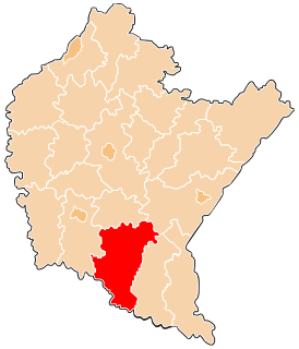
Zagórz is a town in Sanok County, Subcarpathian Voivodeship, Poland, on the river Osława in the Bukowsko Upland mountains, located 6.5 kilometres (4.0 mi) south-east of Sanok on the way to Ustrzyki Dolne, 32.4 kilometres (20.1 mi) distance. The nearest towns in northeastern Slovakia are Palota and Medzilaborce. Zagórz has a population of 4,988 (02.06.2009).

Tarnawa Dolna is a village in the administrative district of Gmina Zagórz, within Sanok County, Subcarpathian Voivodeship, in south-eastern Poland. It lies approximately 5 kilometres (3 mi) south of Zagórz, 9 km (6 mi) south of Sanok, and 65 km (40 mi) south of the regional capital Rzeszów.

Gmina Bukowsko is a rural gmina in Sanok County, Subcarpathian Voivodeship, in south-eastern Poland. Its seat is the village of Bukowsko, which lies approximately 14 kilometres (9 mi) south-west of Sanok and 62 km (39 mi) south of the regional capital Rzeszów.
Gmina Komańcza is a rural gmina in Sanok County, Subcarpathian Voivodeship, in south-eastern Poland, on the Slovak border. Its seat is the village of Komańcza, which lies approximately 25 kilometres (16 mi) south-west of Sanok and 76 km (47 mi) south of the regional capital Rzeszów.

Zawadka Morochowska is a former village in the administrative district of Gmina Komańcza, within Sanok County, Subcarpathian Voivodeship, in south-eastern Poland, close to the border with Slovakia. It was approximately 16 kilometres (10 mi) north-east of Komańcza, 15 km (9 mi) south of Bukowsko, and 75 km (47 mi) south of the regional capital Rzeszów.
Jurowce is a village in the administrative district of Gmina Sanok, within Sanok County, Subcarpathian Voivodeship, in south-eastern Poland. It lies approximately 8 kilometres (5 mi) north-west of Sanok and 50 km (31 mi) south of the regional capital Rzeszów.

Markowce is a village now in Tysmenytsia Raion in Ivano-Frankivsk Oblast of western Ukraine that was in the administrative district of Gmina Sanok, within Sanok County, Subcarpathian Voivodeship, in south-eastern Poland. It lies approximately 8 kilometres (5 mi) west of Sanok and 55 km (34 mi) south of the regional capital Rzeszów.
Brzozowiec is a village in the administrative district of Gmina Zagórz, within Sanok County, Subcarpathian Voivodeship, in south-eastern Poland. It lies approximately 11 kilometres (7 mi) south-west of Zagórz, 14 km (9 mi) south of Sanok, and 69 km (43 mi) south of the regional capital Rzeszów.
Kalnica is a village in the administrative district of Gmina Zagórz, within Sanok County, Subcarpathian Voivodeship, in south-eastern Poland. It lies approximately 19 kilometres (12 mi) south of Zagórz, 22 km (14 mi) south of Sanok, and 77 km (48 mi) south of the regional capital Rzeszów.
Łukowe is a village in the administrative district of Gmina Zagórz, within Sanok County, Subcarpathian Voivodeship, in south-eastern Poland. It lies approximately 12 kilometres (7 mi) south of Zagórz, 15 km (9 mi) south of Sanok, and 71 km (44 mi) south of the regional capital Rzeszów.
Mokre is a village in the administrative district of Gmina Zagórz, within Sanok County, Subcarpathian Voivodeship, in south-eastern Poland. It lies approximately 11 kilometres (7 mi) south-west of Zagórz, 12 km (7 mi) south of Sanok, and 66 km (41 mi) south of the regional capital Rzeszów.
Olchowa is a village in the administrative district of Gmina Zagórz, within Sanok County, Subcarpathian Voivodeship, in south-eastern Poland. It lies approximately 9 kilometres (6 mi) south of Zagórz, 13 km (8 mi) south of Sanok, and 69 km (43 mi) south of the regional capital Rzeszów.
Poraż is a village in the administrative district of Gmina Zagórz, within Sanok County, Subcarpathian Voivodeship, in south-eastern Poland. It lies approximately 5 kilometres (3 mi) south-west of Zagórz, 8 km (5 mi) south of Sanok, and 64 km (40 mi) south of the regional capital Rzeszów.
Średnie Wielkie is a village in the administrative district of Gmina Zagórz, within Sanok County, Subcarpathian Voivodeship, in south-eastern Poland. It lies approximately 13 kilometres (8 mi) south of Zagórz, 17 km (11 mi) south of Sanok, and 72 km (45 mi) south of the regional capital Rzeszów.
Tarnawa Górna is a village in the administrative district of Gmina Zagórz, within Sanok County, Subcarpathian Voivodeship, in south-eastern Poland. It lies approximately 6 kilometres (4 mi) south of Zagórz, 10 km (6 mi) south of Sanok, and 66 km (41 mi) south of the regional capital Rzeszów.
Zahutyń is a village in the administrative district of Gmina Zagórz, within Sanok County, Subcarpathian Voivodeship, in south-eastern Poland. It lies approximately 3 kilometres (2 mi) north-west of Zagórz, 4 km (2 mi) south-east of Sanok, and 59 km (37 mi) south of the regional capital Rzeszów.


