Cheboygan County Airport is a public use airport located two nautical miles (3.7 km) west of the central business district of Cheboygan, a city in Cheboygan County, Michigan, United States. It is owned by the Cheboygan Airport Authority. It is included in the Federal Aviation Administration (FAA) National Plan of Integrated Airport Systems for 2017–2021, in which it is categorized as a basic general aviation facility. The airport is accessible from Levering Road and is close to US Highway 23.

Wakulla County Airport is a county-owned, public-use airport in Wakulla County, Florida, United States. It is located three nautical miles (6 km) south of the central business district of Panacea, Florida.

Tillamook Airport is a public use airport located 3 miles (4.8 km) south of the central business district of Tillamook, a city in Tillamook County, Oregon, United States. It is owned by the Port of Tillamook Bay. According to the FAA's National Plan of Integrated Airport Systems for 2009–2013, it is categorized as a general aviation facility.

Fremont Municipal Airport is a city-owned public-use airport located three nautical miles (6 km) southwest of the central business district of Fremont, a city in Newaygo County, Michigan, United States. The airport in uncontrolled, and is used for general aviation purposes. Additionally, skydiving and ultralight activity is conducted at the field. It is included in the Federal Aviation Administration (FAA) National Plan of Integrated Airport Systems for 2017–2021, in which it is categorized as a local general aviation facility.

Sylacauga Municipal Airport, also known as Merkel Field, is a city-owned public-use airport located three nautical miles west of the central business district of Sylacauga, a city in Talladega County, Alabama, United States. It is included in the FAA's National Plan of Integrated Airport Systems for 2011–2015, which categorized it as a general aviation facility.

Weedon Field is a city-owned, public-use airport located three nautical miles north of the central business district of Eufaula, a city in Barbour County, Alabama, United States.

Posey Field is a city-owned public-use airport located three nautical miles northeast of the central business district of Haleyville, a city in Winston County, Alabama, United States.

Lanett Municipal Airport is a city-owned public-use airport located three nautical miles southwest of the central business district of Lanett, a city in Chambers County, Alabama, United States. According to the FAA's National Plan of Integrated Airport Systems for 2009–2013, it is categorized as a general aviation facility.

Roy E. Ray Airport is a privately owned, public-use airport located three nautical miles northeast of the central business district of Bayou La Batre, a city in Mobile County, Alabama, United States.
Erie Air Park is a public use ultralight airport located one nautical mile north of the central business district of Erie, a village in Whiteside County, Illinois, United States.

Ingersoll Airport is a public use airport located two nautical miles northwest of the central business district of Canton, a city in Fulton County, Illinois, United States. The airport is owned by the Canton Park District. It is included in the FAA's National Plan of Integrated Airport Systems for 2011–2015, which categorized it as a general aviation facility.
Choteau Airport is a public use airport located one nautical mile (2 km) northeast of the central business district of Choteau, a city in Teton County, Montana, United States. The airport is owned by the city and county. It is included in the National Plan of Integrated Airport Systems for 2011–2015, which categorized it as a general aviation airport.
Mission Field is a public use airport located five nautical miles east of the central business district of Livingston, a city in Park County, Montana, United States. It is owned by the city and county. This airport is included in the National Plan of Integrated Airport Systems for 2011–2015, which categorized it as a general aviation facility.

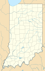
Goshen Municipal Airport is a public use airport located three nautical miles (6 km) southeast of the central business district of Goshen, a city in Elkhart County, Indiana, United States. It is owned by the Goshen Board of Aviation Commissioners. This airport is included in the National Plan of Integrated Airport Systems for 2011–2015, which categorized it as a general aviation facility.

Fulton County Airport is a public use airport located four nautical miles north of the central business district of Wauseon, a city in Fulton County, Ohio, United States. It is owned by the Fulton County Commissioners. This airport is included in the National Plan of Integrated Airport Systems for 2011–2015, which categorized it as a general aviation facility.

Wheeler Airport is a private use airport in Starke County, Indiana, United States. It is located six nautical miles (11 km) south of the central business district of Knox, Indiana, and was previously a public use airport.

Kentland Municipal Airport is a public use airport located one nautical mile (2 km) southeast of the central business district of Kentland, in Newton County, Indiana, United States. It is owned by the Kentland Board of Aviation Commissioners. This airport included in the National Plan of Integrated Airport Systems for 2011–2015, which categorized it as a general aviation facility.

Panguitch Municipal Airport is a public use airport located three nautical miles (6 km) northeast of the central business district of Panguitch, a city in Garfield County, Utah, United States. It is owned by the Panguitch City Corp. This airport is included in the National Plan of Integrated Airport Systems for 2011–2015, which categorized it as a general aviation facility.

Ravalli County Airport is a public use airport in Ravalli County, Montana, United States. It is owned by Ravalli County and located one nautical mile (2 km) east of the central business district of Hamilton, Montana. This airport is included in the National Plan of Integrated Airport Systems for 2011–2015, which categorized it as a general aviation facility.

Crawfordsville Regional Airport is a public use airport located 4 miles (6.4 km) south of the central business district of Crawfordsville, a city in Montgomery County, Indiana, United States. The airport was founded in June 1945 and is owned by the city. It is included in the Federal Aviation Administration (FAA) National Plan of Integrated Airport Systems for 2019–2023, in which it is categorized as a local general aviation facility.


