Morses Gulch is a coastal valley in Marin County, California, United States.
Contents
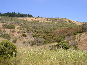
It descends the western slope of Bolinas Ridge and drains into Bolinas Lagoon. [1]
Morses Gulch is a coastal valley in Marin County, California, United States.
It descends the western slope of Bolinas Ridge and drains into Bolinas Lagoon. [1]

Bolinas Bay is a small bay, approximately 5 miles (8 km) long, on the Pacific coast of California in the United States. It is in Marin County, north of the Golden Gate, approximately 15 miles (25 km) northwest of San Francisco. The town of Bolinas is at its shore.

Bolinas Lagoon is a tidal estuary, approximately 1,100 acres (4.5 km2) in area, located in the West Marin region of Marin County, California, United States, adjacent to the town of Bolinas. It is a part of the Greater Farallones National Marine Sanctuary. In 1974, Aubrey Neasham and William Pritchard wrote in support of Bolinas Lagoon as Drake's New Albion landing site.
The Marin-Bolinas Botanical Gardens are botanical gardens specializing in succulents, located in Bolinas, California, United States. They are not open to the public as of 2018. The gardens were created by Dr. Herman Schwartz, a retired physician. They now contain over 2,000 species; the children's garden has 280 types of succulents. The gardens include six greenhouses, including ones dedicated to aloes and euphorbias. A Marin County native flower garden is currently being added.
Copper Mine Gulch is a valley in Marin County, California, United States, which is associated with a small stream.

Wilkins Gulch is a valley in western Marin County, California, United States, located northwest of Pike County Gulch. It is associated with a small stream.
Pike County Gulch is a coastal valley in Marin County, California, United States, which is associated with a small stream. It is located between Wilkins Gulch and Audubon Canyon.
McKinnan Gulch is a valley in Marin County, California, United States.

Stinson Gulch is a valley in Marin County, California, United States which is associated with a small stream.

Bolinas Ridge is a north-south ridge in southwestern Marin County, California. Much of the western side of the ridge is protected parkland in the Golden Gate National Recreation Area, and the eastern side is watershed lands of the Marin Municipal Water District.
Olema Valley is a gorge formed by the San Andreas Fault in rural west Marin County, Northern California. The valley runs from the southern end of Tomales Bay through Point Reyes Station, the town of Olema, and Dogtown, to the Bolinas Lagoon, which lies between Bolinas and Stinson Beach. It is part of the Golden Gate National Recreation Area.
Whittemore Gulch is a valley in San Mateo County, California. It contains a small stream which is a tributary of Purisima Creek. The gulch is managed by the Midpeninsula Regional Open Space District as part of Purisima Creek Redwoods Open Space Preserve. The trail through the gulch is closed to bicycle and equestrian traffic.
Grabtown Gulch is a valley in San Mateo County, California. It contains a stream which is a tributary of Purisima Creek.
Soda Gulch is a valley in San Mateo County, California. It contains a small stream which is a tributary of Purisima Creek.
Rogers Gulch is a small river in San Mateo County, California. It contains a small stream which is a tributary of Lobitos Creek.
Bradley Creek is a river in San Mateo County, California, and is a tributary of the Pescadero Creek.
Roy Gulch is a valley in San Mateo County, California, containing a small stream that is a tributary of Pescadero Creek.
Dark Gulch is a valley in San Mateo County, California associated with a small stream that is a tributary of Pescadero Creek.

KPH is a coast radio station on the Pacific Coast of the United States. For most of the 20th century, it provided ship to shore communications including telegrams and marine telex service. The station discontinued commercial operation in 1998, but is operated occasionally as a historic service – its signal can be received over a large portion of the western hemisphere.
Coyote Gulch is a stream in San Francisco, California. It is one of the last remaining free flowing, unculverted creeks in San Francisco. It runs from the foothills of the Presidio to the Pacific Ocean. The stream often is confused with another stream that defines the boundary of Baker Beach and China Beach that is basically Lobos Creek after it goes through the filtration system.
Duxbury Reef State Marine Conservation Area (SMCA) is a marine protected area located about 1 mile (2 km) west of Bolinas in Marin County on California’s north central coast. This marine protected area covers 0.66 square miles (1.7 km2). Duxbury Reef SMCA prohibits the take of all living marine resources, except the recreational take of finfish from shore only and the recreational take of abalone.
37°55′08″N122°40′16″W / 37.918814°N 122.671095°W
| | This Marin County, California–related article is a stub. You can help Wikipedia by expanding it. |