
The Tasman Sea is a marginal sea of the South Pacific Ocean, situated between Australia and New Zealand. It measures about 2,000 km (1,200 mi) across and about 2,800 km (1,700 mi) from north to south. The sea was named after the Dutch explorer Abel Janszoon Tasman, who in 1642 was the first known person to cross it. British explorer Lieutenant James Cook later extensively navigated the Tasman Sea in the 1770s during his three voyages of exploration.

The Selwyn River / Waikirikiri flows through the Selwyn District of Canterbury in the South Island of New Zealand.
The Ohikanui River is a tributary of the Buller River in New Zealand's South Island. It flows north for 20 kilometres, joining the Buller 14 kilometres from its outflow into the Tasman Sea. It and its smaller neighbour the Ohikaiti River are often called the Big Ohika River and Little Ohika River respectively.
Awarua Point is located on the southwestern coast of New Zealand's South Island, at the northern end of Big Bay, 40 kilometres (25 mi) north of Milford Sound, and 15 kilometres (9.3 mi) north of the mouth of the Hollyford River.
Arapito is a town in the Karamea area of New Zealand. Arapito is a farming community on the south side of the Karamea River, and upriver from the main Karamea township.
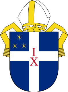
The Diocese of Christchurch is one of the thirteen dioceses and hui amorangi of the Anglican Church in Aotearoa, New Zealand and Polynesia. The Diocese covers the area between the Conway River and the Waitaki River in the South Island of New Zealand.
The Motupiko River is a river of the Tasman Region of New Zealand's South Island. A major tributary of the Motueka River, it flows north from its origins southeast of the Hope Saddle, meeting the Motueka at Kohatu Junction, 15 kilometres west of Wakefield. The Motupiko's tributaries include the Rainy River.
The Ohikaiti River is a river of the West Coast Region of New Zealand's South Island. It flows north, paralleling the course of the larger Ohikanui River which lies two kilometres to the west. The Ohikaiti empties into the Buller River at the Buller Gorge, 15 kilometres southwest of Westport.
The Omoeroa River is a river of the West Coast region of New Zealand's South Island. It flows northwest from its source high in the Southern Alps, 14 kilometres north of Aoraki / Mount Cook, reaching the Tasman Sea 12 kilometres west of Franz Josef.
The Oneone River is a short river of the West Coast Region of New Zealand's South Island. It is located northwest of Harihari, and reaches the Tasman Sea at the estuary of its larger northern neighbour, the Wanganui River.
The Ōtoko River is a river of the West Coast Region of New Zealand's South Island. It flows generally northwest from the northern slopes of Mount Hooker, reaching the Paringa River 20 kilometres south of Bruce Bay.
The Pahau River or Pahu River is a river of the north Canterbury region of New Zealand's South Island. It has its origins in the Tekoa Range, 25 kilometres (16 mi) northwest of Culverden, and flows initially north before turning south to flow down a long valley between two ridges. At the northern edge of the Canterbury Plains it turns southeast, flowing past the southern outskirts of Culverden to reach the Hurunui River 8 kilometres (5 mi) southeast of the town.
The Saxon River is a river of the Tasman Region of New Zealand's South Island. It flows northwest to reach the Big River 10 kilometres southeast off Kahurangi Point. The Saxon river's entire length is within Kahurangi National Park.
The Tutaki River is a river of the Tasman Region of New Zealand's South Island. It flows north from its sources southwest of Lake Rotoroa to reach the Mangles River 10 kilometres east of Murchison.
The Waikākaho River is a river of the Marlborough Region of New Zealand's South Island. It flows south from its sources southeast of Havelock to reach the Wairau River 5 kilometres (3 mi) west of Tuamarina.

Te Waikoropupū River, previously known as the Waikoropupū River, is a river of the Tasman Region of New Zealand's South Island. It originates in the Kahurangi National Park and flows generally northeast to reach the Tākaka River close to the town of Tākaka. On its way it passes close to the Te Waikoropupū Springs, which drain into the river and add significantly to its water volume.

Golden Bay / Mohua is a shallow, paraboloid-shaped bay in New Zealand, near the northern tip of the South Island. An arm of the Tasman Sea, the bay lies northwest of Tasman Bay / Te Tai-o-Aorere and Cook Strait. It is protected in the north by Farewell Spit, a 26 km long arm of fine golden sand that is the country's longest sandspit. The Aorere and Tākaka rivers are the major waterways to flow into the bay from the south and the west.
Ann Lovell, her husband James and their children were the first European settlers in Golden Bay at Motupipi, east of Tākaka, New Zealand. Lovell was described in her biography as a homemaker, gold courier and shopkeeper. She was born about 1803/4.
Cracroft is a south-west suburb of Christchurch, Canterbury, New Zealand.

Motupipi is a settlement in the Tasman District of New Zealand's upper South Island, located at the mouth of the Motupipi River east of Tākaka.
