Related Research Articles

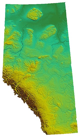
Alberta is one of the thirteen provinces and territories of Canada. Located in Western Canada, the province has an area of 661,190 km2 (255,290 sq mi) and is bounded to the south by the United States state of Montana along 49° north for 298 km (185 mi); to the east at 110° west by the province of Saskatchewan for 1,223 km (760 mi); and at 60° north the Northwest Territories for 644 km (400 mi). The southern half of the province borders British Columbia along the Continental Divide of the Americas on the peaks of the Rocky Mountains, while the northern half borders British Columbia along the 120th meridian west. Along with Saskatchewan it is one of only two landlocked provinces or territories.
Kootanae House, also spelled Kootenae House, was a North West Company fur trading post built by Jaco Finlay under the direction of David Thompson near present-day Invermere, British Columbia in 1807. It was abandoned in 1812. In 1808 Thompson reckoned its location as 50°32′12″N115°56′15″W. The actual location is Kootenae House National Historic Site, located at 50.526624°N 116.045440°W.

The District of Athabasca was a regional administrative district of Canada's Northwest Territories. It was formed in 1882, was later enlarged, and then abolished with the creation of the provinces of Saskatchewan and Alberta in 1905. The very easternmost part is now within Manitoba.

Aldersyde is a hamlet in Alberta, Canada within the Foothills County. Located between Highway 2 and Highway 2A south of Highway 7, the hamlet is approximately 8 kilometres (5.0 mi) southeast of Okotoks, 10 kilometres (6.2 mi) north of High River and 25 kilometres (16 mi) south of Calgary. The Canadian Pacific Kansas City Aldersyde subdivision runs through the hamlet.
There are several lakes named Mud Lake within the Canadian province of Alberta.

Saskatchewan River Crossing is a locality in western Alberta, Canada. It is located within Banff National Park at the junction of Highway 93 and Highway 11. It is administered by Improvement District No. 9.

The Headwall Lakes are in a valley south-east of Mount Chester in Kananaskis Country in Alberta, Canada. They can be accessed from the Smith-Dorrien / Spray Trail road. Their waters flow down Headwall Creek into Smith-Dorrien Creek then south east into Lower Kananaskis Lake
Shark Tooth Mountain, officially named in 1954, is also known as The Sharktooth or Sharp Tooth Mountain. It is a mountain in the East Kootenay region of southeastern British Columbia, Canada, southwest of Whiteswan Lake. Presumably, the name is related to the profile of the peak. It sits to the southwest of Whiteswan Lake Provincial Park, with Lussier Hot Springs and Ram Creek Hot Springs nearby, and is part of the Kootenay Ranges subdivision of the Canadian Rockies in Western Alberta and most of British Columbia.

The Rocky Mountain Foothills are an upland area flanking the eastern side of the Rocky Mountains, extending from the Liard River in British Columbia southward into Alberta. Bordering the Interior Plains system, they are part of the Rocky Mountain System or Eastern System of the Western Cordillera of North America.
Driftpile is a community on the Drift Pile River 150 Indian reserve, in northern Alberta, Canada. It is located on Highway 2, approximately 191 kilometres (119 mi) east of Grande Prairie.
Kananaskis Village is an unincorporated community in Alberta's Rockies within the Kananaskis Country park system in the Kananaskis Improvement District of Alberta, Canada. It is located approximately 26 km (16 mi) south of the Trans-Canada Highway, 3 km (1.9 mi) west of Highway 40 via Mt. Allan Drive and Centennial Drive. The community is located on the west shore of the Kananaskis River at the base of Mount Kidd.
Tonquin Pass, 1948 m (6393 ft), is a mountain pass in the Canadian Rockies, linking Tonquin Valley in Jasper National Park, Alberta, to Mount Robson Provincial Park and adjoining areas of British Columbia. It is at the headwaters of Tonquin Creek, which flows into British Columbia. Located on the interprovincial boundary, it is on the Continental Divide.

The Banff Park Museum National Historic Site, located in downtown Banff, Alberta, is an exhibition space associated with Banff National Park.
Mount Barwell is a summit in Alberta, Canada.
Mount Burke is a summit in Alberta, Canada.
Mount Burns is a summit in Alberta, Canada.
Mount Clitheroe is a summit in Alberta, Canada. It takes its name from Clitheroe, in England.
Mount Dyson is a summit in Alberta, Canada.
End Mountain is a summit in Alberta, Canada.

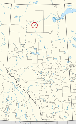
Tallcree 173A, also known as North Tallcree, is an Indian reserve of the Tallcree First Nation in Alberta, located within Mackenzie County. It is 40 kilometres (25 mi) southeast of Fort Vermilion. In the 2021 Canadian Census, Tallcree 173A had a recorded population of 201 living in 50 of its 56 total private dwellings.
References
- ↑ "Mount Burney". Geographical Names Data Base . Natural Resources Canada.
- ↑ Place-names of Alberta. Ottawa: Geographic Board of Canada. 1928. p. 27.