Related Research Articles
The Westerwaldkreis is a district (Kreis) in the north-east of Rhineland-Palatinate, Germany. Neighbouring districts are Altenkirchen, Lahn-Dill, Limburg-Weilburg, Rhein-Lahn, the district-free city Koblenz, Mayen-Koblenz and Neuwied.

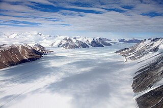
The Nimrod Glacier is a major glacier about 85 nautical miles long, flowing from the polar plateau in a northerly direction through the Transantarctic Mountains into the Ross Ice Shelf, Antarctica.
Lillie Glacier is a large glacier in Antarctica, about 100 nautical miles long and 10 nautical miles wide. It lies between the Bowers Mountains on the west and the Concord Mountains and Anare Mountains on the east, flowing to Ob' Bay on the coast and forming the Lillie Glacier Tongue.
The Hauberg Mountains are a group of mountains of about 35 nautical miles extent, located 12 nautical miles north of Cape Zumberge and 30 nautical miles south of the Sweeney Mountains in eastern Ellsworth Land, Antarctica.

Ferrar Glacier is a glacier in Antarctica. It is about 35 nautical miles long, flowing from the plateau of Victoria Land west of the Royal Society Range to New Harbour in McMurdo Sound. The glacier makes a right (east) turn northeast of Knobhead, where it where it is apposed, i.e., joined in Siamese-twin fashion, to Taylor Glacier. From there, it continues east along the south side of Kukri Hills to New Harbor.
Mount Lawrence is a peak, 1,230 metres (4,040 ft) high, just north of Mount Coates in the David Range of the Framnes Mountains, Mac. Robertson Land, Antarctica. It was mapped by Norwegian cartographers from air photos taken by the Lars Christensen Expedition, 1936–37, and was named by the Antarctic Names Committee of Australia for J. Lawrence, a diesel mechanic at Mawson Station in 1959.

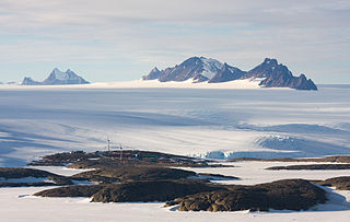
The David Range (67°54′S62°30′E is a mountain range that extends for 26 kilometres in the Framnes Mountains of Mac.Robertson Land in Antarctica. The range is surrounded by, and largely covered by, an ice sheet. Only the peaks are visible.

The Quartermain Mountains are a group of exposed mountains in Antarctica, about 20 nautical miles long, typical of ice-free features of the McMurdo Dry Valleys, Victoria Land. They are east of the Lashly Mountains, south of the Asgard Range, west of the Kukri Hills and Royal Society Range, and some distance north of the Worcester Range.
The Latady Mountains are a group of mountains rising west of Gardner Inlet and between Wetmore Glacier and Ketchum Glacier, in southeastern Palmer Land, Antarctica.
On the continent of Antarctica, the Aramis Range is the third range south in the Prince Charles Mountains, situated 11 miles southeast of the Porthos Range and extending for about 30 miles in a southwest–northeast direction. It was first visited in January 1957 by Australian National Antarctic Research Expeditions (ANARE) southern party led by W.G. Bewsher, who named it for a character in Alexandre Dumas' novel The Three Musketeers, the most popular book read on the southern journey.
Armstrong Glacier is a glacier flowing from the south side of Mount Bagshawe westward into George VI Sound. It provides the only known safe route for mechanical vehicles from George VI Sound to the Palmer Land plateau. It was named by the United Kingdom Antarctic Place-Names Committee for Edward B. Armstrong, British Antarctic Survey surveyor at Stonington Island, 1964–65.
Trost Peak is a peak, 980 m, standing 1.5 nautical miles (2.8 km) northeast of Mount Burnett in the Masson Range of the Framnes Mountains. Mapped by Norwegian cartographers from aerial photos taken by the Lars Christensen Expedition, 1936–37. Remapped by ANARE, 1957–60, and named for P.A. Trost, physicist at Mawson Station, 1958.

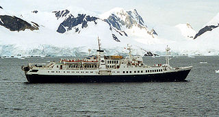
Paradise Harbour is a wide embayment behind Lemaire Island and Bryde Island, indenting the west coast of Graham Land, Antarctica, between Duthiers Point and Leniz Point. The name was first applied by whalers operating in the vicinity and was in use by 1920.
Mount Lira is a mountain located 5 nautical miles (9 km) east of the Condon Hills, in Enderby Land, Antarctica. The geology of this feature was investigated by the Soviet Antarctic Expedition of 1961–62, which called it "Gora Lira", probably because of its shape.
The Marshall Mountains are a group of mountains overlooking Beardmore Glacier in the Queen Alexandra Range, Antarctica. They are bounded on the north by Berwick Glacier, and on the south by Swinford Glacier.
The Mackin Table is an ice-topped, wedge-shaped plateau, about 20 nautical miles long, standing just north of Patuxent Ice Stream in the Patuxent Range of the Pensacola Mountains, Antarctica.
The Malta Plateau is an ice-covered plateau of about 25 nautical miles extent in the Victory Mountains of Victoria Land, Antarctica. The plateau is irregular in shape and is bounded on the south and west by Mariner Glacier, on the north by tributaries to Trafalgar Glacier, and on the east by tributaries to Borchgrevink Glacier.
Steinemann Island is an island off the northeast coast of Adelaide Island, about 10 nautical miles (18 km) southwest of Mount Velain. Mapped from air photos taken by Ronne Antarctic Research Expedition (RARE) (1947–48) and Falkland Islands and Dependencies Aerial Survey Expedition (FIDASE) (1956–57). Named by United Kingdom Antarctic Place-Names Committee (UK-APC) for Samuel Steinemann, Swiss physicist who has made laboratory investigations on the flow of single and polycrystalline ice.
The South Masson Range is the southernmost of the three parts into which the Masson Range of the Framnes Mountains, Anatarctica is divided. It rises to 1,070 metres (3,510 ft) and extending 2 miles (3.2 km) in a northeast-southwest arc.
References
 This article incorporates public domain material from "Coates, Mount". Geographic Names Information System . United States Geological Survey.