Mac. Robertson Land

Last updated
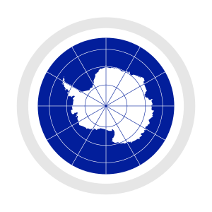
Location of Mac. Robertson Land (red), Australian Antarctic Territory in Antarctica. Mac. Robertson Land in Australian Antarctic Territory.svg
Location of Mac. Robertson Land (red), Australian Antarctic Territory in Antarctica.

Mac. Robertson Land is the portion of Antarctica lying southward of the coast between William Scoresby Bay and Cape Darnley. It is located at 70°00′S65°00′E / 70.000°S 65.000°E / -70.000; 65.000 . In the east, Mac. Robertson Land includes the Prince Charles Mountains. It was named by the British Australian and New Zealand Antarctic Research Expedition (BANZARE) (1929–1931), under Sir Douglas Mawson, after Sir Macpherson Robertson of Melbourne, a patron of the expedition. [1]

Contents

From 1965 onward, members of the SAE (Soviet Antarctic Expeditions) began undertaking geological fieldwork in the Prince Charles Mountains, eventually establishing a base, Soyuz Station, on the eastern shore of Beaver Lake in the northern Prince Charles Mountains.
Nomenclature

Mac.Robertson Land (no space after Mac.) [2] is the official Australian name, but it is known in the United States as Mac. Robertson Land and in Russia as MacRobertson Land. [3]

Features

As well as typical Antarctic geography, Mac. Robertson Land contains significant geographical features such as Tschuffert Peak, Poulton Peak, and Peak Seven; Cape Rouse, Tilley Bay, and Frustration Dome. Two of the most important of Mac. Robertson Land's landmarks are Soyuz Station, located in the Prince Charles Mountains, and the Amery Ice Shelf.

The Australian polar station Mawson has been operating here since 1954.

See also

Related Research Articles

<span class="mw-page-title-main">Mawson Station</span> Antarctic station in Australian Antarctic Territory

Mawson Station, commonly called Mawson, is one of three permanent bases and research outposts in Antarctica managed by the Australian Antarctic Division (AAD). Mawson lies in Holme Bay in Mac. Robertson Land, East Antarctica in the Australian Antarctic Territory, a territory claimed by Australia. Established in 1954, Mawson is Australia's oldest Antarctic station and the oldest continuously inhabited Antarctic station south of the Antarctic Circle. It houses approximately 20 personnel over winter and up to 53 in summer.

<span class="mw-page-title-main">Anare Mountains</span> Mountain range in Victoria Land, Antarctica

The Anare Mountains are a large group of mainly snow-covered peaks and ridges along the northern coast of Victoria Land, Antarctica. The group is bounded on the north and east by the Pacific Ocean, on the west by Lillie Glacier, and on the south by Robertson Glacier, Ebbe Glacier and Dennistoun Glacier. Kirkby Glacier, 20 miles (32 km) in length, drains the central Anare Mountains and flows northwest to the sea 3 miles (5 km) from Cape North, and just north of Arthurson Bluff, northern Victoria Land. The mountain range is situated on the Pennell Coast, a portion of Antarctica lying between Cape Williams and Cape Adare.

<span class="mw-page-title-main">Scullin Monolith</span> Monolith of Antarctica

The Scullin Monolith is a crescent-shaped rock fronting the sea 6 km (3.7 mi) west of the similar Murray Monolith, and 8 km (5.0 mi) from Torlyn Mountain, in Mac. Robertson Land, Antarctica. It is a steep massif of metasedimentary gneiss and granitic origin, with the adjacent coastline consisting of 40 m high ice cliffs. The monolith rises steeply to extend from 435 m high Mikkelsen Peak westward in a crescent that forms Douglas Bay.

<span class="mw-page-title-main">Princess Elizabeth Land</span> Australian antarctic claim

Princess Elizabeth Land is the sector of Antarctica between longitude 73° east and Cape Penck. The sector is claimed by Australia as part of the Australian Antarctic Territory, although this claim is not widely recognised.

<span class="mw-page-title-main">Lambert Glacier</span> Major glacier in East Antarctica

Lambert Glacier is a major glacier in East Antarctica. At about 50 miles (80 km) wide, over 250 miles (400 km) long, and about 2,500 m deep, it is the world's largest glacier. It drains 8% of the Antarctic ice sheet to the east and south of the Prince Charles Mountains and flows northward to the Amery Ice Shelf. It flows in part of Lambert Graben and exits the continent at Prydz Bay.

<span class="mw-page-title-main">Prince Charles Mountains</span> Mountain range in Antarctica

The Prince Charles Mountains are a major group of mountains in Mac. Robertson Land in Antarctica, including the Athos Range, the Porthos Range, and the Aramis Range. The highest peak is Mount Menzies, with a height of 3,228 m (10,591 ft). Other prominent peaks are Mount Izabelle and Mount Stinear. These mountains, together with other scattered peaks, form an arc about 420 km (260 mi) long, extending from the vicinity of Mount Starlight in the north to Goodspeed Nunataks in the south.

<span class="mw-page-title-main">Cape Denison</span> Headland of Antarctica

Cape Denison is a rocky point at the head of Commonwealth Bay in George V Land, Antarctica. It was discovered in 1912 by the Australasian Antarctic Expedition (1911–14) under Douglas Mawson, who named it for Sir Hugh Denison of Sydney, a patron of the expedition. The cape was the site of the expedition's main base. Called by Mawson "the windiest place on Earth", the site experiences fierce katabatic winds.

<span class="mw-page-title-main">Framnes Mountains</span> Mountain range in Antarctica

The Framnes Mountains is a group of Antarctic mountain ranges in Mac. Robertson Land, to the south of the Mawson Coast. The range is surrounded by, and largely covered by, an ice sheet.

The Scott Mountains are a large number of isolated peaks lying south of Amundsen Bay in Enderby Land of East Antarctica, Antarctica. Discovered on 13 January 1930 by the British Australian New Zealand Antarctic Research Expedition (BANZARE) under Sir Douglas Mawson. He named the feature Scott Range after Captain Robert Falcon Scott, Royal Navy. The term mountains is considered more appropriate because of the isolation of its individual features.

<span class="mw-page-title-main">Enderby Land</span> Projecting landmass of Antarctica

Enderby Land is a projecting landmass of Antarctica. Its shore extends from Shinnan Glacier at about 67°55′S44°38′E to William Scoresby Bay at 67°24′S59°34′E, approximately 124 of the earth's longitude. It was first documented in western and eastern literature in February 1831 by John Biscoe aboard the whaling brig Tula, and named after the Enderby Brothers of London, the ship's owners who encouraged their captains to combine exploration with sealing.

<span class="mw-page-title-main">David Range</span> Mountain range in Antarctica

The David Range (67°54′S62°30′E is a mountain range that extends for 26 kilometres in the Framnes Mountains of Mac.Robertson Land in Antarctica. The range is surrounded by, and largely covered by, an ice sheet. Only the peaks are visible.

Athos Range is the northernmost range in the Prince Charles Mountains of Mac. Robertson Land, Antarctica. The range consists of many individual mountains and nunataks that trend east–west for 40 miles (64 km) along the north side of Scylla Glacier.

<span class="mw-page-title-main">Mount Elkins</span> Mountain in Enderby Land, Antarctica

Mount Elkins, also known as Jökelen is a dark, steep-sided mountain with three major peaks, the highest 2,300 meters (7,500 ft) above sea level, in the Napier Mountains of Enderby Land. Enderby Land is part of East Antarctica and is claimed by Australia as part of the Australian Antarctic Territory. The mountain was named after Terence James Elkins, an ionospheric physicist with the Australian National Antarctic Research Expeditions at Mawson Station in 1960.

<span class="mw-page-title-main">Cape Batterbee</span> Headland in Enderby Land, Antarctica

Cape Batterbee is a small, rocky point on the coast, the most northerly cape of Enderby Land. It is located 92 km north of Mount Elkins.

The Porthos Range is the second range south in the Prince Charles Mountains of Antarctica, extending for about 30 miles in an east-to-west direction between Scylla Glacier and Charybdis Glacier. First visited in December 1956 by the Australian National Antarctic Research Expeditions (ANARE) southern party under W.G. Bewsher (1956-57) and named after Porthos, a character in Alexandre Dumas, père's novel The Three Musketeers, the most popular book read on the southern journey.

Rippon Glacier is a small glacier located in Kemp Land, East Antarctica. It is close east of Seaton Glacier, flowing southward into Edward VIII Ice Shelf.

On the continent of Antarctica, the Aramis Range is the third range south in the Prince Charles Mountains, situated 11 miles southeast of the Porthos Range and extending for about 30 miles in a southwest–northeast direction. It was first visited in January 1957 by Australian National Antarctic Research Expeditions (ANARE) southern party led by W.G. Bewsher, who named it for a character in Alexandre Dumas' novel The Three Musketeers, the most popular book read on the southern journey.

<span class="mw-page-title-main">Masson Range</span>

The Masson Range is a high broken chain of mountains, consisting primarily of the North Masson, Central Masson and South Masson Ranges, forming a part of the Framnes Mountains.

<span class="mw-page-title-main">Central Masson Range</span>

The Central Masson Range is the central segment of the three parts of the Masson Range, Antarctica. It rises to 1,120 metres (3,670 ft) and extends 4 nautical miles (7 km) in a north–south direction.

<span class="mw-page-title-main">North Masson Range</span>

North Masson Range is part of the Masson Range, which is divided into three parts of which this segment is the northern, rising to 1,030 metres (3,380 ft) and extending 3 miles (4.8 km) in a north–south direction.

References

  1. Australian Antarctic Division. Mac. Robertson Land Archived 2011-06-02 at the Wayback Machine
  2. Australian Antarctic Division. "Antarctic Gazetteer". Australian Antarctic Division. Retrieved 2011-07-08.
  3. SCAR Gazetteer Ref. No 8833 Mac. Robertson Land