Related Research Articles

Booth Island is a Y-shaped island, 5 nautical miles long and rising to 980 metres (3,220 ft) in the northeast part of the Wilhelm Archipelago, Antarctica.
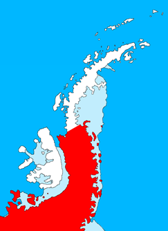
Palmer Land is the portion of the Antarctic Peninsula, Antarctica that lies south of a line joining Cape Jeremy and Cape Agassiz. This application of Palmer Land is consistent with the 1964 agreement between the Advisory Committee on Antarctic Names and the UK Antarctic Place-Names Committee, in which the name Antarctic Peninsula was approved for the major peninsula of Antarctica, and the names Graham Land and Palmer Land for the northern and southern portions, respectively. The line dividing them is roughly 69° S.
The Anare Mountains are a large group of mainly snow-covered peaks and ridges along the northern coast of Victoria Land, Antarctica. The group is bounded on the north and east by the Pacific Ocean, on the west by Lillie Glacier, and on the south by Ebbe Glacier and Dennistoun Glacier. They are north of the Concord Mountains and east of the Bowers Mountains.

The Usarp Mountains are a major mountain range in North Victoria Land, Antarctica. They are west of the Rennick Glacier and trend north to south for about 190 kilometres (118 mi). The mountains are bounded to the north by Pryor Glacier and the Wilson Hills. They are west of the Bowers Mountains.

Mac. Robertson Land is the portion of Antarctica lying southward of the coast between William Scoresby Bay and Cape Darnley. It is located at 70°00′S65°00′E. In the east, Mac. Robertson Land includes the Prince Charles Mountains. It was named by the British Australian and New Zealand Antarctic Research Expedition (BANZARE) (1929–1931), under Sir Douglas Mawson, after Sir Macpherson Robertson of Melbourne, a patron of the expedition.

The Prince Charles Mountains are a major group of mountains in Mac. Robertson Land in Antarctica, including the Athos Range, the Porthos Range, and the Aramis Range. The highest peak is Mount Menzies, with a height of 3,228 m (10,591 ft). Other prominent peaks are Mount Izabelle and Mount Stinear. These mountains, together with other scattered peaks, form an arc about 420 km (260 mi) long, extending from the vicinity of Mount Starlight in the north to Goodspeed Nunataks in the south.

The Framnes Mountains is a group of Antarctic mountain ranges in Mac. Robertson Land, to the south of the Mawson Coast. The range is surrounded by, and largely covered by, an ice sheet.
Wilson Hills is a group of scattered hills, nunataks and ridges that extend northwest–southeast about 70 nautical miles between Matusevich Glacier and Pryor Glacier in Antarctica.
The Mariner Glacier is a major glacier over 60 nautical miles long, descending southeast from the plateau of Victoria Land, Antarctica, between Mountaineer Range and Malta Plateau, and terminating at Lady Newnes Bay, Ross Sea, where it forms the floating Mariner Glacier Tongue.
The Tabarin Peninsula is a peninsula 15 nautical miles long and 5 to 12 nautical miles wide, lying south of the trough between Hope Bay and Duse Bay and forming the east extremity of Trinity Peninsula in the Antarctic Peninsula.
The Emlen Peaks is a group of scattered peaks and nunataks, 16 miles (26 km) long and 7 miles (11 km) wide. It is 6 miles (9.7 km) south of Daniels Range in the south end of the Usarp Mountains in northern Victoria Land, Antarctica.
On the continent of Antarctica, the Aramis Range is the third range south in the Prince Charles Mountains, situated 11 miles southeast of the Porthos Range and extending for about 30 miles in a southwest–northeast direction. It was first visited in January 1957 by Australian National Antarctic Research Expeditions (ANARE) southern party led by W.G. Bewsher, who named it for a character in Alexandre Dumas' novel The Three Musketeers, the most popular book read on the southern journey.
The Blånabbane Nunataks are a small group of nunataks about 15 nautical miles (30 km) east of Mount Twintop in Mac. Robertson Land. They were mapped and named by Norwegian cartographers working from air photos taken by the Lars Christensen Expedition, 1936–37.
The Playfair Mountains are a group of mountains between Swann Glacier and Squires Glacier in southeast Palmer Land, Antarctica.
Mount Henderson is a mountain in the Framnes Mountains of Mac. Robertson Land in the Antarctic. It is southeast of Holme Bay and northeast of the Masson Range.
Hunt Peak is a triangular rock peak, 610 metres (2,000 ft) high, marking the north side of the entrance to Stonehouse Bay on the east coast of Adelaide Island, Antarctica. It was discovered and first roughly surveyed in 1909 by the French Antarctic Expedition under Jean-Baptiste Charcot. It was resurveyed in 1948 by the Falkland Islands Dependencies Survey (FIDS), who named the point marked by this peak for Sergeant Kenneth D. Hunt, a mechanic for the expedition's Noorduyn Norseman airplane in 1950. Further survey in 1957–58 by the FIDS showed no definable point in the vicinity and the name was transferred to the peak.
Mount Mackellar is a massive mountain, 4,295 metres (14,091 ft) high, standing at the head of Mackellar Glacier, 3 nautical miles south of Pagoda Peak in the Queen Alexandra Range, Antarctica.
The Tomilin Glacier is a glacier over 15 nautical miles long, draining north from Pope Mountain in the central Wilson Hills. It enters the sea east of Goodman Hills and Cape Kinsey, forming a substantial glacier tongue.

Rakuda Glacier is a glacier flowing to the coast just east of Rakuda Rock in Queen Maud Land. Mapped from surveys and air photos by Japanese Antarctic Research Expedition (JARE), 1957–62, who gave the name.
References
![]() This article incorporates public domain material from "Poulton Peak". Geographic Names Information System . United States Geological Survey.
This article incorporates public domain material from "Poulton Peak". Geographic Names Information System . United States Geological Survey.
| | This Mac. Robertson Land location article is a stub. You can help Wikipedia by expanding it. |