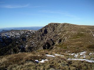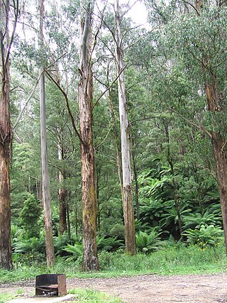
The Alpine National Park is a national park located in the Central Highlands and Alpine regions of Victoria, Australia. The 646,000-hectare (1,600,000-acre) national park is located northeast of Melbourne. It is the largest National Park in Victoria, and covers much of the higher areas of the Great Dividing Range in Victoria, including Victoria's highest point, Mount Bogong at 1,986 metres (6,516 ft) and the associated subalpine woodland and grassland of the Bogong High Plains. The park's north-eastern boundary is along the border with New South Wales, where it abuts the Kosciuszko National Park. On 7 November 2008 the Alpine National Park was added to the Australian National Heritage List as one of eleven areas constituting the Australian Alps National Parks and Reserves.
Victoria is the smallest mainland state in Australia. As of 2008 it contained 2,850 separate protected areas with a total land area of 39,273 km2 (15,163 sq mi). Of these, 45 were national parks, totalling 28,023 km2 (10,820 sq mi).

The Australian Alps is a mountain range in southeast Australia. It comprises an interim Australian bioregion, and is the highest mountain range in Australia. The range straddles the borders of eastern Victoria, southeastern New South Wales, and the Australian Capital Territory. It contains Australia's only peaks exceeding 2,000 m (6,600 ft) in elevation, and is the only bioregion on the Australian mainland in which deep snow falls annually. The range comprises an area of 1,232,981 ha.

Mount Gambier is the second most populated city in South Australia, with an estimated urban population of 33,233 as of 2021. The city is located on the slopes of Mount Gambier, a volcano in the south east of the state, about 450 kilometres (280 mi) south-east of the capital Adelaide and just 17 kilometres (11 mi) from the Victorian border. The traditional owners of the area are the Bungandidj people. Mount Gambier is the most important settlement in the Limestone Coast region and the seat of government for both the City of Mount Gambier and the District Council of Grant.

Mount Worth State Park is a state park in Victoria, Australia. It is located 15 km south of Warragul in the western Strzelecki Ranges. It offers rainforest walking trails and scenic views of Gippsland as well as across the Latrobe Valley to the Great Dividing Range.
The Mount Arapiles-Tooan State Park is a state park in the Wimmera plains of western Victoria, Australia. It encompasses Mount Arapiles, Mitre Rock, and the Tooan block. The park covers an area of 7,475 hectares and is valuable for nature conservation, with approximately 14% of the State's flora species represented in the Mount Arapiles area.

Mount Napier State Park is a state park in the Australian state of Victoria. It is 20 km northeast of Mount Eccles; its centerpiece is Mount Napier, a true volcanic cone. The park was established in 1987, and today encompasses 2800 hectares of land. The local Aboriginal name for the mount is Tapoc.

Granya is a town in northeastern Victoria, Australia on the Murray arm of Lake Hume in the Towong Shire local government area, 378 kilometres (235 mi) northwest of the state capital, Melbourne.

The Big River, a perennial river of the North-East Murray catchment of the Murray-Darling basin, is located in the East Gippsland and Alpine regions of Victoria, Australia. It flows from the northern slopes of Falls Creek in the Australian Alps, joining with the Cobungra River near Anglers Rest to form the Mitta Mitta River.

The Bundara River, a perennial river of the North-East Murray catchment of the Murray-Darling basin, is located in the East Gippsland and Alpine regions of Victoria, Australia.

Mount Buangor State Park is located 60 kilometres west of Ballarat, Victoria in Bayindeen. The 2400-hectare park takes in varied eucalypt forest, creek flats, a waterfall, steep escarpments, and the area's highest peak, Mount Buangor. The park contains a 15 km network of walking trails.

Mount Terrible is a mountain within the Great Dividing Range, located to the south-west of Kevington in Victoria, Australia. The mountain is located within the 100 hectares Mount Terrible Natural Features and Scenic Reserve.
Mount Lawson State Park is a 13,150-hectare (32,500-acre) park situated approximately 60 km east of Wodonga in the state of Victoria, Australia. It was protected for its diverse vegetation, rare flora and fauna, aesthetic qualities and cultural heritage.
Mount Samaria State Park is a 7,600-hectare (19,000-acre) park situated approximately 20 km north of Mansfield in the state of Victoria, Australia. The park is bounded on the western side by the Broken River and Lake Nillahcootie.
Mount Selma is a mountain located to the north-east of Aberfeldy in Victoria, Australia. Its peak is 1463 metres above sea level. The headwaters of the Aberfeldy River rise on its southerly slopes.
Mount Elizabeth is a mountain to the east of Tambo Crossing in East Gippsland, Victoria, Australia. It lies within the Mount Elizabeth Nature Conservation Reserve managed by Parks Victoria. The reserve, which covers 5,234 hectares, was established in 1984. The reserve is the only known location where the endangered plant species leafy nematolepis occurs. Other rare or vulnerable plant species found in the reserve include Tullach Ard grevillea, outcrop guinea-flower, Mount Elizabeth hovea, monkey mint-bush and leafless pink-bells. Fauna species of note include the lace monitor, yellow-tailed black cockatoo and gang-gang cockatoo.
The Ada River is a perennial river of the Bemm River catchment, located in the East Gippsland region of the Australian state of Victoria.
The Goolengook River is a perennial river of the Bemm River catchment, located in the East Gippsland region of the Australian state of Victoria.

The Arte River is a perennial river of the Bemm River catchment, located in the East Gippsland region of the Australian state of Victoria.
The Little Arte River is a perennial river of the Bemm River catchment, located in the East Gippsland region of the Australian state of Victoria.


