
Mount Karinya is a mountain in South Australia near the town of Moculta. [1] It has an elevation of 451 metres. [2] The mount was known as Mount Despond until its name was changed on 10 April 1941. [3]
Mount Karinya is a mountain in South Australia near the town of Moculta. [1] It has an elevation of 451 metres. [2] The mount was known as Mount Despond until its name was changed on 10 April 1941. [3]
Birdsville is a rural town and locality in the Shire of Diamantina, Queensland, Australia. The locality is on the Queensland border with both the Northern Territory and South Australia. The town is situated 10 kilometres (6 mi) north of the South Australian border. In the 2021 census, the locality of Birdsville had a population of 110 people.
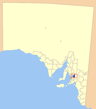
Barossa Council is a local government area in the Barossa Valley in South Australia. The council area covers 912 square kilometres, and had a population of over 23,000 in the 2016 Census.
The Division of Angas was an Australian Electoral Division in South Australia. The division was created in 1903 and abolished in 1934. It was named for George Fife Angas, a South Australian pioneer politician, banker and pastoralist who played a significant part in the formation and establishment of the Province of South Australia.
The Division of Angas was an Australian Electoral Division in South Australia. The division was proclaimed at the redistribution of 11 May 1949 and abolished in 1977. It was named for George Fife Angas, a South Australian pioneer politician, banker and pastoralist who played a significant part in the formation and establishment of the Province of South Australia.
Tungkillo is a town in South Australia, located approximately 5 km (3.1 mi) south of Mount Pleasant. It sits on Adelaide-Mannum Road, 60 km (37 mi) north-east of the state capital, Adelaide and 25 km (16 mi) north-west of Mannum. At the 2006 census, Tungkillo had a population of 360.

Mount Pleasant is a town situated in the Barossa Council, just north of the Adelaide Hills region of South Australia, 55 kilometres east-north-east of the state capital, Adelaide. It is located in the Barossa Council and Mid Murray Council local government areas, and is at an altitude of 440 metres above sea level. Rainfall in the area averages 687 mm per annum.

Palmer is a town just east of the Adelaide Hills region of South Australia along the Adelaide-Mannum Road, 70 kilometres east-north-east of the state capital, Adelaide and 15 km west-north-west of Mannum. It is located in the Mid Murray Council local government area.
The Cataract River, a perennial river that is part of the Hawkesbury-Nepean catchment, is located in the Macarthur region of New South Wales, Australia.
The Jooriland River, a perennial river that is part of the Hawkesbury-Nepean catchment, is located in the Central Tablelands and Macarthur regions of New South Wales, Australia.
Moculta is a locality in the Australian state of South Australia located about 69 kilometres (43 mi) north-east of the state capital of Adelaide and about 12 kilometres (7.5 mi) north-east of the municipal seat of Angaston. At the 2016 census, Moculta shared a population of 227 with part of Truro).
Mount Victor Station is a pastoral lease currently operating as a sheep station located about 115 kilometres (71 mi) east of Hawker and 175 kilometres (109 mi) west of Broken Hill in the state of South Australia,
The Burke River, a watercourse that is part of the Nepean River catchment, is located in the Southern Highlands of New South Wales, Australia.

NNeales Flat is a rural locality southeast of Eudunda in the Mid North region in South Australia. It is in the Regional Council of Goyder local government area, the South Australian House of Assembly electoral district of Stuart and the Australian House of Representatives Division of Grey.

County of Young is a cadastral unit located in the Australian state of South Australia covers land located in the state’s east on the north side of the Murray River. It was proclaimed in 1860 by Governor MacDonnell and named after his predecessor, Governor Young. It has been partially divided in the following sub-units of hundreds – Markaranka, Parcoola, Pooginook and Stuart.

County of Burra is a cadastral unit located in the Australian state of South Australia which covers land located in the state’s east associated with the town of Burra. It was proclaimed in 1851 by Governor Young and named after the town of Burra.
The District Council of Ridley-Truro was a local government area in South Australia from 1991 to 1997.
The District Council of Mannum was a local government area in South Australia from 1877 to 1997, centring on the town of Mannum.
The District Council of Truro was a local government area in South Australia from 1876 to 1991.
Irongate is a rural locality in the Toowoomba Region, Queensland, Australia. In the 2021 census, Irongate had a population of 135 people.
Burra Creek is a stream in South Australia rising in the northern Mount Lofty Ranges, flowing generally southwards and eastwards to join the River Murray at Morgan.
34°28′42″S139°10′15″E / 34.4784173°S 139.1708347°E
| | This South Australia geography article is a stub. You can help Wikipedia by expanding it. |
| | This Australia mountain, mountain range, or peak related article is a stub. You can help Wikipedia by expanding it. |