The Neptune Range is a mountain range, 112 km (70 mi) long, lying WSW of Forrestal Range in the central part of the Pensacola Mountains in Antarctica. The range is composed of Washington Escarpment with its associated ridges, valleys and peaks, the Iroquois Plateau, and the Schmidt and Williams Hills. It was discovered and photographed on 13 January 1956 on a US Navy transcontinental plane flight from McMurdo Sound to Weddell Sea and return.
The Salvesen Mountains or Salvesen Range is a mountain range on the southern tip of South Georgia, rising to a maximum elevation of 2,330 metres (7,644 ft). They were created 127 million years ago and are made mainly from granite. The Cretaceous granite is embedded into the Jurassic basaltic lavas and dolerite dykes. Both of which are black so they create a striking colour contrast in exposures. Both the granite and the basalt were formed from rising magma formed on the divergent plate boundary where the southern Atlantic Ocean opened. The main ranges of South Georgia famously crossed by Ernest Shackleton in 1916, are less rugged and precipitous than the Salvesen Mountains as they are formed from folded sandstone. These were formed from sand deposition, the sediment for which was derived from erosion of the igneous rocks and rifting continental blocks.

The Prince Charles Mountains are a major group of mountains in Mac. Robertson Land in Antarctica, including the Athos Range, the Porthos Range, and the Aramis Range. The highest peak is Mount Menzies, with a height of 3,228 m (10,591 ft). Other prominent peaks are Mount Izabelle and Mount Stinear. These mountains, together with other scattered peaks, form an arc about 420 km (260 mi) long, extending from the vicinity of Mount Starlight in the north to Goodspeed Nunataks in the south.
The Tula Mountains are a group of extensive mountains lying immediately eastward of Amundsen Bay in Enderby Land, Antarctica. They were discovered on January 14, 1930, by the British Australian New Zealand Antarctic Research Expedition (BANZARE) under Mawson and named "Tula Range" by him after John Biscoe's brig, the Tula, from which Biscoe discovered Enderby Land in 1831. The term "mountains" was recommended for the group following an ANARE sledge survey in 1958 by G.A. Knuckey.
The Scott Mountains are a large number of isolated peaks lying south of Amundsen Bay in Enderby Land of East Antarctica, Antarctica. Discovered on 13 January 1930 by the British Australian New Zealand Antarctic Research Expedition (BANZARE) under Sir Douglas Mawson. He named the feature Scott Range after Captain Robert Falcon Scott, Royal Navy. The term mountains is considered more appropriate because of the isolation of its individual features.
Wilkniss Mountains is a prominent group of conical mountains, 10 miles (16 km) long running north–south, located 9 miles (14 km) east-southeast of Mount Feather, Quartermain Mountains, in Victoria Land, Antarctica. The mountains are 3 miles (4.8 km) wide in the north portion where Mount Blackwelder and Pivot Peak rise above ice-free valleys. Except for an outlying southwest peak, the south portion narrows to a series of mainly ice-covered smaller peaks. Named by Advisory Committee on Antarctic Names (US-ACAN) in 1992 after Peter E. Wilkniss, a chemist who from 1975 has served in various positions at the National Science Foundation, including Deputy Assistant Director of the Directorate for Scientific, Technological, and International Affairs; Director, Division of Polar Programs, 1984–93; senior science associate to the assistant director for Geosciences, from 1993.
Athos Range is the northernmost range in the Prince Charles Mountains of Mac. Robertson Land, Antarctica. The range consists of many individual mountains and nunataks that trend east–west for 40 miles (64 km) along the north side of Scylla Glacier.
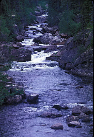
Mount Ashley is a mountain, 1,155 metres (3,790 ft) high, standing south of the Bay of Isles, South Georgia, between the heads of Grace Glacier and Lucas Glacier. Salisbury Plain is nearby. It is named for Clifford Warren Ashley, an American artist, author, and whaling historian.
The Christmas Mountains are a series of rounded peaks in northern New Brunswick, Canada, at the headwaters of North Pole Stream and the Little Southwest Miramichi River, west of Big Bald Mountain, and south of Mount Carleton. The mountains, in part, separate the Miramichi River watershed from the watersheds of the Serpentine River and the Nepisiguit River.
The Porthos Range is the second range south in the Prince Charles Mountains of Antarctica, extending for about 30 miles in an east-to-west direction between Scylla Glacier and Charybdis Glacier. First visited in December 1956 by the Australian National Antarctic Research Expeditions (ANARE) southern party under W.G. Bewsher (1956-57) and named after Porthos, a character in Alexandre Dumas, père's novel The Three Musketeers, the most popular book read on the southern journey.
Mount Storegutt is a mountain, 1,465 m, standing 28 nautical miles (50 km) west of Edward VIII Bay and 10 nautical miles (18 km) south of Jennings Bluff It was mapped by Norwegian cartographers from aerial photos taken by the Lars Christensen Expedition of 1936–37 and was named Storegutt.
On the continent of Antarctica, the Aramis Range is the third range south in the Prince Charles Mountains, situated 11 miles southeast of the Porthos Range and extending for about 30 miles in a southwest–northeast direction. It was first visited in January 1957 by Australian National Antarctic Research Expeditions (ANARE) southern party led by W.G. Bewsher, who named it for a character in Alexandre Dumas' novel The Three Musketeers, the most popular book read on the southern journey.
Mount Antell is a mountain rising above 610 metres (2,000 ft), overlooking the north coast of South Georgia midway between Bjelland Point and Hercules Point. It was surveyed by the South Georgia Survey in the period 1951–57, and named by the UK Antarctic Place-Names Committee for Georg Antell, foreman of the South Georgia Whaling Company station at nearby Leith Harbour, 1913–39.
Mount Bartlett is a mountain 3 nautical miles (6 km) southeast of Mount Storer, in the Tula Mountains in Enderby Land. It was plotted from air photos taken from ANARE aircraft in 1956 and 1957. It was named by the Antarctic Names Committee of Australia (ANCA) for A.J. Bartlett, a member of the crew of the Discovery during the British Australian New Zealand Antarctic Research Expedition (BANZARE) of 1929–31.
Nils Plain is an ice plain of about 25 nautical miles (46 km) extent, lying northward of Mount Roer in the Sverdrup Mountains, Queen Maud Land. Mapped by Norwegian cartographers from surveys and air photos by Norwegian-British-Swedish Antarctic Expedition (NBSAE) (1949–52) and air photos by the Norwegian expedition (1958–59). Named for Nils Roer, surveyor of the NBSAE.
Mount Parviainen is a mountain close northeast of Mount Henksen, in the north part of the Tula Mountains in Enderby Land. It was plotted from air photos taken from ANARE aircraft in 1956 and was named by the Antarctic Names Committee of Australia (ANCA) for L. Parviainen, a member of the crew of the Discovery during the British Australian New Zealand Antarctic Research Expedition (BANZARE) of 1929–31.
Mount Morrison is a mountain 1.5 nautical miles (3 km) northeast of Mount Best, in the Tula Mountains of Enderby Land in Antarctica. It was plotted from air photos taken from Australian National Antarctic Research Expeditions aircraft in 1956 and was named by the Antarctic Names Committee of Australia for Murdo Campbell Morrison, from Lionel, Isle of Lewis, Outer Hebrides, a member of the crew of the Discovery during the British Australian New Zealand Antarctic Research Expedition of 1929–31.
Mount Medina is a prominent ice-covered mountain which rises to 1,845 metres (6,050 ft) from the northeastern part of Hadley Upland and overlooks the head of Gibbs Glacier in southern Graham Land, Antarctica. It was photographed by the Ronne Antarctic Research Expedition in November 1947, and was surveyed by the Falkland Islands Dependencies Survey in 1958. The mountain was named by the UK Antarctic Place-Names Committee after Pedro de Medina (1493–1567), Spanish Cosmographer Royal, who wrote Arte de Navegar, an important manual of navigation.
Mount Bond is a mountain just south of Mount Rhodes, in the Tula Mountains in Enderby Land. Plotted from air photos taken from ANARE aircraft in 1956. Named by Antarctic Names Committee of Australia (ANCA) for E. Bond, a member of the crew of the Discovery during the British Australian New Zealand Antarctic Research Expedition (BANZARE), 1929–31.