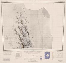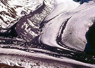
Mount Cornwell is a mountain, 2,460 metres (8,070 ft) high, standing 2 miles (3 km) south of Mount Washburn in Gromshin Heights along the northeast side of Newcomer Glacier in the northern part of the Sentinel Range. It surmounts lower Vicha Glacier to the east and Newcomer Glacier to the west.

Mount Dalrymple is a mountain between Mount Alf and Mount Goldthwait in the northern part of the Sentinel Range, Antarctica. It surmounts Sabazios Glacier to the north-northeast and Embree Glacier to the southeast.

Mount Alf is a mountain rising over 3,200 m between Mount Sharp and Mount Dalrymple in the north part of the Sentinel Range, Antarctica. It surmounts Sabazios Glacier to the northeast.

The Gothic Mountains is a group of mountains, 32 kilometres (20 mi) long, in the Queen Maud Mountains of Antarctica, located west of Watson Escarpment and bounded by Scott Glacier, Albanus Glacier, and Griffith Glacier. The mountains were first visited in December 1934 by the Byrd Antarctic Expedition (ByrdAE) geological party led by Quin Blackburn. The name was proposed by Edmund Stump, leader of a U.S. Antarctic Research Program (USARP) - Arizona State University geological party which made investigations here in the 1980-81 season. The mountains are composed of granites which have weathered to produce a series of spires and peaks reminiscent of a Gothic cathedral.

Mount Ojakangas is an elongated mountain rising to about 2,450 m, 2 nautical miles (3.7 km) northwest of Mount Washburn in Gromshin Heights in the north part of the Sentinel Range, Ellsworth Mountains. It surmounts Vicha Glacier to the east and Newcomer Glacier to the west.

Mount Waldron is a mountain in Antarctica, the summit of Veregava Ridge in the Sentinel Range of Ellsworth Mountains. It is situated 3 nautical miles (6 km) north of Mount Tuck, and surmounts Dater Glacier to the west, Orizari Glacier to the north, Berisad Glacier to the northeast, and Hansen Glacier to the southeast.
Krout Glacier is a tributary glacier, 4 nautical miles (7 km) long, draining the north slopes of the Prince Olav Mountains, Antarctica, between Mount Sellery and Mount Smithson and entering Gough Glacier just east of Mount Dodge. It was named by the Advisory Committee on Antarctic Names for Equipment Operator Walter L. Krout, U.S. Navy, of Operation Deep Freeze, 1964.
Mount Stump is a mostly ice-free mountain rising to 2,490 metres, located 1 nautical mile (1.9 km) north-northeast of Mount Colbert and 2 nautical miles (3.7 km) northeast of Mount Borcik in the southeast part of the Hays Mountains of the Queen Maud Mountains in Antarctica.

Dick Glacier is a tributary glacier, 7 nautical miles (13 km) long, flowing west from Mount Campbell to enter Shackleton Glacier just north of Taylor Nunatak, in the Queen Maud Mountains of Antarctica. It was named by the Advisory Committee on Antarctic Names for Lieutenant Alan L. Dick, a member of U.S. Navy Squadron VX-6 during Operation Deep Freeze 1964.

Mount Giovinetto is the summit of a buttress-type mountain located 2 nautical miles (3.7 km) north of Mount Ostenso and 1.5 nautical miles (2.8 km) south of Mount Viets in the main ridge of the Sentinel Range, Antarctica. It surmounts Rumyana Glacier to the east and Delyo Glacier to the northeast.

Mount Morris is a steep, sharp mountain about 1 nautical mile (2 km) south of Mount Ostenso, in the main ridge of the Sentinel Range of the Ellsworth Mountains in Antarctica. It surmounts Patton Glacier to the eas-northeast.
Mount Saltonstall is a tabular mountain, 2,975 m, standing 1 nautical mile (1.9 km) south of Mount Innes-Taylor at the south side of Poulter Glacier, in the Queen Maud Mountains, Antarctica. Discovered in December 1934 by the Byrd Antarctic Expedition geological party under Quin Blackburn, and named by Byrd for John Saltonstall, contributor to the expedition.

Mount Dawson is a sharp, pyramidal mountain located 4 km (2.5 mi) northwest of Mount Reimer in the north part of the Sentinel Range, Antarctica. It surmounts Vidul Glacier to the east.

Zhenda Glacier is the 8 km long and 4.8 km wide glacier on the east side of the main crest of northern Sentinel Range in Ellsworth Mountains, Antarctica. It is situated west of Sabazios Glacier and southeast of Skaklya Glacier. The glacier drains the northeast slopes of Mount Sharp and the east slopes of Mount Barden, flows northeastwards and together with Skaklya Glacier joins Sabazios Glacier west of Mount Lanning in Sostra Heights.

Blenika Peak is the sharp rocky peak rising to 2,560 m (8,400 ft) just east of the main crest of northern Sentinel Range in Ellsworth Mountains, Antarctica. It surmounts Zhenda Glacier to the southeast and Skaklya Glacier to the north.

Skaklya Glacier is the 3 nautical miles long and 1 nautical mile wide glacier on the east side of the main crest of northern Sentinel Range in Ellsworth Mountains, Antarctica. It is situated northwest of Zhenda Glacier and southeast of the head of Vidul Glacier. The glacier drains the south slopes of Mount Reimer and the north slopes of Blenika Peak, flows east-northeastwards and together with Zhenda Glacier joins Sabazios Glacier west of Mount Lanning in Sostra Heights.

Vidul Glacier is the 7.5 km long and 1.4 km wide glacier on the east side of the main crest of northern Sentinel Range in Ellsworth Mountains, Antarctica. It is situated northwest of Skaklya Glacier and southwest of the middle course of Newcomer Glacier. The glacier drains the north slopes of Mount Reimer and the east slopes of Mount Dawson, flows northwards and joins Newcomer Glacier west of Mount Warren in Gromshin Heights.

Sabazios Glacier is the 10 nautical miles long and 3 nautical miles wide glacier on the east side of northern Sentinel Range in Ellsworth Mountains, Antarctica. It is situated south of Newcomer Glacier, west of Anchialus Glacier, north of Embree Glacier, and east of Zhenda Glacier and Skaklya Glacier. The glacier drains the east slopes of Mount Alf and Mount Sharp, and the north slopes of the side ridge that trends 9.15 km from Mount Dalrymple on the main crest of Sentinel Range east-northeast to Robinson Pass, flows northwards and joins Newcomer Glacier northwest of Mount Lanning in Sostra Heights.

Mursalitsa Peak is the mostly ice-covered peak on the west side of northern Sentinel Range in Ellsworth Mountains, Antarctica rising to 2400 m on the side ridge extending from Mount Sharp on the main crest of the range. It is named after Mursalitsa Ridge in the Rhodope Mountains, Bulgaria.


