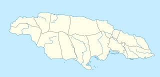
St Catherine is a parish in the south east of Jamaica. It is located in the county of Middlesex, and is one of the island's largest and most economically valued parishes because of its many resources. It includes the first capital of Jamaica, Spanish Town, originally known as San Jago de la Vega or Santiago de la Vega.

Saint Elizabeth, one of Jamaica's largest parishes, is located in the southwest of the island, in the county of Cornwall. Its capital, Black River, is located at the mouth of the Black River, the widest on the island.

The Parish of Manchester is an administrative civil parish located in west-central Jamaica, in the county of Middlesex. Its capital, Mandeville, is a major business centre, and the only parish capital not located on the coast or on a major river. Its St. Paul of the Cross Pro-Cathedral is the episcopal see of the Latin Catholic Diocese of Mandeville.

Roaring River Park is a heritage and nature park near Petersfield, Westmoreland Parish, Jamaica.

The Klasies River Caves are a series of caves located to the east of the Klasies River mouth on the Tsitsikamma coast in the Humansdorp district of Eastern Cape Province, South Africa. The three main caves and two shelters at the base of a high cliff have revealed evidence of middle stone age-associated human habitation from approximately 125,000 years ago. The 20 metres (66 ft) thick deposits were accumulated from 125,000 years ago. Around 75,000 years ago, during cave remodelling, the stratigraphic sediments were moved out into external middens.
Speleoperipatus is a monospecific genus of velvet worm in the Peripatidae family, containing the single species Speleoperipatus spelaeus.
The Jamaican Caves Organisation (JCO) is an all-volunteer caving organisation devoted to the preservation, exploration and documentation of caves in Jamaica. It is currently the only non-profit group in Jamaica dedicated to education, research and advocacy about caves.

The Green Grotto Caves are show caves and a prominent tourist attraction on the north coast of Jamaica. Named for the green algae that cover its walls, the structure of the cave is strikingly different from inland systems; the cave is a Flank Margin Cave with two well-defined levels apparently indicating two periods with differing sea-levels. The innermost cavern contains a crystal-clear underground lake.

Dunn's Hole is a large chamber cave in Trelawny Parish, Jamaica. It consists of a very large chamber approximately 200 metres long, 100 metres wide and 80 metres high, located at the bottom of a 200 metre pit. It is the largest known underground chamber in Jamaica. The main chamber contains a large stalagmite approximately 8 metres high.

Windsor Great Cave is a 3,000 metres (9,800 ft) long cave in Trelawny Parish on the north coast of Jamaica. The land external to the main entrance is owned by the WWF (UK), and access is often denied by the Windsor Research Centre who act as their proxy.

Coffee River Cave is a large river cave in Manchester Parish in west-central Jamaica. It is 2800 metres in length and at an altitude of 250 metres.

Gourie Cave is a large river cave in Manchester Parish in west-central Jamaica. At 3505 metres it is the longest cave known in the island. It is liable to flooding.

At nearly 200 metres, Smokey Hole Cave in Manchester, Jamaica is the deepest known cave in the island.

Oxford Cave is a cave in Manchester Parish in west-central Jamaica. It is 765 metres long and at 290 metres altitude. The cave entrance is close by a main road and because of its accessibility has suffered much graffiti, vandalism and litter. It is a roost for a great many bats, but these are under threat from the number of anti-social human visitors, many there to collect bat guano to use as farm fertiliser, others for bashments.

At 186 metres (610 ft), Morgans Pond Hole in Manchester Parish, Jamaica is the second deepest known cave in the island.
Thatchfield Great Cave is a large cave in Saint Ann Parish near the north coast of Jamaica. Because it is considered to be under threat its exact location is not widely publicised.

Bad Hole Cave is an impressively large rising cave in the Cockpit Country of Jamaica. This is a limestone Karst region that is very rich in caves.

Belmont Cave is a white limestone dry cave in the Cockpit Country of Jamaica. It is also known as Drip Cave, being a single cave with two close entrances.

Carambie Cave is a large, relatively dry, white limestone cave in Trelawny Parish, Jamaica. It is believed that it may have been used by Taíno people although no evidence of their presence has been found. It does contain historical graffiti dating back to 1821.

The One-Eye River is a river in the parishes of Manchester and St Elizabeth in Jamaica. It is a tributary of the Black River.


