Related Research Articles

Kincardineshire, also known as the Mearns, is a historic county, registration county and lieutenancy area on the coast of northeast Scotland. It is bounded by Aberdeenshire on the north and west, and by Angus on the south.

The Great North of Scotland Railway (GNSR) was one of the two smallest of the five major Scottish railway companies prior to the 1923 Grouping, operating in the north-east of the country. Formed in 1845, it carried its first passengers the 39 miles (63 km) from Kittybrewster, in Aberdeen, to Huntly on 20 September 1854. By 1867 it owned 226+1⁄4 route miles (364.1 km) of line and operated over a further 61 miles (98 km).

The Alford Valley Railway is a 2 ft narrow gauge railway in the Howe of Alford, Aberdeenshire, Scotland. It is located at what used to be the terminus of the passenger and goods Alford Valley Railway which connected with the Great North of Scotland Railway main line at Kintore.

The Aberdeen–Inverness line is a railway line in Scotland linking Aberdeen and Inverness. It is not electrified. Most of the line is single-track, other than passing places and longer double-track sections between Insch and Kennethmont and Inverurie and Berryden Junction (Aberdeen).

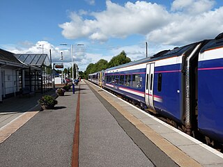
Aberdeen railway station is the main railway station in Aberdeen, Scotland. It is the busiest railway station in Scotland north of the major cities of Glasgow and Edinburgh. It is located on Guild Street in the city centre, next to Union Square.

Forres railway station serves the town of Forres, Moray in Scotland. The station is managed and served by ScotRail and is on the Aberdeen–Inverness line, between Nairn and Elgin, measured 119 miles 42 chains (192.4 km) from Perth via the Dava route.
Keith railway station is a railway station serving the town of Keith, Moray, Scotland. The station is managed by ScotRail and is on the Aberdeen to Inverness Line, between Huntly and Elgin, measured 53 miles 8 chains (85.5 km) from Aberdeen, or 30 miles 20 chains (48.7 km) from Forres.
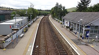
Huntly railway station is a railway station serving the town of Huntly in Scotland. The station is managed by ScotRail and is on the Aberdeen to Inverness Line, between Insch and Keith, 40 miles 67 chains (65.7 km) from Aberdeen.
Carnoustie railway station is a railway station which serves the town of Carnoustie, Angus, Scotland. It is sited 10 miles 33 chains (16.8 km) east of the former Dundee East station, on the Dundee to Aberdeen line, between Golf Street and Arbroath. There is a crossover at the south end of the station, which can be used to facilitate trains turning back if the line north to Arbroath is blocked. ScotRail manage the station and provide almost all services.

Newtonmore railway station serves the village of Newtonmore, Highland, Scotland. The station is managed by ScotRail and is on the Highland Main Line. The station is 68 miles 62 chains (110.7 km) from Perth, between Dalwhinnie and Kingussie, and has a single platform which is long enough for a ten-coach train. It is currently the only station on the Highland Main Line to have one platform, although the former second platform can still be seen adjacent to the first platform.
Cove Bay, known locally as Cove, is a suburb on the south-east edge of Aberdeen, Scotland.
Newtonhill is a commuter town in Kincardineshire, Scotland. It is popular due to its location, just six miles south of Aberdeen with easy reach of Stonehaven and with views over the North Sea.

The Aberdeen Railway was a Scottish railway company which built a line from Aberdeen to Forfar and Arbroath, partly by leasing and upgrading an existing railway.

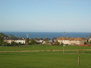
Muchalls is a small coastal ex-fishing village in Kincardineshire, Scotland, south of Newtonhill and north of Stonehaven. Muchalls is situated slightly north of a smaller hamlet known as the Bridge of Muchalls. At the western edge of Muchalls is the historic Saint Ternan's Church. The rugged North Sea coastline near Muchalls features numerous cliffs, sea stacks and headlands, not infrequently in haar. The Grim Brigs headland is situated at Muchalls southern edge and Doonie Point headland is approximately 1.5 kilometres south.
The Scottish Midland Junction Railway was authorised in 1845 to build a line from Perth to Forfar. Other companies obtained authorisation in the same year, and together they formed a route from central Scotland to Aberdeen. The SMJR opened its main line on 4 August 1848. Proposals to merge with other railways were rejected by Parliament at first, but in 1856 the SMJR merged with the Aberdeen Railway to form the Scottish North Eastern Railway. The SNER was itself absorbed into the larger Caledonian Railway in 1866. The original SMJR main line was now a small section of a main line from Carlisle and central Scotland to Aberdeen.

Laurencekirk railway station is a railway station serving the communities of Laurencekirk and The Mearns in Aberdeenshire, Scotland. The station was reopened on 18 May 2009 at a cost of £3 million. It is sited 210 miles 44 chains (338.8 km) from Carlisle, and is between Montrose and Stonehaven, on the Dundee to Aberdeen line. There is a crossover at the north end of the station, which can be used to facilitate trains turning back if the line south to Montrose is blocked.
The Montrose and Bervie Railway was a Scottish railway. When the Aberdeen Railway opened in 1850, the coastal settlements north of Montrose were not linked in, and local interests promoted a branch line from Montrose to Bervie. They found it impossible to raise capital at first, but from 1861 the larger railways were promoting new connections around Aberdeen, and the Great North of Scotland Railway (GNoSR) decided that the Bervie line would give it a route to the south.
The Brechin and Edzell District Railway was a local line in Scotland connecting Edzell, then a developing tourist centre, to the nearby main population centre of Brechin, where there was a branch of the Caledonian Railway. The short line opened in 1896, and it was worked by the Caledonian Railway.
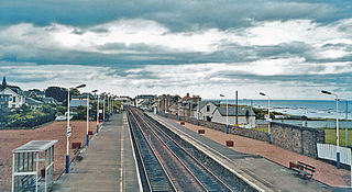
Marykirk railway station served the village of Marykirk, Kincardineshire, Scotland from 1849 to 1956 on the Aberdeen Railway.

St Cyrus railway station served the village of St Cyrus, Aberdeenshire, Scotland from 1865 to 1951.
References
- 1 2 Quick, Michael (2022) [2001]. Railway passenger stations in Great Britain: a chronology (PDF). version 5.04. Railway & Canal Historical Society. p. 325.
- ↑ "Muchalls station on OS 25inch map Kincardineshire XIII.1 (Combined)". National Library of Scotland. 1902. Retrieved 28 June 2020.
- ↑ McRae, Andrew (1997). British Railway Camping Coach Holidays: The 1930s & British Railways (London Midland Region). Vol. Scenes from the Past: 30 (Part One). Foxline. p. 22. ISBN 1-870119-48-7.
- ↑ "Muchalls Station Will Close Next Month: Bus Links at Aberdeen and Stonehaven". The Press and Journal. 24 November 1950. p. 6. Retrieved 20 April 2022.
- ↑ "Muchalls PS". www.scotlandswar.co.uk. Retrieved 9 September 2018.