Related Research Articles

Brine is water with a high-concentration solution of salt. In diverse contexts, brine may refer to the salt solutions ranging from about 3.5% up to about 26%. Brine forms naturally due to evaporation of ground saline water but it is also generated in the mining of sodium chloride. Brine is used for food processing and cooking, for de-icing of roads and other structures, and in a number of technological processes. It is also a by-product of many industrial processes, such as desalination, so it requires wastewater treatment for proper disposal or further utilization.

The Missoula floods were cataclysmic glacial lake outburst floods that swept periodically across eastern Washington and down the Columbia River Gorge at the end of the last ice age. These floods were the result of periodic sudden ruptures of the ice dam on the Clark Fork River that created Glacial Lake Missoula. After each ice dam rupture, the waters of the lake would rush down the Clark Fork and the Columbia River, flooding much of eastern Washington and the Willamette Valley in western Oregon. After the lake drained, the ice would reform, creating Glacial Lake Missoula again.

Onondaga Lake is a lake in Central New York, immediately northwest of and adjacent to Syracuse, New York. The southeastern end of the lake and the southwestern shore abut industrial areas and expressways; the northeastern shore and northwestern end border a series of parks and museums.
Industrial wastewater treatment describes the processes used for treating wastewater that is produced by industries as an undesirable by-product. After treatment, the treated industrial wastewater may be reused or released to a sanitary sewer or to a surface water in the environment. Some industrial facilities generate wastewater that can be treated in sewage treatment plants. Most industrial processes, such as petroleum refineries, chemical and petrochemical plants have their own specialized facilities to treat their wastewaters so that the pollutant concentrations in the treated wastewater comply with the regulations regarding disposal of wastewaters into sewers or into rivers, lakes or oceans. This applies to industries that generate wastewater with high concentrations of organic matter, toxic pollutants or nutrients such as ammonia. Some industries install a pre-treatment system to remove some pollutants, and then discharge the partially treated wastewater to the municipal sewer system.

Lake Assal is a crater lake in central-western Djibouti. It is located at the western end of Gulf of Tadjoura between Arta Region, and Tadjoura Region, touching Dikhil Region, at the top of the Great Rift Valley, some 120 km (75 mi) west of Djibouti city. Lake Assal is a saline lake that lies 155 m (509 ft) below sea level in the Afar Triangle, making it the lowest point on land in Africa and the third-lowest point on Earth after the Sea of Galilee and the Dead Sea. No outflow occurs from the lake, and due to high evaporation, the salinity level of its waters is 10 times that of the sea, making it the fourth most saline body of water in the world, behind Garabogazköl, Lake Retba, and Gaet'ale Pond. The salt in the lake is exploited under four concessions awarded in 2002 at the southeast end of the lake; the major share of production is held by Société d’Exploitation du Lac and Société d’Exploitation du Salt Investment S.A de Djibouti.

First flush is the initial surface runoff of a rainstorm. During this phase, water pollution entering storm drains in areas with high proportions of impervious surfaces is typically more concentrated compared to the remainder of the storm. Consequently, these high concentrations of urban runoff result in high levels of pollutants discharged from storm sewers to surface waters.

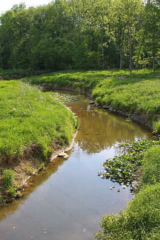
Ninemile Creek, also known as Nine Mile Creek, is a stream in Central New York in the United States. Its source is at Otisco Lake in the town of Marcellus, from where the creek runs northward for 21.75 miles (35.00 km) through the villages of Marcellus and Camillus to Onondaga Lake in the town of Geddes. Nine Mile Creek is a scenic stream noted for trout fishing.
The suspended load of a flow of fluid, such as a river, is the portion of its sediment uplifted by the fluid's flow in the process of sediment transportation. It is kept suspended by the fluid's turbulence. The suspended load generally consists of smaller particles, like clay, silt, and fine sands.
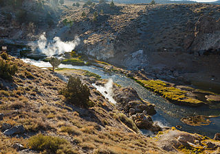
Hot Creek, starting as Mammoth Creek, is a stream in Mono County of eastern California, in the Western United States. It is within the Inyo National Forest.

The Marcellus Formation or the Marcellus Shale is a Middle Devonian age unit of sedimentary rock found in eastern North America. Named for a distinctive outcrop near the village of Marcellus, New York, in the United States, it extends throughout much of the Appalachian Basin.

A river is a natural flowing watercourse, usually a freshwater stream, flowing on the Earth's land surface or inside caves towards another waterbody at a lower elevation, such as an ocean, sea, bay, lake, wetland, or another river. In some cases, a river flows into the ground or becomes dry at the end of its course without reaching another body of water. Small rivers can be referred to by names such as creek, brook, and rivulet. There are no official definitions for these various generic terms for a watercourse as applied to geographic features, although in some countries or communities, a stream is customarily referred to by one of these names as determined by its size. Many names for small rivers are specific to geographic location; examples are "run" in some parts of the United States, "burn" in Scotland and Northeast England, and "beck" in Northern England. Sometimes a river is defined as being larger than a creek, but not always; the language is vague.

Dissolved load is the portion of a stream's total sediment load that is carried in solution, especially ions from chemical weathering. It is a major contributor to the total amount of material removed from a river's drainage basin, along with suspended load and bed load. The amount of material carried as dissolved load is typically much smaller than the suspended load, though this is not always the case, particularly when the available river flow is mostly harnessed for purposes such as irrigation or industrial uses. Dissolved load comprises a significant portion of the total material flux out of a landscape, and its composition is important in regulating the chemistry and biology of the stream water.
Three components that are included in the load of a river system are the following: dissolved load, wash load and bed material load. The bed material load is the portion of the sediment that is transported by a stream that contains material derived from the bed. Bed material load typically consists of all of the bed load, and the proportion of the suspended load that is represented in the bed sediments. It generally consists of grains coarser than 0.062 mm with the principal source being the channel bed. Its importance lies in that its composition is that of the bed, and the material in transport can therefore be actively interchanged with the bed. For this reason, bed material load exerts a control on river channel morphology. Bed load and wash load together constitute the total load of sediment in a stream. The order in which the three components of load have been considered – dissolved, wash, bed material – can be thought of as progression: of increasingly slower transport velocities, so that the load peak lags further and further behind the flow peak during any event.

Overdeepening is a characteristic of basins and valleys eroded by glaciers. An overdeepened valley profile is often eroded to depths which are hundreds of metres below the lowest continuous surface line along a valley or watercourse. This phenomenon is observed under modern day glaciers, in salt-water fjords and fresh-water lakes remaining after glaciers melt, as well as in tunnel valleys which are partially or totally filled with sediment. When the channel produced by a glacier is filled with debris, the subsurface geomorphic structure is found to be erosionally cut into bedrock and subsequently filled by sediments. These overdeepened cuts into bedrock structures can reach a depth of several hundred metres below the valley floor.

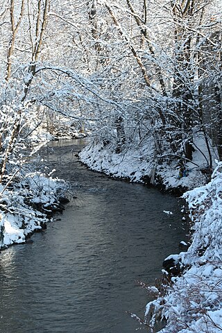
Onondaga Creek is a major tributary of Onondaga Lake which is located in Onondaga County, New York. The headwaters of the creek originate 27 miles (43 km) south of the city of Syracuse near the hamlet of Vesper, in the town of Tully, New York. The creek flows north through the Tully Valley and through the city of Syracuse where it empties into Onondaga Lake.
Solomon Creek is a tributary of the Susquehanna River in Luzerne County, Pennsylvania, in the United States. It is approximately 8.8 miles (14.2 km) long and flows through Fairview Township, Hanover Township, and Wilkes-Barre. The creek is affected by acid mine drainage and has significant loads of iron, aluminum, and manganese. The creek's named tributaries are Spring Run, Sugar Notch Run, and Pine Creek. The Solomon Creek watershed is located in the Anthracite Valley section of the ridge-and-valley geographical province. Major rock formations in the watershed include the Mauch Chunk Formation, the Spechty Kopf Formation, and the Catskill Formation.
Mud Creek is a tributary of Chillisquaque Creek in Columbia County and Montour County in Pennsylvania, in the United States. It is approximately 8.3 miles (13.4 km) long and flows through Madison Township, Columbia County and Derry Township, Montour County. The main tributaries of the creek are unnamed tributaries. The creek's watershed has an area of 17.70 square miles and is in West Hemlock Township, Montour County as well as the two townships it flows through. The watershed is mostly agricultural and forested and the main developed areas are Washingtonville and Jerseytown.
Syracuse is a city in Central New York sited on the former lands of the Onondaga Nation. Officially incorporated as a village in 1825, it has been at a major crossroads over the last two centuries, first of the Erie Canal and its branch canals, then on the railway network. The city grew on the back of its salt and chemical industries, and later as a center of manufacturing and engineering. Although its industries have dwindled, the city has remained the economic and educational hub of Central New York, a region with over a million inhabitants; the population of the city, though, has been in decline since peaking in the 1950s.

The Wellington Formation is an Early Permian geologic formation in Kansas and Oklahoma. The formation's Hutchinson Salt Member is more recognized by the community than the formation itself, and the salt is still mined in central Kansas. The Wellington provides a rich record of Permian insects and its beddings provide evidence for reconstruction of tropical paleoclimates of the Icehouse Permian with the ability in cases to measure the passage of seasons. Tens of thousands of insect fossil recovered from the Wellington shales are kept in major collections at the Harvard Museum of Comparative Zoology and Yale Peabody Museum of Natural History.
Brine mining is the extraction of useful materials which are naturally dissolved in brine. The brine may be seawater, other surface water, groundwater, or hyper-saline solutions from several industries. It differs from solution mining or in-situ leaching in that those methods inject water or chemicals to dissolve materials which are in a solid state; in brine mining, the materials are already dissolved.
References
- 1 2 "Tully Valley Mudboils Onondaga Creek Fact Sheet" (PDF). Onondaga Environmental Institute. Onondaga Environmental Institute. Retrieved 3 April 2024.
- ↑ Kappel, William M.; McPherson, Wendy S. (January 1998). "Remediation of Mudboil Discharges in the Tully Valley of Central New York" (PDF). U.S. Geological Survey.
- 1 2 3 4 "Saline Tully Valley Mudboils Origin and Mitigation" (PDF). Onondaga Nation. Retrieved 3 April 2024.
- 1 2 "THE TULLY MUDBOILS HD". YouTube. Onondaga Nation. Retrieved 3 April 2024.
| | This hydrology article is a stub. You can help Wikipedia by expanding it. |