Related Research Articles
Budawang National Park is a national park in New South Wales, Australia, located approximately 200 kilometres (120 mi) southwest of Sydney and 25 kilometres (16 mi) north of Batemans Bay. It contains part of the Budawang Mountain Range.

The Changbai Mountains are a major mountain range in Northeast Asia that extends from the Northeast Chinese provinces of Heilongjiang, Jilin and Liaoning, across the China-North Korea border, to the North Korean provinces of Ryanggang and Chagang. They are also referred to as the Šanggiyan Mountains in the Manchu language, or the Great Paekdu in Korean. Most of its peaks exceed 2,000 m (6,600 ft) in height, with the tallest summit being Paektu Mountain at 2,744 m (9,003 ft), which contains the Heaven Lake, the highest volcanic crater lake in the world at an surface elevation of 2,189.1 m (7,182 ft). The protected area Longwanqun National Forest Park is located within the vicinity of the mountain range.
Changsha County is a county in Hunan Province, China. It is under the administration of the prefecture-level city of Changsha. Located in the west portion of Changsha, the county is bordered to the north by Miluo City and Pingjiang County, to the west by Wangcheng, Kaifu and Furong Districts, to the southwest by Yuhua District, and to the southeast and the east by Liuyang City. Changsha County covers 1,756 km2 (678 sq mi). As of 2015 it has a registered population of 743,000 and a permanent resident population of 916,000. The county has 5 subdistricts and 13 towns under its jurisdiction. The county seat is Xingsha Subdistrict (星沙街道).

Temperate rainforests are rainforests with coniferous or broadleaf forests that occur in the temperate zone and receive heavy rain.

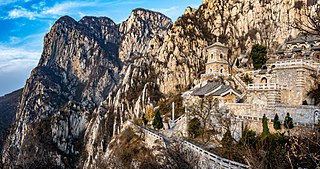
Mount Song is an isolated mountain range in north central China's Henan Province, along the southern bank of the Yellow River. It is known in literary and folk tradition as the central mountain of the Five Great Mountains of China. Since at least as early as the early 1st millennium BC, Chinese astronomical mythology had acquired the idea that Mount Song is "the centre of Heaven and Earth." It was respected as such by the successive dynasties of the Chinese Empire.

Datong Township (Chinese: 大同鄉; pinyin: Dàtóng Xiāng; Wade–Giles: Da4-t'ung2 Hsiang1) is a mountain indigenous township in the southwestern part of Yilan County, Taiwan. It is the second largest township in Yilan County after Nan'ao Township.

The Flathead National Forest is a national forest in the western part of the U.S. state of Montana. The forest lies primarily in Flathead County, south of Glacier National Park. The forest covers 2,404,935 acres of which about 1 million acres (4,000 km2) is designated wilderness. It is named after the Flathead Native Americans who live in the area.

The Mufu Mountains are a range of mountains located on the border of Jiangxi and Hubei provinces in China.

Zhangjiajie National Forest Park is a national forest park located in Zhangjiajie, Hunan Province, China. It is one of several national parks within the Wulingyuan Scenic Area.

Mount Sanqing is a renowned Taoist sacred mountain located 40 kilometres (25 mi) north of Yushan County in Jiangxi Province. Sanqing means the "Three Pure Ones" in Chinese as Mount Sanqing is made up of three main summits: Yujing, Yushui, and Yuhua, representing the Taoist trinity.

The Luoxiao Mountains are a system of mountain ranges in the People's Republic of China that straddle Jiangxi, Hubei, and Hunan provinces.

Dongping National Forest Park is a forest park located on the north side of Chongming Island in Chongming District, Shanghai, China.

The Benxi Water Caves is a partially submerged cavern system containing a forest of stalactites and stalagmites, located 26 kilometres (16 mi) east of Benxi, Liaoning Province, People's Republic of China. It was made a national park on January 10, 1994, and is open to the public all year round. It was designated an "AAAAA"-class tourist attraction by CNTA in 2015.

The Fushui River (富水) is a river flowing through Tongshan and Yangxin Counties in the south-eastern part of Hubei province, China.

The Gaoligong Mountains are a mountainous sub-range of the southern Hengduan Mountain Range, located in the western Yunnan highlands and straddling the border of southwestern China and northern Myanmar (Burma).
Taijiang County is a county in eastern Guizhou province, China. It is under the administration of the Qiandongnan Miao and Dong Autonomous Prefecture.
Tiãntángzhài is the second highest peak of the Dabie Mountains located on the border between Hubei and Anhui provinces in the People's Republic of China. Straddling Hubei's Luotian County and Huanggang City along with Jinzhai County in Anhui, the mountain rises to a height of 1,729.13 metres (5,673.0 ft) above sea level. It forms the watershed between the Huai and Yangtze Rivers and is also known as the "Number one pass in the southeastern Yangtze River region" (吴楚东南第一关).

The Wugongshan or Wu-kung Mountains, now a tourist resort, are a range of mountains located in the west of Jiangxi, China. It is the geography boundary of Anfu County, Luxi County, Jiangxi, Yichun, Jiangxi, and Lianhua County. Its highest point is 1918.3 m high Baihe Feng located in Anfu County.
Fahai Temple Forest Park is one of the largest public parks within the 6th Ring Road of Beijing. It is located near the Cuiwei Mountain, in the Moshikou region of Shijingshan District, which is in the western part of central Beijing.
The Geleshan National Forest Park or Gele Mountain National Forest Park, is a nationally protected park in China, located in Geleshan, Shapingba District, 16 km west of Chongqing city centre.
References
- ↑ ~28.9877 N 113.8262 E