The Islamabad Capital Territory is the only federal territory of Pakistan that is centred around Islamabad, the capital of Pakistan. Located on the northern edge of the Pothohar Plateau and at the foot of the Margalla Hills, in the northwestern area of the Punjab region, the territory shares borders with the province of Khyber Pakhtunkhwa in the west and with the province of Punjab in the remaining directions. It covers an area of 906.5 square kilometres (350.0 sq mi) and according to the 2023 national census, has a population of over 1 million in the city proper, while over 2 million in the whole territory. The territory is represented in the National Assembly by NA-52, NA-53, and NA-54 constituencies and by four seats in the Senate.

Postal codes used in the United Kingdom, British Overseas Territories and Crown dependencies are known as postcodes. They are alphanumeric and were adopted nationally between 11 October 1959 and 1974, having been devised by the General Post Office . The system uses alphanumeric codes to designate geographic areas. A full postcode, also known as a "postcode unit," identifies a group of addresses or a major delivery point. It consists of an outward code and inward code. The outward code indicates the area and district, while the inward code specifies the sector and delivery point, typically encompassing about 15 addresses.

The public sector, also called the state sector, is the part of the economy composed of both public services and public enterprises. Public sectors include the public goods and governmental services such as the military, law enforcement, infrastructure, public transit, public education, along with health care and those working for the government itself, such as elected officials. The public sector might provide services that a non-payer cannot be excluded from, services which benefit all of society rather than just the individual who uses the service. Public enterprises, or state-owned enterprises, are self-financing commercial enterprises that are under public ownership which provide various private goods and services for sale and usually operate on a commercial basis.

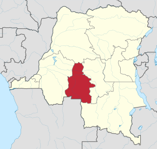
Kasaï-Occidental was one of the eleven provinces of the Democratic Republic of the Congo between 1966 and 2015, when it was split into the Kasaï-Central and the Kasaï provinces.
In computing, an address space defines a range of discrete addresses, each of which may correspond to a network host, peripheral device, disk sector, a memory cell or other logical or physical entity.
A post town is a required part of all postal addresses in the United Kingdom and Ireland, and a basic unit of the postal delivery system. Including the correct post town in the address increases the chance of a letter or parcel being delivered on time. Post towns in general originated as the location of delivery offices. As of 2004, their main function is to distinguish between localities or street names in addresses not including a postcode.

The provinces of Burkina Faso are divided into 351 departments, whose urbanized areas are grouped into the same commune (municipality) with the same name as the department. The department also covers rural areas that are not governed locally by the elected municipal council of the commune, but by the state represented at departmental level by a prefect.
In the Republic of Ireland, the retail sector provides one of the largest sources of employment in the economy, representing over 12% of the workforce. As of 2017, approximately 40,000 wholesale and retail businesses employed almost 280,000 people in Ireland, with the Department of Enterprise, Trade and Employment reporting that 90% of these businesses were Irish-owned.
Postcodes were introduced in the Isle of Man in 1993, with the island becoming the IM postcode area. Each town or area is associated with one or more postcode districts, assigned by Isle of Man Post Office. Outside the larger towns, the postcode districts are further broken down and each postal sector is assigned to a number of villages and settlements.

Panchkula is a planned city and district headquarter in the Panchkula district in Haryana, India. It is a satellite town of the state capital Chandigarh. Panchkula is a border city with Punjab, Chandigarh and Himachal Pradesh. The origin of the name Panchkula came from "the place where five irrigation canals meet". It is approximately 4 km (2.5 mi) southeast of Chandigarh, 105 km (65 mi) southwest of Shimla, 44 km (27 mi) from Ambala and 259 km (161 mi) northeast of New Delhi, the national capital. It is a part of the Chandigarh capital region or Greater Chandigarh. The Chandigarh-Mohali-Panchkula metropolitan region collectively forms a Chandigarh Tricity, with a combined population of over two million.
Hundred Quarters is a neighbourhood in the Korangi District in eastern Karachi, Pakistan. It was previously part of Korangi Town, which was an administrative unit that was disbanded in 2011. There are one hundred houses in this neighbourhood. It is divided into many sectors such as sector D-AREA, E- AREA, B-AREA C-AREA.
Korangi Sector 33 is a neighbourhood in the Korangi District in eastern Karachi, Pakistan. It was previously part of Korangi Town, which was an administrative unit that was disbanded in 2011. The area is divided into six further townships: 33/A, 33/B, 33/C, 33/D, 33/E, and 33/F.

New Karachi Town lies in the northern part of the city Gulberg Town. It was formed when katchi abadis were resettled following the 1958 coup d'état. In 2001 it was subdivided into 13 union councils. The town system was disbanded in 2011, and New Karachi Town was re-organized as part of Karachi Central District in 2015.
Shah Nawaz Bhutto Colony is a neighborhood in the Karachi Central district of Karachi, Pakistan. It is administered as part of New Karachi Town.
Iqbal Baloch Colony is a neighbourhood in the Orangi municipality of Karachi, Pakistan. It is administered as part of Karachi West district, but was part of the Orangi Town borough until that was disbanded in 2011.

Uttara Model Town or simply Uttara is a neighbourhood of Dhaka, the capital of Bangladesh. The name derives from the Bengali word uttor meaning "north". It lies on the road to Gazipur, and adjoins Hazrat Shahjalal International Airport.

The economy of the Western Cape in South Africa is dominated by the city of Cape Town, which accounted for 72% of the Western Cape's economic activity in 2016. The single largest contributor to the region's economy is the financial and business services sector, followed by manufacturing. Close to 30% of the gross regional product comes from foreign trade with agricultural products and wine dominating exports. High-tech industries, international call centres, fashion design, advertising and TV production are niche industries rapidly gaining in importance.
Real estate in Bangladesh refers to the industry and market related to the buying, selling, and development of properties in the country. It is a fastest growing sector in Bangladesh.


