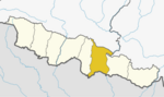
Dhanusha District,, a part of Province No. 2, is one of the seventy-seven districts of Nepal. It is situated in the Outer Terai. The district, with Janakpur as its district headquarter, covers an area of 1,180 km2 (460 sq mi) and has a population (2011) of 754,777.
Dubarchaur is a village in Sindhupalchok District in the Bagmati Zone of central Nepal. At the time of the 1991 Nepal census it had a population of 5034 and had 1063 houses in the village.
Bagchaura is a village development committee in Dhanusa District in the Janakpur Zone of south-eastern Nepal. At the time of the 1991 Nepal census it had a population of 4,557 and had 812 houses.
Bhutahi Paterwa is a village development committee in Dhanusa District in the Janakpur Zone of south-eastern Nepal. At the time of the 1991 Nepal census it had a population of 3,748 persons living in 739 individual households.
Giddha is a village development committee in Dhanusa District in the Janakpur Zone of south-eastern Nepal. At the time of the 1991 Nepal census it had a population of 4,147 persons living in 714 individual households.
Hariharpur is a town in Chhireswarnath Municipality in Dhanusa District in the Janakpur Zone of south-eastern Nepal. The formerly Village Development Committee was converted into municipality merging along with existing vedics Ramdaiya, Sakhuwa Mahendranagar, Hariharpur and Digambarpur on 18 May 2014. At the time of the 1991 Nepal census it had a population of 6,259 persons residing in 1133 individual households.
Kachuri Thera is a village development committee in Dhanusa District in the Janakpur Zone of south-eastern Nepal. At the time of the 1991 Nepal census it had a population of 4,560 persons living in 818 individual households.
Lohana Bahbangama is a village development committee in Dhanusa District in the Janakpur Zone of south-eastern Nepal. At the time of the 1991 Nepal census it had a population of 4,772 persons living in 824 individual households. It is near to Janakpur. This village is surrounded by.
Lagmamdha Guthi, often shortened to 'Lagma', is a Village Development Committee (VDC) in Dhanusa District in the Janakpur Zone of south-eastern Nepal. At the time of the 1991 Nepal census, it had a population of 3,726 people living in 663 individual households.
Lakshminibas is a village development committee in Dhanusa District in the Janakpur Zone of south-eastern Nepal. At the time of the 1991 Nepal census it had a population of 2,656 persons living in 459 individual households.
Lakshmipur Bagewa is a village development committee in Dhanusa District in the Janakpur Zone of south-eastern Nepal. At the time of the 1991 Nepal census it had a population of 5,490 persons living in 950 individual households. It has one government school, Sri Lakshminiya Janta Madhyamik Vidhiyalaya.
Mithileshwar Mauwahi is a village development committee in Dhanusa District in the Janakpur Zone of south-eastern Nepal. At the time of the 1991 Nepal census it had a population of 3,082 persons living in 590 individual households.
purandaha is a village development committee in Dhanusa District in the Janakpur Zone of South-Eastern Nepal. At the time of the 1991 Nepal census it had a population of 4,847 persons living in 923 individual households.
Mahuwa is a village development committee in Dhanusa District in the Janakpur Zone of south-eastern Nepal. At the time of the 1991 Nepal census it had a population of 5,194.
Mahuwa is a village development committee in Dhanusa District in the Janakpur Zone of south-eastern Nepal. At the time of the 1991 Nepal census it had a population of 4,439.

Paterwa is a village development committee in Dhanusa District in the Janakpur Zone of south-eastern Nepal. At the time of the 1991 Nepal census it had a population of 3,364 persons living in 589 individual households.
Raghunathpur is a Village Development Committee in Dhanusa District in the Janakpur Zone of south-eastern Nepal. At the time of the 1991 Nepal census it had a population of 9,762 persons residing in 1962 individual households.
Sapahi is a former Village Development Committee in Dhanusa District besides of ramdaiya village in the Janakpur Zone of south-eastern Nepal. At the time of the 1991 Nepal census it had a population of 6,023 persons residing in 1078 individual households. Sapahi is birthplace and home town of first president of Nepal Ram Baran Yadav.
Suganikash is a village development committee in Dhanusa District in the Janakpur Zone of south-eastern Nepal. At the time of the 1991 Nepal census it had a population of at least 100 persons living in 524 individual households.
Malpi is a village development committee in Kabhrepalanchok District in the Bagmati Zone of central Nepal. At the time of the 1991 Nepal census it had a population of 3033 in 571 individual households.