
The Mukwonago River is one of the cleanest and most biologically diverse streams in southeastern Wisconsin. [1] The river is part of the Mukwonago River Watershed which spans 47,500 acres through and around the town of Mukwonago. [2] [3]
The Mukwonago River is one of the cleanest and most biologically diverse streams in southeastern Wisconsin. [1] The river is part of the Mukwonago River Watershed which spans 47,500 acres through and around the town of Mukwonago. [2] [3]
At least 53 species of fish, including two state listed species, and sixteen species of mussels are found in the Mukwonago River. [1] Ten of the eleven Sunfish found in Wisconsin are present in the river including the threatened Northern Sunfish. All three species of Killifish (Topminnows), including the endangered Starhead Topminnow, can be found. In addition, the river is also home to a high biodiversity of waterfowl, reptiles, amphibians, insects, aquatic plants, and other wetland life. It holds one of the last and largest strands of wild rice in Southeastern Wisconsin. This high level of biodiversity is quite uncommon for a stream of this size and is only comparable to large rivers in Wisconsin like the Mississippi River or Wisconsin River. [4]
Some of the invasive species that have been introduced to the watershed are the Asiatic Clam (Corbicula fluminea), Zebra Mussel (Dreissena polymorpha), Purple loosestrife (Lythrum salicaria), Eurasian Water-milfoil (Myriophyllum spicatum), and Curly-leaf pondweed (Potamogeton crispus). [5]

The Tippecanoe River is a gentle, 182-mile-long (293 km) river in the Central Corn Belt Plains ecoregion in northern Indiana. It flows from Crooked Lake in Noble County to the Wabash River near what is now Battle Ground, about 12 miles (19 km) northeast of Lafayette. The name "Tippecanoe" was derived from a Miami-Illinois word for buffalo fish, reconstructed as */kiteepihkwana/ or as kiteepihkwana siipiiwi.

The zebra mussel is a small freshwater mussel. The species was originally native to the lakes of southern Russia and Ukraine, but has been accidentally introduced to numerous other areas and has become an invasive species in many countries worldwide. Since the 1980s, the species has invaded the Great Lakes, Hudson River, and Lake Travis.

The longear sunfish is a freshwater fish in the sunfish family, Centrarchidae, of order Perciformes. It is native to the area of eastern North America stretching from the Great Lakes down to northeastern Mexico. The longear sunfish reaches a maximum recorded length of about 24 cm (9.5 in), with a maximum recorded weight of 790g (1.7 lb). Most do not live beyond six years. The longear sunfish is quite colorful, with an olive to rusty-brown back, bright orange belly and blue-green bars on the sides of its head. A unique characteristic is their elongated operculum flap, giving an appearance of a "long ear".

The Taunton River watershed or Taunton River basin is made up of 562 square miles (1,500 km2) of rivers, lakes, ponds, streams, and wetlands in southeastern Massachusetts, US. It is the second largest watershed in the state. Also, it is a significant part of a much larger multi-state watershed, the Narragansett Bay watershed.

The redear sunfish, also known as the shellcracker, Georgia bream, cherry gill, chinquapin, improved bream, rouge ear sunfish and sun perch) is a freshwater fish in the family Centrarchidae and is native to the southeastern United States. Since it is a popular sport fish, it has been introduced to bodies of water all over North America. It is known for its diet of mollusks and snails.
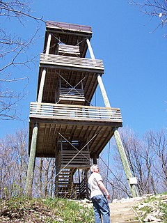
The Kettle Moraine State Forest is a state forest in southeastern Wisconsin. The chief feature of the reserve is the Kettle Moraine, a highly glaciated area. The area contains very hilly terrain and glacial landforms, such as kettles, kames and eskers. The 56,000-acre (23,000 ha) forest is divided into two large and three small units, which are spread across a hundred miles.

The Shiawassee River in the U.S. state of Michigan drains an area of 1,201 square miles (3,110 km2) within Oakland, Genesee, Livingston, Shiawassee, Midland and Saginaw counties. It flows in a generally northerly direction for about 110 miles (180 km) from its source to its confluence with the Tittabawassee River creating the Saginaw River, which drains into the Saginaw Bay of Lake Huron.
The Chipola Slabshell is a part of the phylum: Mollusca and the class: Bivalvia. This species has suffered a large decrease with upwards of 75% of habitat lost. It is now confined to only a few remnant sites in small drainage from the Chipola river. The federal ESA protects it as a designated threatened species by Florida’s Endangered and Threatened Species Rule.
Castle Rock Lake is an artificial lake on the Wisconsin River. It is located in central Wisconsin in Adams County and Juneau County. The lake has an inflow from Petenwell Lake, Yellow River, Big Roche a Cri., and Klien Creek. It has a surface area of 16,640 acres (67.3 km2) and its depth varies from 8–20 ft (2.4–6.1 m) in most places, with area in the old river beds reaching as deep as 35 ft (11 m).
The Dragon Run watershed in the U.S. state of Virginia encompasses 140 square miles (360 km2) and is home to many flora and fauna species. The brackish water stream, labeled on topographic maps as Dragon Swamp, is fed by underground springs, surface runoff, and numerous feeding swamps. In a study of 232 rivers and streams in the Chesapeake Bay, the Nature Conservancy and the Chesapeake Bay Foundation found the Dragon Run to rank second in terms of ecological significance. Efforts are being made to preserve the Dragon Run, including Governor Tim Kaine’s large purchase of land in order to maintain and protect the watershed’s original state.
The Platte River is a tributary of the Mississippi River in southwestern Wisconsin in the United States. Its watershed lies almost entirely within Grant County, with only a small portion in neighboring Iowa County, and its main tributary is the Little Platte River. It is about 47 mi (76 km) long.

The spotted sunfish, also known as a stumpknocker, is a member of the freshwater sunfish family Centrarchidae and order perciformes. The redspotted sunfish, redear sunfish and pumpkinseed sunfish are its closest relatives. Lepomis punctatus is olive-green to brown in color with black to reddish spots at the base of each scale that form rows of dots on the side. The scientific name punctatus refers to this spotted pattern. It was first described in 1831 by Valenciennes.

The Starhead topminnow is a native United States species that ranges from the Ouachita River drainage in Louisiana, the Big Black river in Mississippi, and extends northward into the Mississippi River and Lake Michigan basins to the southern Michigan and southern Wisconsin areas. The Starhead topminnow is endangered due to the removal of aquatic vegetation and the continued development of land that infringes on its habitat.
Lake Beulah is an unincorporated community in the town of East Troy, Walworth County, Wisconsin, United States. The unincorporated community surrounds the freshwater Lake Beulah.

The northern sunfish is a North American species of freshwater fish in the sunfish family (Centrarchidae) of order Perciformes. Lepomis peltastes was traditionally recognized as a subspecies of longear sunfish but is often considered to be a separate species. However, this change remains controversial.

Medicine Lake is an inland lake located approximately 8 miles northwest of downtown Minneapolis, Minnesota. The lake lies within Hennepin County and is surrounded by two municipalities. At 902 acres, it is Hennepin County's second largest lake behind Lake Minnetonka and is popular among boaters, sailors, and fishers. Medicine Lake's most significant tributary is Plymouth Creek, which enters the lake at West Medicine Lake Park. The lake is also fed by rain and drainage from nearby cities, including Medicine Lake, Plymouth, New Hope, Golden Valley and Minnetonka.
Little Muskego Lake is located in Muskego, Waukesha County, Wisconsin, along a tributary of the Fox River. It is populated by musk grass, water celery, and several invasive plant species. Fishing is permitted for personal consumption only. Bass and panfish are most commonly caught. It hosts many recreational activities, including boating, swimming, waterskiing, and ice fishing. Its mean depth is 14 meters (46 ft) with an area of 190.2 hectares.
The flora of Door County, Wisconsin comprise a variety of plant species. Geobotanically, Door County belongs to the North American Atlantic Region.
The Swan Lake Wildlife Area is a 2,466 acres (998 ha) tract of protected land located in Columbia County, Wisconsin, managed by the Wisconsin Department of Natural Resources (WDNR). Land to be used for the Wildlife Area was first acquired in 1963 to provide for hunting and other outdoor recreational activities in the county. In addition to outdoor recreation activities, the Wildlife Area was established to protect the Fox River watershed.