Related Research Articles

Troup County is a county located in the west central portion of the U.S. state of Georgia. As of the 2020 census, the population was 69,426. The county seat is LaGrange.

Talbot County is a county located in the west central portion of the U.S. state of Georgia. The 2020 census showed a population of 5,733. The county seat and largest city is Talbotton.

Muscogee County is a county located on the central western border of the U.S. state of Georgia named after the Muscogee that originally inhabited the land with its western border with the state of Alabama that is formed by the Chattahoochee River. As of the 2020 census, the population was 206,922. Its county seat and only city is Columbus, with which it has been a consolidated city-county since the beginning of 1971.

Harris County is a county located in the west-central portion of the U.S. state of Georgia; its western border with the state of Alabama is formed by the Chattahoochee River. As of the 2020 census, the population was 34,668. The county seat is Hamilton. The largest city in the county is Pine Mountain, a resort town that is home to the Franklin D. Roosevelt State Park. Harris County was created on December 14, 1827, and named for Charles Harris, a Georgia judge and attorney.

Chattahoochee County, also known as Cusseta-Chattahoochee County, is a county located on the western border in central Georgia. As of the 2020 census, the population was 9,565. The county seat is Cusseta, with which the county shares a consolidated city-county government. The city of Cusseta remains a geographically distinct municipality within Chattahoochee County. The county was created on February 13, 1854.
Columbus is a consolidated city-county located on the west-central border of the U.S. state of Georgia. Columbus lies on the Chattahoochee River directly across from Phenix City, Alabama. It is the county seat of Muscogee County, with which it officially merged in 1970; the original merger excluded Bibb City, which joined in 2000 after dissolving its own city charter.

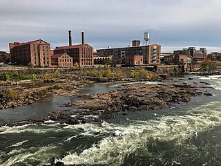
The Chattahoochee River is a river in the Southern United States. It forms the southern half of the Alabama and Georgia border, as well as a portion of the Florida and Georgia border. It is a tributary of the Apalachicola River, a relatively short river formed by the confluence of the Chattahoochee and Flint rivers and emptying from Florida into Apalachicola Bay in the Gulf of Mexico. The Chattahoochee River is about 430 miles (690 km) long. The Chattahoochee, Flint, and Apalachicola rivers together make up the Apalachicola–Chattahoochee–Flint River Basin. The Chattahoochee makes up the largest part of the ACF's drainage basin.
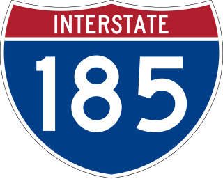
Interstate 185 (I-185) is a 49.3-mile-long (79.3 km) auxiliary Interstate Highway in the west-central part of the US state of Georgia. I-185 also carries the unsigned State Route 411 (SR 411) and is named the Chet Atkins Parkway for its entire length. It provides a freeway connection between Columbus and I-85, which continues on to the Atlanta metropolitan area.
Cataula is an unincorporated community and census-designated place (CDP) in Harris County, Georgia, United States.

State Route 85 (SR 85) is a 96.5-mile-long (155.3 km) state highway in the west-central part of the U.S. state of Georgia. It travels within portions of Muscogee, Harris, Talbot, Meriwether, Coweta, Fayette, and Clayton counties. It connects the Columbus and Forest Park areas, via Manchester, Woodbury, Senoia, Fayetteville, and Riverdale.
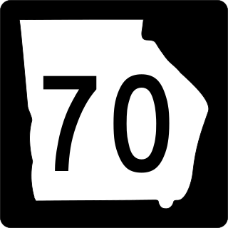
State Route 70 (SR 70) is a 43.1-mile-long (69.4 km) state highway that travels southwest-to-northeast through portions of Coweta and Fulton counties in the north-central part of the U.S. state of Georgia. The highway connects Newnan with the west-central part of Atlanta.
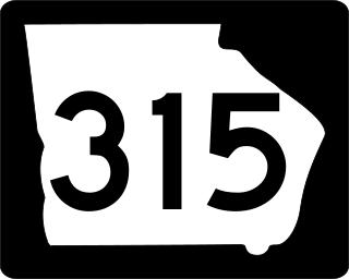
State Route 315 (SR 315) is a 29.8-mile-long (48.0 km) east-west state highway in the west-central part of the U.S. state of Georgia. The highway travels from SR 219 at Goat Rock Road in southwestern Harris County to SR 208 in Olive Branch, west of Talbotton, in west-central Talbot County.

In the US state of Georgia, Interstate 20 (I-20) travels from the Alabama state line to the Savannah River, which is the South Carolina state line. The highway enters the state near Tallapoosa. It travels through the Atlanta metropolitan area and exits the state in Augusta. The highway also travels through the cities of Bremen, Douglasville, Conyers, Covington, and Madison. I-20 has the unsigned state highway designation of State Route 402 (SR 402).

The Columbus metropolitan area, officially the Columbus metropolitan statistical area, and colloquially known as the Chattahoochee Valley, is a metropolitan statistical area consisting of six counties in the U.S. state of Georgia and one county in Alabama, anchored by the city of Columbus.
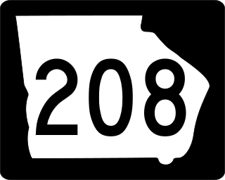
State Route 208 (SR 208) is a 43.2-mile-long (69.5 km) state highway located in the west-central part of the U.S. state of Georgia. It runs east from a point between Columbus and Hamilton. It passes through Harris County, Talbot County, and Taylor County.
The Columbus–Auburn–Opelika, GA–AL Combined Statistical Area is a trading and marketing area made up of six counties in Georgia and two in Alabama. The statistical area includes two metropolitan areas: the Columbus metropolitan area and the Auburn–Opelika metropolitan area. As of 2021, the CSA had a population of 503,709.

State Route 116 (SR 116) is a 30.7-mile-long (49.4 km) state highway that runs west-to-east through portions of Harris and Talbot counties in the west-central part of the U.S. state of Georgia.
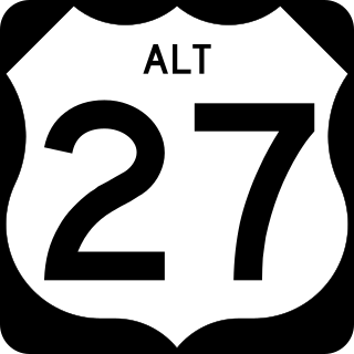
U.S. Highway 27 Alternate is an alternate route of US 27. It travels from the northwestern corner of Columbus northeast to just before Shiloh, north to Greenville, and northwest to Carrollton.

State Route 219 (SR 219) is a 58.9-mile-long (94.8 km) state highway that runs south-to-north through portions of Muscogee, Harris, Troup, and Heard counties in the west-central part of the U.S. state of Georgia. It runs from Columbus north to a point southwest of Franklin.
Ossahatchie Creek is a stream in the U.S. state of Georgia that runs through Harris and Talbot counties in the west central part of the state. It is a tributary to Mulberry Creek.
References
- 1 2 U.S. Geological Survey Geographic Names Information System: Mulberry Creek
- ↑ https://etd.auburn.edu/bitstream/handle/10415/6428/A.COTTRELL_THESIS.pdf?isAllowed=y&sequence=2 Movement And Habitat Use Of Shoal Bass Micropterus cataractae In Two Chattahoochee River Tributaries, Cottrell, Amy Marie
- ↑ Krakow, Kenneth K. (1975). Georgia Place-Names: Their History and Origins (PDF). Macon, GA: Winship Press. p. 36. ISBN 0-915430-00-2.
32°37′49″N85°04′52″W / 32.63028°N 85.08111°W