
Verdalsøra is a town in the municipality of Verdal in Trøndelag county, Norway. The town is the administrative center of the municipality. It is located along the Trondheimsfjord at the mouth of the river Verdalselva. The village of Vinne lies 4 kilometres (2.5 mi) to the southeast, Trones lies about 5 kilometres (3.1 mi) to the north, the villages of Forbregd/Lein lie about 4 kilometres (2.5 mi) to the northeast, and the village of Stiklestad lies about 3 kilometres (1.9 mi) to the east. In 1998, the municipal council of Verdal voted to grant the urban area of Verdalsøra town status under the laws of Norway.

Malm (help·info) is the administrative centre of the municipality of Verran in Trøndelag county, Norway. The village of Malm is located along the Breistadsundet strait which flows into the Trondheimsfjorden. The village of Bartnes lies across the strait from Malm. The village lies about a 32 kilometres (20 mi) drive northwest of the town of Steinkjer, about 12 kilometres (7.5 mi) northwest of the village of Follafoss, and about 20 kilometres (12 mi) south of the village of Namdalseid. The Norwegian County Road 720 runs through the village.
Velle is a village in the municipality of Steinkjer in Trøndelag county, Norway. The village sits at the end of one of the innermost parts of the Trondheimsfjord, west of the village of Følling and northeast of the villages of Beitstad and Bartnes. The village sits along Norwegian County Road 17 about 20 kilometres (12 mi) northwest of the town of Steinkjer.

Åsen is a village in Levanger municipality in Trøndelag county, Norway. The village is located between the lakes Hammervatnet and Hoklingen. The European route E06 highway and the Nordlandsbanen railway line both pass through the village. The train stops at Åsen Station. The village is centered around the agriculture and forestry industries. There is also some woodworking industries, including an organ-making factory. The village is also the site of Åsen Church.
Byavatnet is a lake in the municipality of Levanger in Trøndelag county, Norway. It is located about 2.5 kilometres (1.6 mi) south of the village of Ekne and about 3 kilometres (1.9 mi) west of the village of Ronglan. The lake Hammervatnet lies about 3.5 kilometres (2.2 mi) south of Byavatnet and the lake Sønningen lies about 1.5 kilometres (0.93 mi) to the northwest. The 2.31-square-kilometre (570-acre) lake is about 5 kilometres (3.1 mi) long and about 800 metres (0.5 mi) wide.
Movatnet is a lake in the municipality of Levanger in Trøndelag county, Norway. The 6.83-square-kilometre (2.64 sq mi) lake lies immediately to the east of the lake Hoklingen and just to the west of the village of Markabygd.
Hoklingen is a lake in the municipality of Levanger in Trøndelag county, Norway. The 6.1-square-kilometre (2.4 sq mi) lake lies just to the east of the village of Åsen and about 6 kilometres (3.7 mi) south of the village of Skogn.
Momarka is a village in the municipality of Levanger in Trøndelag county, Norway. It is located just south of the town of Levanger. The Nordlandsbanen railway line and the European route E6 highway both run through the village. Since 2002, Momarka has been considered a part of the town of Levanger urban area so separate population statistics are no longer tracked.
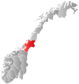
Frol is a former municipality in the old Nord-Trøndelag county, Norway. The 140-square-kilometre (54 sq mi) municipality existed from 1856 until its dissolution in 1962. The municipality was first known as Levanger landsogn and then in 1911 the name was changed to Frol. The municipality included all the area surrounding the town of Levanger in what is now the municipality of Levanger in Trøndelag county.
Skogn is a village in Levanger municipality in Trøndelag county, Norway. The village is located on the eastern shore of the Trondheimsfjorden, about 8 kilometres (5.0 mi) southwest of the town of Levanger. The European route E06 highway runs through the village, just past the Fiborgtangen industrial area located along the shore. There is a Norske Skog Skogn paper mill at Fiborgtangen. The Nordlandsbanen railway line stops in the village at Skogn Station.

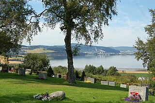
Ekne is a village in the municipality of Levanger in Trøndelag county, Norway. It is located 8 kilometres (5.0 mi) west of the village of Skogn and about 15 kilometres (9.3 mi) southwest of the town of Levanger. The lakes Sønningen and Byavatnet lie south of the village. Ekne Church is located in this village. The World War II-era Falstad concentration camp was also located here.

Sparbu is a village in the municipality of Steinkjer in Trøndelag county, Norway. The village is located about 12 kilometres (7.5 mi) south of the town of Steinkjer. The European route E6 highway runs through the village as does the Nordlandsbanen railway line which stops at the Sparbu Station. The village of Mære lies about 2 kilometres (1.2 mi) to the north, the village of Røra lies about 8 kilometres (5.0 mi) to the south, and the lake Leksdalsvatnet lies about 8 kilometres (5.0 mi) to the east.

Norwegian County Road 774 is a 4.2-kilometre (2.6 mi) long county road in the municipality of Levanger in Trøndelag county, Norway. It begins at the junction with the European route E06 highway at the village of Mule. It then heads into and through parts of the town of Levanger. There, the road continues as the Levanger–Hokstad Ferry operated by Tide Sjø to the village of Hokstad on the island of Ytterøya. After the ferry, the road changes to Norwegian County Road 135.

Ytterøya is an island in the Trondheimsfjord in the municipality of Levanger in Trøndelag county, Norway. The 15-kilometre (9.3 mi) long island has an area of 27.8 square kilometres (10.7 sq mi) has about 600 residents. The highest point is the 210-metre (690 ft) tall Sanstadkammen. The island has good agricultural land and has settlements across the whole island. The Levanger–Hokstad Ferry connects the village of Hokstad on the island to the town of Levanger on the mainland. Ytterøy Church is located on the island.
Lysthaugen is a village in the municipality of Verdal in Trøndelag county, Norway. It is located on the southern side of the river Verdalselva, about 10 kilometres (6.2 mi) east of the town of Verdalsøra and about 7 kilometres (4.3 mi) southwest of the village of Vuku. The mountain Skitholvola lies about 8 kilometres (5.0 mi) south of the village.
Medjå or Grong is a village which serves as the administrative center of the municipality of Grong in Trøndelag county, Norway. It is located along the river Namsen, at the confluence with the river Sanddøla. The Nordland Line runs along the eastern part of the village, stopping at Grong Station. The European route E6 highway runs through the western edge of the village. Grong Church, the main church for the area, is also located in this village.
Frosta is the administrative centre of Frosta municipality in Trøndelag county, Norway. The village is located in the central part of the Frosta peninsula, about 30 kilometres (19 mi) southwest of the town of Levanger. The smaller village of Logtun lies about 5 kilometres (3.1 mi) southwest of Frosta.
Åsen is a former municipality in the old Nord-Trøndelag county, Norway. The 140-square-kilometre (54 sq mi) municipality existed from 1838 until its dissolution in 1962. The municipality was located to the southwest part of what is now Levanger municipality in Trøndelag county, roughly bordered in the north by the lakes Hammervatnet and Hoklingen, and by the Åsenfjorden to the west. The administrative centre was the village of Åsen.
Skogn is a former municipality in the old Nord-Trøndelag county, Norway. The 340-square-kilometre (130 sq mi) municipality existed from 1838 until its dissolution in 1962. The municipality was located to the south and southwest of the town of Levanger in what is now Levanger municipality in Trøndelag county. The administrative centre was the village of Skogn.


