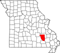
Munger is an unincorporated community in northeast Reynolds County, in the U.S. state of Missouri. [1]
The community is on Missouri Route N approximately one-third of a mile south of the Reynolds-Iron county line. It is approximately 8.5 miles west of Ironton and 4.5 miles northeast of Johnson's Shut-Ins State Park. The East Fork of the Black River flows past the community. [2]
An early variant name was "Mungers Mill". [1] A post office called Munger was established in 1884, and remained in operation until 1932. [3] The community has the name of the local Munger family. [4]
Black is an unincorporated community in northern Reynolds County, Missouri, United States. It is located on Route 49 on the Middle Fork of the Black River, approximately six miles north-northeast of Centerville and southwest of Johnson's Shut-Ins State Park.
Redford is an unincorporated community in Reynolds County, Missouri, United States. It is located on Misssour Route O approximately eight miles south-southeast of Centerville. Ellington is six miles to the southwest. Sinking Creek flows past the southwest side of the community.
Emden is an unincorporated village in eastern Shelby County, Missouri, United States. It is located on Route 168 approximately nine miles east of Shelbyville. There is a post office there, and two churches, plus houses and a few abandoned storefront buildings.
Westover is an unincorporated community in Crawford County, in the U.S. state of Missouri. The community is on Dry Creek at the end of Missouri Route BB, approximately seven miles south-southeast of Steelville and five miles northeast of Cherryville.
Strother Creek is a stream in southwest Iron and northern Reynolds counties in the U.S. state of Missouri. It is a tributary to the Middle Fork of the Black River.
Adonis is an unincorporated community in northern Polk County, in the U.S. state of Missouri.
Bee Fork is an unincorporated community in Reynolds County, in the U.S. state of Missouri.
Dagonia was an unincorporated community in western Reynolds County, in the U.S. state of Missouri. The community was on the east bank of Logan Creek along Missouri Route B. Reynolds is about seven miles to the north along Route B and Ellington lies approximately nine miles to the southeast.
Edgehill is an unincorporated community in northern Reynolds County, in the U.S. state of Missouri.
Exchange is an unincorporated community in southwest Reynolds County, in the Ozarks of southeast Missouri. The community is located along Missouri Route 106, approximately 3.5 miles west of Ellington. The community sits on the floodplain of Logan Creek.
Garwood is an unincorporated community in southern Reynolds County, in the U.S. state of Missouri. The community is on Missouri Route 34 and approximately eight miles northeast of Van Buren in adjacent Carter County.
Hadley is an unincorporated community in southern Reynolds County, in the U.S. state of Missouri. The community is in the southeast corner of the county and approximately 4.5 mile west of Leepr in adjacent Wayne County.
Hyatts Creek is a stream in southwest Iron and northeast Reynolds counties in the U.S. state of Missouri. It is a tributary of the Black River.
Oates is an unincorporated community in northern Reynolds County, in the U.S. state of Missouri. The community is located on Brushy Creek st the intersection of Missouri Route J and county road 836. Nearby communities include Black, approximately seven miles to the east-southeast on the Middle Fork of the Black River and Buick, about six miles to the northwest in Iron County.
Ohlman is an unincorporated community in western Reynolds County, in the U.S. state of Missouri. The community is located at the intersection of Missouri routes 72 and TT approximately five miles southeast of Bunker and 2.5 miles northwest of Reynolds.
Ruble is an unincorporated community in southern Reynolds County, in the U.S. state of Missouri. The community is on Missouri Route HH approximately seven miles southeast of Ellington. Webb Creek flows past the south side of the community to enter Clearwater Lake four miles to the east.
West Fork is an unincorporated community in Reynolds County, in the U.S. state of Missouri. The community lies on south bank of the West Fork of the Black River adjacent to the confluence of Toms Creek with the Black. The community lies approximately six miles east-northeast of Bunker on Missouri Route KK.
Pickel is an unincorporated community in Ste. Genevieve County, in the U.S. state of Missouri.
Adelbert is an extinct town in Washington County, in the U.S. state of Missouri. The site is adjacent to the Missouri Pacific Railroad line on the west side of Mill Creek and one mile north of Mineral Point and southeast of Fountain Farm. Cadet lies approximately two miles to the northeast on Missouri Route 47.
Burbank is an unincorporated community in Wayne County, in the U.S. state of Missouri. The community is located on Missouri Route E, approximately 2.5 miles east-northeast of Greenville.
37°35′51″N90°47′47″W / 37.59750°N 90.79639°W