
Krishna district is a district in the coastal Andhra Region in Indian state of Andhra Pradesh, with Machilipatnam as its administrative headquarters. It is surrounded on the East by Bay of Bengal, West by Guntur, Bapatla and North by Eluru and NTR districts and South again by Bay of Bengal.
Kankipadu is a suburb of Vijayawada and a in Krishna District of the Indian state of Andhra Pradesh. It is also the mandal headquarters of Kankipadu mandal in Vuyyuru revenue division.
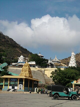
Avanigadda is a town in Krishna district of the Indian state of Andhra Pradesh. It is the mandal headquarters of Avanigadda mandal in Machilipatnam revenue division.
Bantumilli is a village in the Krishna district of the Indian state of Andhra Pradesh. It is the mandal headquarters of Bantumilli mandal of Machilipatnam revenue division. It is well connected by road. It is located at 28 km from Machilipatnam, 50 km from Bhimavaram and 34 km from Gudivada.
Chandarlapadu is a village in NTR district of the Indian state of Andhra Pradesh. It is located in Chandarlapadu mandal of Nandigama revenue division. It is one of the villages in the mandal to be a part of Andhra Pradesh Capital Region.
Muppalla (Muppalla) is a village palnadu district of the Indian state of Andhra Pradesh. It is located in Muppalla village ipur mondal of Guntur revenue division.
Chintalapadu is a village in NTR district of the Indian state of Andhra Pradesh. It is located in Chandarlapadu mandal of Vijayawada revenue division. It forms a part of Andhra Pradesh Capital Region.
Mulapadu is a village in NTR district of the Indian state of Andhra Pradesh. It is located in Ibrahimpatnam mandal under Vijayawada revenue division.
Chintalapadu may refer to:
Eturu is a village in NTR district of the Indian state of Andhra Pradesh. It is located in Chandarlapadu mandal of Nandigama Revenue Division. It is a part of Andhra Pradesh Capital Region.
Thotaravulapadu is a village in NTR district of the Indian state of Andhra Pradesh. It is located in Chandarlapadu mandal of Nandigama revenue division. It is one of the villages in the mandal to be a part of Andhra Pradesh Capital Region.
Thondapi is a village in palnadu district of the Indian state of Andhra Pradesh. It is located in Muppalla mandal of sattenapalli revenue division.
Bobbellapadu is a village in Krishna district of the Indian state of Andhra Pradesh. It is located in Chandarlapadu mandal of Vijayawada revenue division. It is a part of Andhra Pradesh Capital Region.
Kodavatikallu is a village in NTR district of the Indian state of Andhra Pradesh. Ancient name of this village is Kotilangaala Puram.
Pokkunuru is a village in Krishna district of the Indian state of Andhra Pradesh. It is located in Chandarlapadu mandal of Vijayawada revenue division. It is forms a part of Andhra Pradesh Capital Region.
Sattenapalle mandal is one of the mandals in Palnadu district of the Indian state of Andhra Pradesh. It is under the administration of Sattenapalli revenue division and the headquarters are located at Sattenapalle. The mandal is bounded by Krosuru, Pedakurapadu, Rajupalem, Medikonduru, Muppalla and Phirangipuram.And it is a part of APCRDA also comes under capital region
Nandigama mandal is one of the 20 mandals in NTR district of the Indian state of Andhra Pradesh. It is under the administration of Nandigama revenue division and the headquarters are located at Nandigama. The mandal is bounded Penuganchiprolu, Kanchikacherla, Chandarlapadu mandals and also a portion of it by the state of Telangana.
Krishna Chandrapur is a census town and a gram panchayat within the jurisdiction of the Mathurapur police station in the Mathurapur I CD block in the Diamond Harbour subdivision of the South 24 Parganas district in the Indian state of West Bengal.

NTR district is a district in coastal Andhra Region in the Indian state of Andhra Pradesh. The district headquarters is located at Vijayawada. The district is named after former Chief Minister of Andhra Pradesh N. T. Rama Rao. The district shares boundaries with Guntur, Palnadu, Krishna, Eluru, Khammam and Suryapet districts
Palnadu district is a district in coastal Andhra Region in the Indian state of Andhra Pradesh. With Narasaraopet as its administrative headquarters, it was formed on 4 April 2022 to become one of the resultant twenty-six districts The district was formed from Gurazala, Sattenapalli and Narasaraopet revenue divisions from Palnadu district. The district covers most of the Palnadu region.

