| Murphy Complex Fire | |
|---|---|
 | |
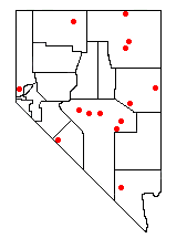
| Location | Idaho and Nevada, United States |
| Statistics | |
| Date(s) | July 16, 2007 – August 2007 |
| Burned area | 652,016 acres (263,862 ha) |
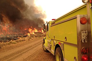
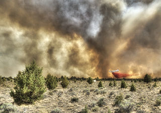
The Murphy Complex Fire was a 2007 wildfire that included acreage upon the Bureau of Land Management (BLM) Bruneau and Jarbidge Field Offices of Idaho, BLM Elko Field Office of Nevada, and Forest Service Mountain City and Jarbidge Districts of Nevada. It burned an estimated 652,016 acres (263,862 ha ) of land. [1] By acreage, it was the third largest wildfire in the United States between 1997 and 2009. [1] The fire affected Owyhee and Twin Falls counties in Idaho, and Elko County, Nevada. Nearly three times as much acreage burned in the two Idaho counties as burned in Nevada. [2] Aerial crews were primarily responsible for fighting the fire in Castleford, Idaho. [3] About 560 wildfire firefighters were involved including a Type 1 team that specializes in fighting large wildfires. [4] This was the third large fire in as many years on land managed by the Jarbidge Field Office in Idaho's Twin Falls District. Because of this, the BLM held a workshop on large wildfires in the district on May 12–14, 2009. [5]

A wildfire or wildland fire is a fire in an area of combustible vegetation occurring in rural areas. Depending on the type of vegetation present, a wildfire can also be classified more specifically as a brush fire, bushfire, desert fire, forest fire, grass fire, hill fire, peat fire, vegetation fire, or veld fire.

The Bureau of Land Management (BLM) is an agency within the United States Department of the Interior that administers more than 247.3 million acres (1,001,000 km2) of public lands in the United States which constitutes one eighth of the landmass of the country. President Harry S. Truman created the BLM in 1946 by combining two existing agencies: the General Land Office and the Grazing Service. The agency manages the federal government's nearly 700 million acres (2,800,000 km2) of subsurface mineral estate located beneath federal, state and private lands severed from their surface rights by the Homestead Act of 1862. Most BLM public lands are located in these 12 western states: Alaska, Arizona, California, Colorado, Idaho, Montana, Nevada, New Mexico, Oregon, Utah, Washington and Wyoming.

Idaho is a state in the northwestern region of the United States. It borders the state of Montana to the east and northeast, Wyoming to the east, Nevada and Utah to the south, and Washington and Oregon to the west. To the north, it shares a small portion of the Canadian border with the province of British Columbia. With a population of approximately 1.7 million and an area of 83,569 square miles (216,440 km2), Idaho is the 14th largest, the 12th least populous and the 7th least densely populated of the 50 U.S. states. The state's capital and largest city is Boise.
The fire was a combination of six wildfires caused by lightning in south-central Idaho and north-central Nevada that started on July 16–17, 2007. The four largest fires were called the Rowland, Elk Mountain, Smith Crossing and Buck Flat fires. They merged over the weekend of July 21, 2007, and the wildfire was renamed the Murphy Complex Fire. [2] [6] It spread quickly due to the hot and dry conditions and threatened or damaged a wide variety of natural resources, plants, animals, people and property. By the time it was contained on August 2, 2007 an estimated 483,000 acres (195,463 ha) in Idaho and 170,000 acres (68,797 ha) in Nevada had burned. It was the largest Idaho wildfire since 1910. [7] Afterward, the BLM undertook a large scale reclamation effort, which included fencing, seedling planting, shrub planting, drill seeding, aerial seeding, cultural inventory, weed treatment and monitoring. Monitoring is planned for 425,815 acres (172,321 ha). Total reclamation costs are estimated at over $11 million during fiscal years 2007–2010, with full recovery of the natural systems taking several additional years. [2] [7]