
Mtamvuna River is a river that forms the border between KwaZulu-Natal and the Eastern Cape Provinces in South Africa. The river has a wide mouth and flows into the Indian Ocean just south of Port Edward. The Mtamvuna river is approximately 162 km long with a catchment area of 1,553 km². The name means "the reaper of mouthfuls" because of the damage the river does to crops during floods.

The Olifants River, Lepelle or Obalule is a river in South Africa and Mozambique, a tributary of the Limpopo River. It falls into the Drainage Area B of the Drainage basins of South Africa. The historical area of the Pedi people, Sekhukhuneland, is located between the Olifants River and one of its largest tributaries, the Steelpoort River.

The Umfolozi River is a river in KwaZulu-Natal, a province of South Africa. It is formed by the confluence of the Black and White Umfolozi Rivers near the southeastern boundary of the Hluhluwe-Umfolozi Game Reserve. The isiZulu name imFolozi is generally considered to describe the zigzag course followed by both tributaries, though other explanations have been given.

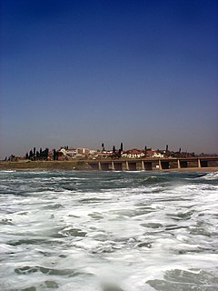
The Umzimkulu River is a river in South Africa. In the past, the Umzimkulu formed part of the border between Eastern Cape and Kwazulu-Natal provinces. Presently this river is part of the Mvoti to Umzimkulu Water Management Area. In late February of every year, the river is host to one of South Africa's most popular canoe races, the Drak Challenge.

The Ohlanga River is a river in KwaZulu-Natal, South Africa, which empties into the Indian Ocean just north of Umhlanga, KwaZulu-Natal, north of Durban. The river has extensive reed beds in the estuary at its mouth, which is only 7 km further southwest from the mouth of the Mdloti River. Presently this river is part of the Mvoti to Umzimkulu Water Management Area.
Water Management Areas (WMAs) are parts of South Africa that are managed by the Water Boards.
Limpopo WMA, or Limpopo Water Management Area(coded: 1), in South Africa includes the following major rivers: the Limpopo River, Matlabas River, Mokolo River, Lephalala River, Mogalakwena River, Sand River and Nzhelele River and covers the following dams.
Luvubu and Letaba WMA, or Levubu and Letaba Water Management Area , includes the following major South African rivers: Mutale River, Luvuvhu River and Letaba River, and cover the following dams:
Olifants WMA, or Olifants Water Management Area , Includes the following major rivers: the Elands River, Wilge River, Steelpoort River and Olifants River, and covers the following dams:
Upper Vaal WMA, or Upper Vaal Water Management Area , is a Water Management Area that includes the following major rivers: the Wilge River, Liebenbergsvlei River, Mooi River and Vaal River, and covers the following Dams:
Middle Vaal WMA. or Middle Vaal Water Management Area , Includes the following major rivers: the Vet River, Vals River and Vaal River, and covers the following Dams:
Thukela WMA, or Thukela Water Management Area ,, Includes only the following major river: the Thukela River, and covers the following Dams:
Mzimvubu to Keiskamma WMA, or Mzimvubu to Keiskamma Water Management Area , includes the following major rivers: the Swane River, Mntafufu River, Mzimvubu River, Mngazi River, Mthatha River, Xora River, Mbashe River, Nqabara River, Gqunube River, Buffalo River, Nahoon River, Groot Kei River and Keiskamma River, and covers the following Dams:
Upper Orange WMA, or Upper Orange Water Management Area , Includes the following major rivers: the Modder River, Riet River, Caledon River and Orange River, and covers the following Dams:
Fish to Tsitsikama WMA, or Fish to Tsitsikama Water Management Area , in South Africa Includes the following major rivers: the Fish River, Kowie River, Boesmans River, Sundays River, Gamtoos River, Kromme River, Tsitsikamma River and Groot River, and covers the following Dams:
Gouritz WMA, or Gouritz Water Management Area , in South Africa includes the following major rivers: the Gouritz River, Olifants River, Kamanassie River, Gamka River, Buffels River, Touws River, Goukou River and Duiwenhoks River, and covers the following Dams:
Olifants/Doorn WMA, or Olifants/Doorn Water Management Area, Includes the following major rivers: the Olifants River, Doorn River, Krom River, Sand River, and Sout River, and covers the following dams:
Berg WMA, or Berg Water Management Area , Include the following major rivers: the Berg River, Diep River and Steenbras River, and covers the following Dams:
The Umkomazi River is a river in KwaZulu-Natal, South Africa.


