Related Research Articles

Masvingo, previously named Victoria, is a province in southeastern Zimbabwe. It has a population of 1.638 million as of the 2022 census, ranking fifth out of Zimbabwe's ten provinces. Established by the British South Africa Company, it was one of the five original provinces of Southern Rhodesia. In 1982, two years after Zimbabwean independence, it was renamed Masvingo Province. The province is divided into seven districts, including Masvingo District, which contains the provincial capital Masvingo City.

Gweru, originally known as Gwelo, is a city in central Zimbabwe. It is on the centre of Midlands Province. Originally an area known to the Ndebele as "The Steep Place" because of the Gweru River's high banks, in 1894 it became the site of a military outpost established by Leander Starr Jameson. In 1914 it attained municipal status, and in 1971 it became a city.

Zvishavane, formerly known as Shabani, is a mining town in Midlands Province, Zimbabwe. Surrounded by low hills, it lies 97 kilometres (60 mi) west of Masvingo, on the main Bulawayo-Masvingo road. Other roads lead from Zvishavane to Gweru, 121 kilometres (75 mi) north, and Mberengwa, 27 kilometres (17 mi) south-west. It is also on direct rail links to Gweru and Beit Bridge which then link up with Harare and Bulawayo in Zimbabwe and to Maputo in Mozambique, and Pretoria in South Africa. It has a private airport serving the city.
The government of Zimbabwe is the main provider of air, rail and road services; historically, there has been little participation of private investors in transport infrastructure.
Shurugwi, originally known as Selukwe, is a small town and administrative centre in Midlands Province, southern Zimbabwe, located about 350 km south of Harare, with a population of 22,900 according to the 2022 census. The town was established in 1899 on the Selukwe Goldfield, which itself was discovered in the early 1890s not long after the annexation of Rhodesia by the Pioneer Column.

Beitbridge is a border town in the province of Matabeleland South, Zimbabwe. The name also refers to the border post and bridge spanning the Limpopo River, which forms the political border between South Africa and Zimbabwe. The border on the South African side of the river is also named Beitbridge.
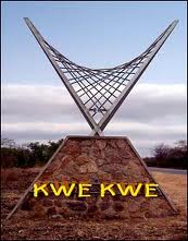
Kwekwe, formerly known as Que Que, is a city in the Midlands province in central Zimbabwe. The city has a population of 119,863 within the city limits, as of the 2022 census, making it the 7th-largest city in Zimbabwe and the second-most populous city in the Midlands, behind Gweru.
Chatsworth is a small settlement in the Masvingo Province of Zimbabwe. It is located about 58 km north of Masvingo on the Masvingo-Gweru railway line. The settlement started in 1911 as a railway station. It administered under the Gutu Rural District Council.
Felixburg is a village in the Masvingo Province of Zimbabwe. It is located about 53 km (33 mi) north of Masvingo on the road that connects Gutu to Chivhu. It was named after Felix Posselt who visited the area in 1888 and later settled at Felixburg.

The A4 is a highway, also known as the R1 Highway, which runs between Beitbridge and Harare. From Beitbridge it passes through Rutenga, Ngundu, Masvingo, Mvuma, Chivhu before reaching Harare.
Silobela is an agricultural Resettlement in Kwekwe District in the Midlands Province of Zimbabwe. It is located about 60 kilometres (37 mi) west of Kwekwe town, 80 kilometres (50 mi) north-west of Gweru town, and bordering Nkayi on the west.
Chirumanzu–Zibagwe is a constituency of the National Assembly of the Parliament of Zimbabwe, located in the Chirumhanzu District in Midlands Province. Mvuma, a small mining town, is one of the largest commercial centers in the constituency. The constituency was created in 2008 from the old Chirumanzu and Zhombe constituencies. Emmerson Mnangagwa, now the President of Zimbabwe, was the inaugural member, followed by his wife, Auxillia Mnangagwa. Its current Member of Parliament is Prosper Machando (ZANU–PF).

Chirumhanzu District is a Second-order Administrative Sub-division of Midlands (Zimbabwe) between Gweru and Masvingo.
The A5 Highway is a national road in Zimbabwe. It joins the cities of Harare and Bulawayo, and is hence known as the Harare-Bulawayo Highway. It is one of the two routes that form the R2 Route, which connects Harare with the Plumtree Border with Botswana.

Chirundu–Beitbridge Road Corridor is a Trans-African Highway Network Zimbabwean link between South Africa and Zambia. It is part of the North–South Corridor Project and forms the entire Zimbabwean section of the Cape to Cairo Road.
The R6 Highway is a primary road, a trunk road and regional road corridor link road in Zimbabwe.
R7 Highway is a primary, paved, regional road corridor in central Zimbabwe virtue of linking the regional corridors R1 Highways that runs from Harare to Beitbridge via Masvingo, and R2 Highway that runs from Harare to Plumtree via Bulawayo.
A18 Road is a national road running from Gweru to Zvishavane/A9 Highway junction in central Zimbabwe. It begins in Gweru at the roundabout where 7th Street ends. 19°27′34″S29°49′27″E and ends at the intersection with A9/P7 Highway just after Zvishavane town. 20°18′51″S30°03′09″E

Beira-Bulawayo railway, also called Machipanda railway, Beira-Harare-Bulawayo railway and Beira railway, is a railway that connects the city of Beira, Mozambique, to the city of Bulawayo, in Zimbabwe. It is 850 km long, in a 1067 mm gauge.
References
- ↑ "Mvuma Chimney". ZimFieldGuide.com.
- ↑ Pers. comm.
- ↑ "City (Town) Mvuma: Map, population, location".
- ↑ Fabiani, W.M.B. (1984). Foster, R.P. (ed.). Archaen gold-copper mineralization in the Athens Mine, Mvuma, Zimbabwe, in Gold '82: The Geology, Geochemistry and Genesis of Gold Deposits. Rotterdam: Geological Society of Zimbabwe, A.A. Balkema. pp. 449–451. ISBN 906191504X.
- ↑ "Mvuma: The REBIRTH…lures investment".
- ↑ "Mvuma reclaims former glory | Celebrating Being Zimbabwean".
- ↑ "Google Maps". Google Maps. Retrieved 15 June 2019.
| International | |
|---|---|
| National | |
| | This Zimbabwe location article is a stub. You can help Wikipedia by expanding it. |