
Westchester County is located in the U.S. state of New York. It is the second-most populous county on the mainland of New York, after the Bronx, and the most populous county in the state north of New York City. According to the 2010 U.S. census, the county had a population of 949,113, estimated to have increased to 967,506 by 2019. Situated in the Hudson Valley, Westchester covers an area of 450 square miles (1,200 km2), consisting of six cities, 19 towns, and 23 villages. Established in 1683, Westchester was named after the city of Chester, England. The county seat is the city of White Plains, while the most populous municipality in the county is the city of Yonkers, with an estimated 199,663 residents in 2018.

A village is a clustered human settlement or community, larger than a hamlet but smaller than a town, with a population typically ranging from a few hundred to a few thousand. Though villages are often located in rural areas, the term urban village is also applied to certain urban neighborhoods. Villages are normally permanent, with fixed dwellings; however, transient villages can occur. Further, the dwellings of a village are fairly close to one another, not scattered broadly over the landscape, as a dispersed settlement.

South Kingstown is a town in, and the county seat of, Washington County, Rhode Island, United States. The population was 30,639 at the 2010 census.

The crab-eating mongoose is a mongoose species ranging from the northeastern Indian subcontinent and Southeast Asia to southern China and Taiwan. It is listed as Least Concern on the IUCN Red List.

Minjur is a town located in the outskirts of North Chennai, India. It is located in the Thiruvallur district in the Indian state of Tamil Nadu. Minjur is called 'Vada Kanchi' meaning North Kanchipuram. The town has two famous temples for Shiva and Vishnu, similar to Kanchipuram. The neighbourhood is served by Minjur railway station of the Chennai Suburban Railway Network.

In the United States, the meaning of "village" varies by geographic area and legal jurisdiction. In many areas, "village" is a term, sometimes informal, for a type of administrative division at the local government level. Since the Tenth Amendment to the United States Constitution prohibits the federal government from legislating on local government, the states are free to have political subdivisions called "villages" or not to and to define the word in many ways. Typically, a village is a type of municipality, although it can also be a special district or an unincorporated area. It may or may not be recognized for governmental purposes.

Benadi is a village in the North-Western region of Karnataka state near Maharashtra Border in India. It is located in the Chikodi taluka of Belgaum district in Karnataka. Before it was a part of Bombay State and Princely state of Kolhapur. It is a part of Twin Village Aadi-Benadi. People who has origin from this village are known as Benadikar.
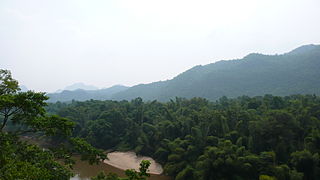
Hirekudi is a village in the southern state of Karnataka, India. It is located in the Chikodi taluk of Belgaum district in Karnataka.
Shiraguppi is a village in the southern state of Karnataka, India. It is located in the Athni taluk of Belgaum district in Karnataka.
Tenasserim Hills or Tenasserim Range is the geographical name of a roughly 1,700 km long mountain chain, part of the Indo-Malayan mountain system in Southeast Asia.
Malikwad is a village which is located in the Belgaum district of Karnataka state, India. It is located on the banks of the Doodhganga River. The river acts as the border between Karnataka and Maharashtra. Due to the border separation, the people in the area are bilingual; many can speak as well as write both Kannada and Marathi languages. Facilities in the village include schools, a library, and public toilets. Agriculture is a mainstream source of income of the village. It is regarded as one of the highest sugarcane producing villages. Along with sugarcane, farmers also grow different kinds of fruits and vegetables such as tomatoes and bananas. Almost one member of every family in the area is in the Indian army, so people have called this village “Sainik Malikwad,” the word “sainik” meaning “soldier.”

Myinmoletkat Taung is the highest mountain of the Bilauktaung, Tenasserim Hills, Burma.

Khanpur is a medium size village in Phillaur tehsil of Jalandhar District of Punjab State, India. The village is administrated by Sarpanch who is elected representative of village. It is situated on Phillaur-Apra road and located 3.8 km away from Nagar, 3 km from census town Apra, 54 km from Jalandhar and 121 km from state capital Chandigarh. Khanpur has postal head office in Dayalpur which is 8 km away from the village.
Pal Qadiam is a medium size village in Phillaur tehsil of Jalandhar District of Punjab State, India. It is located 3.8 km away from Nagar, 4 km from census town Apra, 45 km from Jalandhar and 121 km from state capital Chandigarh. Pal Qadiam has postal head office in Phillaur which is 10 km away from the village. The village is administrated by a sarpanch who is an elected representative of village as per Panchayati raj (India).
Rasulpur is a village in Phillaur tehsil of Jalandhar District of Punjab State, India. The village is administrated by Sarpanch who is the elected representative of village and it is located 1.5 km away from Nagar, 8.6 km from census town Apra, 50 km from Jalandhar and 117 km from state capital Chandigarh. Rasulpur has postal head office in Phillaur which is 6.6 km away from the village.
Baulu Taung is a mountain of the Tenasserim Hills, Burma.
Khaira Mushtarka is a village in the Phillaur tehsil of Jalandhar District of the Indian state of Punjab. It is located 20 kilometres (12 mi) away from Nakodar, 44 kilometres (27 mi) from Jalandhar, and 164 kilometres (102 mi) from the state capital of Chandigarh. The village is administered by the Sarpanch, an elected representative.
Lasara is a village in Phillaur tehsil of Jalandhar District of Punjab State, India. It is located 17 km away from Phillaur, 60 km from Jalandhar and 108 km from state capital Chandigarh. The village is administrated by a Sarpanch, an elected representative of the village.
Manjari is a village located in Chikodi Tehsil of Belgaum district in Karnataka, India. It is located 20 km (12 mi) away from sub-district headquarters Chikodi, the nearest town, and 100 km (62 mi) away from district headquarter Belgaum. As per 2009 stats, Manjari village is also a gram panchayat. The total geographical area of village is 555.71 hectares. Manjari has a total population of 8,613 peoples. There are about 1,844 houses in Manjari village.
