
Ilulissat, formerly Jakobshavn or Jacobshaven, is the municipal seat and largest town of the Avannaata municipality in western Greenland, located approximately 350 km (220 mi) north of the Arctic Circle. With the population of 4,670 as of 2020, it is the third-largest city in Greenland, after Nuuk and Sisimiut. The city is home to almost as many sled-dogs as people.

Ludvig Mylius-Erichsen was a Danish author, ethnologist, and explorer, from Ringkøbing. He was most notably an explorer of Greenland.

Danmark Fjord, also known as Denmark Sound, is a fjord in northeast Greenland within Northeast Greenland National Park.

Peary Land is a peninsula in northern Greenland, extending into the Arctic Ocean. It reaches from Victoria Fjord in the west to Independence Fjord in the south and southeast, and to the Arctic Ocean in the north, with Cape Morris Jesup, the northernmost point of Greenland's mainland, and Cape Bridgman in the northeast.
Ejnar Mikkelsen (1880–1971), was a Danish polar explorer and author. He is most known for his expeditions to Greenland.

Johan Peter Koch was a Danish captain and explorer of the Arctic dependencies of Denmark, born at Vestenskov.

Germania Land or Germanialand is a peninsula in northeastern Greenland. Despite the high latitude it is largely unglaciated.

Independence Fjord or Independence Sound is a large fjord or sound in the eastern part of northern Greenland. It is about 200 km (120 mi) long and up to 30 km (19 mi) wide. Its mouth, opening to the Wandel Sea of the Arctic Ocean is located at 82°15′N21°54′W.
Hagen Fjord is a fjord in north-eastern Greenland. It was named after Niels Peter Høeg Hagen, the cartographer of the main exploration team of the ill-fated Denmark expedition.

Nioghalvfjerdsbrae, sometimes referred to as "79 N Glacier", is a large glacier located in King Frederick VIII Land, northeastern Greenland. It drains an area of 103,314 km2 (39,890 sq mi) of the Greenland Ice Sheet with a flux of 14.3 km3 (3.4 cu mi) per year, as measured for 1996. The glcier has two calving fronts where the glacier meets the ocean, separated by Hovgaard Island. In July 2020, the northern offshoot, the Spalte Glacier broke away from Nioghalvfjerdsbrae and completely disintegrated.

Jørgen Brønlund, was a Greenlandic polar explorer, educator, and catechist. He participated in two Danish expeditions to Greenland in the early 20th century.

Tobias Island is a small island off the northeastern coast of Greenland.
Storstrommen, is one of the major glaciers in northeastern Greenland.

King Frederick VIII Land is a major geographic division of northeastern Greenland. It extends above the Arctic Circle from 76°N to 81°N in a N/S direction along the coast of the Greenland Sea.

Adolf S. Jensen Land is a peninsula in the southern limit of King Frederick VIII Land, northeastern Greenland. Administratively it belongs to the NE Greenland National Park area.
The Denmark expedition, also known as Denmark Expedition to Greenland's Northeast Coast, and as the Danmark Expedition after the ship, was an expedition to the northeast of Greenland in 1906–1908.
Lambert Land is a land area —possibly a peninsula or an island— in King Frederick VIII Land, northeastern Greenland. Administratively it belongs to the NE Greenland National Park area.

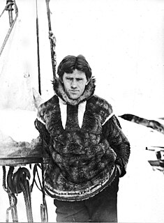
Niels Peter Høeg Hagen, was a Danish military officer, polar explorer and cartographer. He participated in the ill-fated Denmark expedition to NE Greenland in 1906.
Benedict Fjord is a fjord in Peary Land, northern Greenland. To the north, the fjord opens into the Lincoln Sea of the Arctic Ocean.

The Peary Channel was a hypothetical sound or marine channel running from east to west separating Peary Land in northernmost Greenland from the mainland further south.


