Transport in Hungary relies on several main modes, including transport by road, rail, air and water.

Kőbánya-Kispest is the southern terminus of the M3 Line of the Budapest Metro. It is the only station of the line that is above ground.
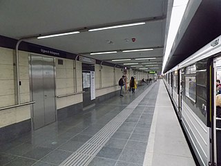
Újpest-központ is the northern terminus of the Budapest Metro Line 3. It is located beneath a busy intersection, the most important public transport hub in Újpest district.
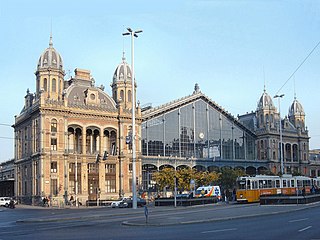
Nyugati pályaudvar, is one of the three main railway terminals in Budapest, Hungary. Known to locals and foreigners alike simply as Nyugati, the station is on the Pest side of Budapest, accessible by the 4 and 6 tramline and the M3 metro line.

Határ út is a station on the M3 (North-South) line of the Budapest Metro. Near the station, there are several tram and bus terminus, and a shopping centre. Határ út station named after the adjacent street Határ út, which literally means "(City) Border Street". Before the formation of Greater Budapest it was the border of Budapest Capital.
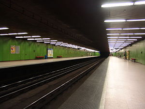
Ecseri út is a station on the M3 (North-South) line of the Budapest Metro. Next to the station there are the northern blocks of Attila József microraion. The station is named after the adjacent street Ecseri út.

Nagyvárad tér is a station on the M3 (blue) line of the Budapest Metro. The area around the station is home to several hospitals and the Semmelweis University medical school. The station is named after the adjacent square Nagyvárad tér, which named after the former Hungarian city of Nagyvárad.

Lehel tér is a station on the Budapest Metro Line 3 (North-South). It is located beneath the eponymous square Lehel tér, named after the Hungarian chieftain Lehel.
Forgách utca is a station on the Budapest Metro Line 3 (North-South). It is located in Angyalföld district, beneath Váci út between its intersections with streets Fáy utca and Forgách utca.

Gyöngyösi utca is a station on the Budapest Metro Line 3 (North-South). It is located under Váci út at its intersection with the streets Gyöngyösi utca and Meder utca.

Újpest-városkapu is a station on the Budapest Metro Line 3 (North-South).

Budapest-Déli station, known to locals and foreigners alike simply as the Déli is one of the three main railway stations in Budapest, Hungary.

Népliget or People's Park is the biggest public park in Budapest, Hungary. It is located southeast of the city centre, and covers an area of 110 hectares. It was established to commemorate the 100th anniversary of the union of Pest, Buda and Óbuda. The park is the site of the Planetarium, which is a laser theatre, and the E-klub, the biggest night club in Budapest.
Kálvin tér is a transfer station on the M3 and the M4 lines of the Budapest Metro. It is located beneath the eponymous square, named after John Calvin.
Ferenciek tere is a station on the M3 (North-South) line of the Budapest Metro located under the eponymous square in the Downtown. It is an important junction, as several bus lines from Buda pass through or terminate here. It is also the station closest to the geographical city centre of Budapest. The station's name was Felszabadulás tér before 1990.

Árpád híd is a station on the Budapest Metro Line 3 (North-South). It was the temporary terminus of Line 3 between 1984 and 1990.
Vecsés is a town of 20,550 inhabitants in Budapest metropolitan area, Pest county, Hungary, situated adjacent to Budapest's Ferihegy Airport.
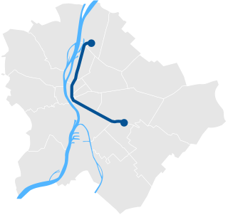
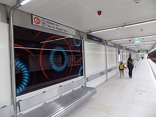
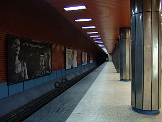
Line 3 is the third and longest line of the Budapest Metro. It runs in a general north-south direction parallel to the Danube on the Pest side, roughly following Váci út south from Újpest to the city center, then following the route of Üllői út southeast to Kőbánya-Kispest. Its daily ridership is estimated at 626,179. Like Line 1, it does not serve Buda.

Újbuda is the 11th district of Budapest, Hungary. It is the most populous district of Budapest with 137,426 inhabitants (2008). Until the 1890s, Újbuda's present territory was a field south of the historical town of Buda. The construction of a new residential area started in the 1900s, the present district was formed in 1930. From 1880 to 1980, Újbuda's population increased from 1,180 to 178,960. There are boulevards, avenues with tram lines, and communist-era housing estates in the district. Line 4 of the Budapest metro passes through Újbuda.

Hungária körgyűrű is the longest and busiest boulevard, also the widest city street in Budapest, Hungary. It's 13 km long and has 6-10 traffic lanes with a rapid tram line on the median of the boulevard. It consists of three parts: Róbert Károly körút, Hungária körút and Könyves Kálmán körút.