| Line 1 | |||
|---|---|---|---|
 | |||
 | |||
| Overview | |||
| Type | Rapid transit | ||
| System | Budapest Metro | ||
| Status | Operational | ||
| Termini | Vörösmarty tér Mexikói út | ||
| Stations | 11 | ||
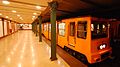
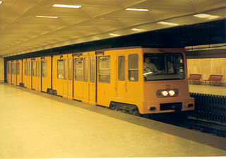
| Line number | Line 1 ("Yellow metro") | ||
| Operation | |||
| Opened | May 2, 1896 | ||
| Operator(s) | BKV | ||
| Technical | |||
| Line length | 4.4 km | ||
| Track gauge | 1,435 mm (4 ft 8 1⁄2 in) | ||
| Electrification | 550 V DC | ||
| Operating speed | 60 km/h | ||
| |||

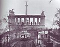
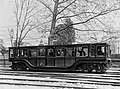
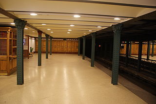
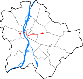
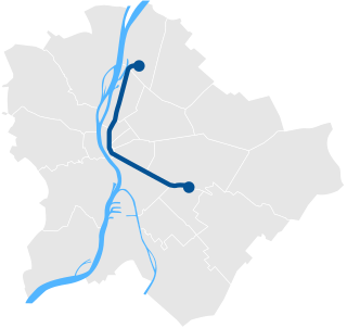
Line 1 (Officially: Millennium Underground Railway, Metro 1 or M1) is the oldest line of the Budapest Metro. It is known locally as "the underground" ("a földalatti"), while the M2, M3 and M4 are called "metró". It is the oldest underground followed by the London Underground and the Mersey Railway (specifically, its Wirral Line), the third rapid transit rail line worldwide of any type to exclusively use electric traction (after the London Underground, specifically the City and South London Railway) and the strictly-above ground Liverpool Overhead Railway (before its closure in 1956), and the first on the European mainland. It was built from 1894 to 1896. In 2002, it was listed as a UNESCO World Heritage Site. [1]

The Budapest Metro is the rapid transit system in the Hungarian capital Budapest. It is the oldest electrified underground railway system on the European continent, and the third-oldest electrically operated underground railway in the world, predated by the 1890 City & South London Railway and the Liverpool Overhead Railway in 1893-96. Its iconic Line 1 was completed in 1896.

The London Underground is a public rapid transit system serving London, England and some parts of the adjacent counties of Buckinghamshire, Essex and Hertfordshire in the United Kingdom.

The Mersey Railway was the first part of the passenger railway connecting the communities of Liverpool, Birkenhead, and now the rest of the Wirral Peninsula in England, which lie on opposite banks of the River Mersey, via the Mersey Railway Tunnel. The railway opened in 1886 with four stations using steam locomotives hauling unheated wooden carriages; in the next six years the line was extended and three more stations opened. Using the first tunnel under the Mersey the line is the world's oldest underground railway outside London.
Contents
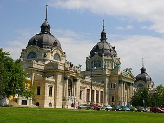
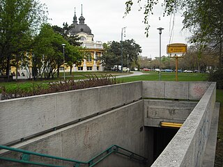
Line 1 runs northeast from the city center on the Pest side under Andrássy út to the Városliget , or City Park. Like Line 3, it does not serve Buda.

Inner City is part of the historic old town of Pest. Until 1949, Inner City was the 4th District. Today it is one of the two neighbourhoods of the District V of Budapest, Hungary, the other one being Lipótváros which is the political and financial centre of Hungary. Budapest's main shopping street, Váci utca is located in the District V, as is the large part of the city's commercial life, banks and travel agencies. Many tourists start sightseeing there.

Pest is the eastern, mostly flat part of Budapest, Hungary, comprising about two thirds of the city's territory. It is separated from Buda and Óbuda, the western parts of Budapest, by the Danube River. Among its most notable sights are the Inner City, the Hungarian Parliament, Heroes' Square and Andrássy Avenue. In colloquial Hungarian, "Pest" is often used for the whole capital of Budapest. The three parts of Budapest united in 1873.

Andrássy Avenue is a boulevard in Budapest, Hungary, dating back to 1872. It links Erzsébet Square with the Városliget. Lined with spectacular Neo-renaissance mansions and townhouses featuring fine facades and interiors, it was recognised as a World Heritage Site in 2002. It is also one of Budapest's main shopping streets, with fine cafes, restaurants, theatres, Embassies and luxury boutiques. Among the most noticeable buildings are the State Opera House, the former Ballet School, the Zoltán Kodály Memorial Museum and Archives, the Hungarian University of Fine Arts and the Ferenc Hopp Museum of East Asian Arts.