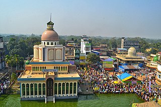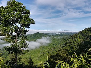
The Chittagong Hill Tracts, often shortened to simply the Hill Tracts and abbreviated to CHT, are a group of districts within the Chittagong Division in southeastern Bangladesh, bordering India and Myanmar (Burma) in the east. Covering 13,295 square kilometres (5,133 sq mi), they formed a single district until 1984, when they were divided into three districts: Khagrachhari, Rangamati, and Bandarban.

Rangamati is the administrative headquarters of Rangamati District in the Chittagong Hill Tracts of Bangladesh. The town is located at 22°37'60N 92°12'0E and has an altitude of 14 metres (46 ft).

Chittagong District, officially Chattogram District, is a district located in south-eastern Bangladesh. It is a part of the Chittagong Division. The port city of Chittagong, which is the second largest city in Bangladesh, is located within this district.

Fatikchhari is an upazila of Chittagong District in Chittagong Division, Bangladesh. It is the largest upazila of Chittagong.

Hathazari is an upazila of Chattogram District in Chattogram Division, Bangladesh.

Rangunia is an upazila of Chattogram District in Chattogram Division, Bangladesh.

Raozan Upazila is an upazila of Chattogram District, in Chattogram Division, Bangladesh. It was established in August,1947.

Baghaichhari is an upazila of Rangamati District in the division of Chittagong, Bangladesh.

Rangamati Sadar is an upazila of Rangamati District in the Division of Chittagong, Bangladesh.

Halda River is a river in south-eastern Bangladesh. It originates at the Badnatali Hill Ranges in Ramgarh Upazila in the Chittagong Hill Tracts, flows through Fatikchhari Upazila, Bhujpur Thana, Hathazari Upazila, Raozan Upazila and Chandgaon Thana of the Chittagong Metropolitan City, and falls into the Karnaphuli River. The 81-kilometre-long (50 mi) river has a very turbulent tributary, the Dhurung River, which joins Purba Dhalai about 48 kilometres (30 mi) downstream. The river is navigable by big boats 29 km (18 mi) from its mouth up to Nazir Hat, and by small boats 16–24 kilometres (9.9–14.9 mi) further up to Narayanhat. The Halda averages 21 feet (6.4 m) in depth and is 30 feet (9.1 m) at its deepest point.
Jafatnagar Union is a union parishad of Fatikchhari Upazila of Chittagong District.
The N1 or Dhaka–Chittagong Highway is the main transportation artery of Bangladesh, connecting the capital city of Dhaka and the southern port city of Chittagong. Approximately 465 kilometres in length, the highway starts at Jatrabari in Dhaka and ends at Teknaf in Cox's Bazar. The highway is known along certain stretches as the Chittagong–Cox's Bazar Highway and the Cox's Bazar–Teknaf Highway.
Nangalmora Union is a union parishad under Hathazari Upazila, Chittagong District, Bangladesh. It has a total area of 462 acres (187 ha).
The R160 or Hathazari-Khagrachhari Road is a transportation artery in Bangladesh, which connected National Highway N106 with Khagrachari City. It is 89 kilometres (55 mi) long, and the road is a Regional Highway of the Roads and Transport department of Bangladesh.
The Z1619 or Gahira (Raozan)–Fatikchhari Road is a transportation artery in Bangladesh, which connects N106 National Highway from Gahira with Regional Highway R160 at Fatikchhari Municipality. It is 24.37 kilometres (15.14 mi) long, and the road is a Zila Road of the Roads and Transport department of Bangladesh.

Raozan Government College, Chittagong is a government-run, honors-level, degree college in Raozan Upazila, Chittagong District, Bangladesh. It was founded in 1963 by AKM Fazlul Kabir Chowdhury, a member of the East Pakistan Provincial Assembly.

Hathazari Government University College is a government-run, honors-level, degree college in Hathazari Upazila, Chittagong District, Bangladesh. It was founded in 1968.

Gohira Degree College is a private, pass-level degree college in Raozan Upazila, Chittagong District, Bangladesh. It was founded in 1968 by writer Mahbub Ul Alam Choudhury.

Chittagong-5 is a constituency represented in the Jatiya Sangsad of Bangladesh. Since 6 August 2024 the constituency is Vacant.

Chittagong–Kaptai highway or Kaptai road is a 52 km (32 mi) regional highway located in the division of Chittagong, Bangladesh. This highway passes through Chittagong, Hathazari Upazila, Raozan Upazila and Rangunia Upazila of Chittagong District to Kaptai in Rangamati District. At least 0.9 million passengers use this highway.


