Mandi Bahauddin, also spelled Mandi Baha ud Din, is a district in the Punjab province of Pakistan.
The Williams Lake First Nation is a First Nations government of the Secwepemc (Shuswap) Nation, located in the Cariboo region of the Central Interior region of the Canadian province of British Columbia, at the city of Williams Lake. It was created when the government of the then-Colony of British Columbia established an Indian reserve system in the 1860s. It is a member government of the Northern Shuswap Tribal Council. Its main Indian Reserve is Williams Lake Indian Reserve No. 1, a.k.a. "Sugarcane" or "The Cane" or "SCB".
Malkot is a village of Abbottabad District in Khyber-Pakhtunkhwa province of Pakistan. Until the local government reforms of 2000 it was a Union Councils of the district.
Chak Malook is a village and union council, an administrative subdivision, of Chakwal District in the Punjab Province of Pakistan, it is part of Chakwal Tehsil, and is located at 32°58'0N 72°57'0E.
Darya Gali is a village and union council of Murree Tehsil in the Murree District of Punjab, Pakistan. It is located in the north of the tehsil and is bounded to the north by Khyber-Pakhtunkhwa, to the south by Ghora Gali and Murree, and to the west by Rawat.
Barian is a town in Punjab (Pakistan). It is located at 33°57'0N 73°23'0E. The town is linked to the city of Abbottabad by a 71 km road via Nathia Gali, the area is often cut off during bad winter weather, in 2005 heavy snowfall had cut the roads to Khanspur and Changla Gali, and in January 2008 snow and heavy landslides cut off roads.
Potha Sharif is a village and union council of Murree Tehsil in the Murree District of Punjab, Pakistan. It is located in the north-east of the tehsil at 33°57'0N 73°30'0E, and is bounded to the north by Phagwari, to the south by Sehr Bagla, to the west by Rawat and to the east by Kashmir. The village contains the mazar of the Sufi saint Hazarat Dada Malik Suraj Abbasi, forefather of the Potha Shareef people. He had seven sons and their descendants are currently present in Potha Shareef. People visit the mazar from different areas of the country to offer tribute.

Gharmala is a village located in Jhelum District, Punjab, Pakistan. It is part of Jhelum Tehsil. and lies along Rohtas Road. The village is about 3 km west of Jhelum and has a population of over 5,000. It has girls' and boys' high schools. Two mosques are there.
Jaloo is a village and union council of Mansehra District in Khyber-Pakhtunkhwa province of Pakistan. It is located in Mansehra Tehsil at 34°19'0N 73°9'0E and has an altitude of 1008 metres (3310).
Wan Radha Ram is a town and Union Council of Kasur District in the Punjab province of Pakistan. It is part of Pattoki Tehsil and is located at 30°56'60N 73°45'0E with an altitude of 181 metres (597 feet).
Monan is a village and union council of Jhelum District in the Punjab Province of Pakistan. It is part of Jhelum Tehsil, and is located at 32°57′0″N73°41′0″E and has an altitude of 229 metres (754 feet).
Kaman is a town and union council of Okara District in the Punjab province of Pakistan. It is located at 31°2'30N 73°9'0E with an altitude of 166 metres.
Duki is a district in the Balochistan province of Pakistan. It is located at an altitude of 1,092 metres above sea level. It is sub-divided into union councils, mainly Vialla Duki, Zangal Rabat, Sadar, Civil Station, Nasarbad, Thal-Chotiali, Luni and Nana Sahib Ziarat. Its main revenue comes from agriculture and natural resources. Being a tribal society it has tribes: Tareens including Raisani, Kakars (Shadozai), Lunis, Zarkoon & Nasar etc.Nasar is the biggest tribe in the district.About 45% population belongs to Nasar Tribe.Duki is one of Pakistan's least developed districts, lagging behind in development, health, education, infrastructure and many other facilities. It is the only district where two polio cases were reported in 2018. Duki was made a district in 2016 and its sub-divisions are Thal-Chotiali, Nana Sahib Ziarat, and Luni.

Fitzsimmons Creek is a large creek in Whistler, British Columbia, Canada, having its origins at the Fitzsimmons Glacier in the Garibaldi Ranges of the Coast Mountains. For half its length of approximately 10 kilometres, the creek courses a U-shaped glacial valley which separates two ski mountains of the Whistler Blackcomb resort, Blackcomb to the north and Whistler to the south.
Jassar Punjabi: جسڑ is a town in the Narowal District of Punjab Province, Pakistan. Jassar is also a caste from jatt clan which stay in Punjab province,Pakistan which basically belongs to Ludhiana, indian. In Pakistan they are Muslim community and in India jassar are Sikh sardar community.
Salyot is a village in UC Kuthiala, District Abbottabad, Khyber Pakhtunkhwa, Pakistan. It is located at 34°9'0N 73°7'0E with an altitude of 1137 metres. Neighbouring settlements include Bagwal Bandi, Bain Gojri and Shadial.
Banseri is a village in the Khyber Pakhtunkhwa province of Pakistan. It is located at 34°9'0N 73°8'0E with an altitude of 1168 metres. Neighbouring settlements include Mukhdabbi, Saliot, and Baghati.
Mari is a village in the Khyber Pakhtunkhwa Province of Pakistan. It is located at 33°57'0N 73°18'0E with an altitude of 1341 metres.
Chakrian is a village in union council of Langay in Gujrat District of Pakistan.

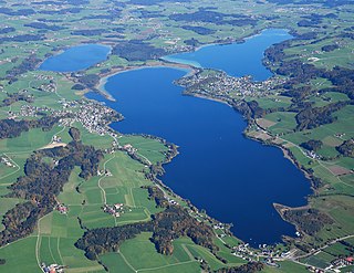
Das Salzburger Seengebiet or Salzburger Seenland is a group of natural lakes northeasterly of the city of Salzburg in Salzburg-Umgebung District and is part of Salzburg alpine foothills.


