Kodad is a town in Suryapet district of the Indian state of Telangana. It is a municipality and the mandal headquarters of Kodad mandal in Kodad revenue division. It lies on the National Highway 65 between Hyderabad and Vijayawada.It is 44 km far away from the district headquarters Suryapet.
Munagala is a village in the Suryapet district in the state of Telangana. It is located in Munagala mandal of Kodad revenue division..It is 24km far away from the district headquarters Suryapet.
Brundavanapuram is a village and Gram panchayat of Nadigudem mandal, Suryapet district, in Telangana state.
Nadigudem is a village in Suryapet district, of the Indian state of Telangana. It is located in Nadigudem mandal of Kodad revenue division.
Moteh or Mothey is a village in Suryapet district of the Indian state of Telangana. It is located in Mothey mandal of Suryapet division.
Kandagatla is a village in Suryapet district in Telangana, India.It falls under Athmakur (S) mandal. It is famous for Thati kallu and surrounded by lots of mountains.
Kodad mandal is one of the 23 mandals in Suryapet district of the Indian state of Telangana. It is under the administration of Kodad revenue division with its headquarters at Kodad. The mandal is located on the banks of Paler river and is bounded by Nadigudem, Munagala, Chilkur, Huzurnagar, Mellachervu mandals. A portion of it also borders Khammam district and the state of Andhra Pradesh.

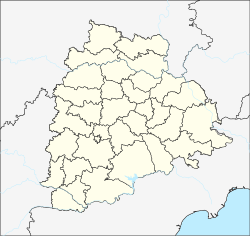
Kodad revenue division is an administrative division in the Suryapet district of the Indian state of Telangana. It is one of the 2 revenue divisions in the district which consists of 9 mandals under its administration. Kodad is the divisional headquarters of the division.
Munagala mandal is one of the 23 mandals in Suryapet district of the Indian state of Telangana. It is under the administration of Kodad revenue division with its headquarters at Munagala. The mandal is bounded by Nadigudem, Mothey, Chivemla, Chilkur mandals.
Mothey mandal is one of the 23 mandals in Suryapet district of the Indian state of Telangana. It is under the administration of Suryapet revenue division with its headquarters at Mothey. It is bounded by Nadigudem Mandal towards South, Chivvemla Mandal towards west, Munagala mandal towards South, Atmakur(S) Mandal towards west and Khammam district towards east.
Ananthagiri mandal is one of the 23 mandals in Suryapet district of the Indian state of Telangana. It is under the administration of Kodad revenue division with its headquarters at Ananthagiri. It is carved out from Kodad and Nadigudem mandals. It is bounded by Nadigudem in the west, Kodad mandal in the south and Khammam district towards north.
Chilkur mandal is one of the 23 mandals in Suryapet district of the Indian state of Telangana. It is under the administration of Kodad revenue division with its headquarters at Chilkur. The mandal is bounded by Kodad mandal to the east, Huzurnagar mandal to the south, Munagala mandal to the north.
Mellachervu mandal is one of the 23 mandals in Suryapet district of the Indian state of Telangana. It is under the administration of Kodad revenue division with its headquarters at Mellachervu. It is bounded by Mattampally mandal towards west, Huzurnagar mandal towards North, Mallareddygudem mandal towards South, Krishna district of Andhra Pradesh towards East.
Mattampally mandal is one of the 23 mandals in Suryapet district of the Indian state of Telangana. It is under the administration of Kodad revenue division with its headquarters at Mattampally. It is bounded by Mellachervu mandal towards East, Huzurnagar mandal towards North, Garidepally mandal towards west, Guntur district of Andhra Pradesh towards South.
Huzurnagar mandal is one of the 23 mandals in Suryapet district of the Indian state of Telangana. It is under the administration of Kodad revenue division with its headquarters at Huzurnagar. It is bounded by Chilkur mandal towards North, Mellachervu mandal and Mattampally mandal towards South, Garidepally Mandal towards west, Kodad mandal towards east.
Mallareddygudem mandal is one of the 23 mandals in Suryapet district of the Indian state of Telangana. It is under the administration of Kodad revenue division with its headquarters at Chintalapalem. It is bounded by Mattampally mandal towards west, Mellachervu mandal towards North, Krishna district of Andhra Pradesh towards East.
Maddirala mandal is one of the 23 mandals in Suryapet district of the Indian state of Telangana. It is under the administration of Suryapet revenue division with its headquarters at Maddirala. It is carved out from Thungaturthy and Nuthankal mandals. It is bounded by Thungaturthy mandal towards West, Nuthankal mandal towards South, Mahabubabad district towards North.
Athmakur (S) mandal is one of the 23 mandals in Suryapet district of the Indian state of Telangana. It is under the administration of Suryapet revenue division with its headquarters at Atmakur. It is bounded by Chivvemla mandal towards South, Nuthankal mandal towards North, Mothey mandal towards East, Suryapet mandal towards South.
Nagaram mandal is one of the 23 mandals in Suryapet district of the Indian state of Telangana. It is under the administration of Suryapet revenue division with its headquarters at Nagaram. It is bounded by Jajireddygudem mandal towards South, Thungathurthy mandal towards East, Thirumalagiri mandal towards North, Nalgonda district towards West,
Chivvemla mandal is one of the 23 mandals in Suryapet district of the Indian state of Telangana. It is under the administration of Suryapet revenue division with its headquarters at Chivvemla. It is bounded by Suryapet mandal towards west, Athmakur (S) mandal towards North, Mothey mandal towards East, Penpahad mandal towards South.