Jinhae-gu is a district in Changwon City, South Korea. This region is served by the Korean National Railroad, and is famous for its annual cherry blossom festival every spring.

The Geum River is located in South Korea. It is a major river that originates in Jangsu-eup, North Jeolla Province. It flows northward through North Jeolla and North Chungcheong Provinces and then changes direction in the vicinity of Greater Daejeon and flows southwest through South Chungcheong Province before emptying into the Yellow Sea near Gunsan city.

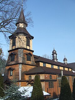
Zawoja is a village in Southern Poland located close to Maków Podhalański. It is situated in Sucha County. With neighbouring village of Skawica it constitutes a rural Zawoja Commune. It has 6,200 inhabitants (2001) and is often mentioned as one of the biggest Polish villages. It is also very often referred as the longest one as it stretches for about 20 kilometres in a picturesque mountain valley. It lies approximately 9 kilometres (6 mi) south of Sucha Beskidzka and 52 km (32 mi) south-west of the regional capital Kraków.
The Battle of Thala was part of the Jugurthine War of 111-104 BC between Rome and Jugurtha of Numidia, a kingdom on the north African coast approximating to modern Algeria. The Romans defeated Jugurtha at the Battle of Thala.
Aitanite/ Aitaneet (عيتنيت) is a village in Lebanon, in the West Beqaa region. Aitanit is located in the southern region of Lebanon, particularly the Beqaa Valley. Aitanit is also located about 1070 meters above sea level and is currently on the edge of a mountain. Below the mountain and the village is Lake Quaroun. In addition, the villages overlooks the village Qaraoun, which is just across the lake. The whole region around the village are farmlands and pastures filled with grape, olive trees, and many other fruit plants.

Sogong-dong is a dong, neighbourhood of Jung-gu in Seoul, South Korea.
Mugyo-dong is a legal dong, or neighbourhood of the Jung-gu district in Seoul, South Korea and governed by its administrative dong, Myeong-dong.
Balia, Bangladesh may refer to the following locations in Bangladesh:

Czarnocin is a village in Piotrków County, Łódź Voivodeship, in central Poland. It is the seat of the gmina called Gmina Czarnocin. It lies approximately 19 kilometres (12 mi) north of Piotrków Trybunalski and 28 km (17 mi) south-east of the regional capital Łódź.
Ungilsan is a mountain near the city of Namyangju, Gyeonggi-do in South Korea. It has an elevation of 610.2 m (2,002 ft).
Eungboksan is a mountain in the counties of Yangyang and Hongcheon, Gangwon-do, in South Korea. It has an elevation of 1,359.6 m (4,461 ft).
Deoksungsan is a mountain of Chungcheongnam-do, western South Korea. It has an elevation of 495 metres.
Bangjangsan is a mountain of Jeollabuk-do, western South Korea. It has an elevation of 743 metres.
Byeonsan (Uisangbong) is a mountain of Jeollabuk-do, western South Korea. It has an altitude of 509 metres.
Seonunsan is a mountain of Jeollabuk-do, western South Korea, with an elevation of 336 metres. It is a popular destination for hiking, with a variety of trails, some leading to a giant 13m carving of Buddha on a cliff, which dates back to the Goryeo dynasty. It is also one of the premier sport climbing destinations in South Korea, having perhaps the highest concentration of difficult routes in the country.
Unjangsan is a mountain of Jeollabuk-do, western South Korea. It has an elevation of 1,126 metres.
Baegamsan (Jeollanam-do) is a mountain of Jeollanam-do, western South Korea. It has an elevation of 742 metres.
Sudosan is a mountain of Gyeongsangbuk-do, eastern South Korea. It has an elevation of 1,317 metres.
Vysotskiy Peak is a peak, 2,035 m, in the north part of Gorki Ridge, overlooking Schussel Moraine in the Humboldt Mountains, Queen Maud Land. Discovered and plotted from air photos by German Antarctic Expedition, 1938-39. Mapped from air photos and surveys by Norwegian Antarctic Expedition, 1956–60; remapped by Soviet Antarctic Expedition, 1960–61, and named after Soviet geographer G.N. Vysotskiy.
Ilsan New Town refers to a planned city occupying Ilsandong-gu and Ilsanseo-gu of Goyang.


