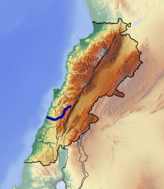
The Nahr al-Kalb (Arabic : نهر الكلب, meaning Dog River) is a river in Lebanon. It runs for 31 km (19 mi) from a spring in Jeita near the Jeita Grotto to the Mediterranean Sea.

The Nahr al-Kalb (Arabic : نهر الكلب, meaning Dog River) is a river in Lebanon. It runs for 31 km (19 mi) from a spring in Jeita near the Jeita Grotto to the Mediterranean Sea.
The Nahr al-Kalb is the ancient Lycus River. [1] Past generals and conquerors have traditionally built monuments at the mouth of the Nahr al-Kalb, known as the Commemorative stelae of Nahr el-Kalb.
The entire site of the Nahr el-Kelb valley with the archaeological sites it conceals is classified on the indicative list of UNESCO world heritage. [2]
The river originates at a low altitude from a source that originates from the Jeita Grotto.
33°57′N35°36′E / 33.950°N 35.600°E

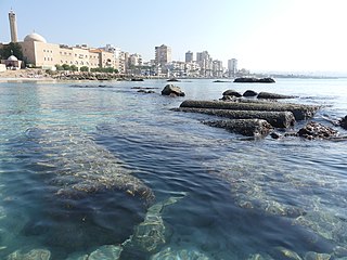
Tyre is a city in Lebanon, one of the oldest continuously inhabited cities in the world, though in medieval times for some centuries by just a small population. It was one of the earliest Phoenician metropolises and the legendary birthplace of Europa, her brothers Cadmus and Phoenix, as well as Carthage's founder Dido (Elissa). The city has many ancient sites, including the Tyre Hippodrome, and was added as a whole to the list of UNESCO World Heritage Sites in 1984. The historian Ernest Renan noted that "One can call Tyre a city of ruins, built out of ruins".

The Nahr al-Kabir, also known in Syria as al-Nahr al-Kabir al-Janoubi or in Lebanon simply as the Kebir, is a river in Syria and Lebanon flowing into the Mediterranean Sea at Arida. The river is 77.8 km (48.3 mi) long, and drains a watershed of 954 km2 (368 sq mi). Its headwaters are at the Ain as-Safa spring in Lebanon and it flows through the Homs Gap in the Orontes River Valley of southern Syria.

The Litani River, the classical Leontes, is an important water resource in southern Lebanon. The river rises in the fertile Beqaa Valley, west of Baalbek, and empties into the Mediterranean Sea north of Tyre. Exceeding 140 km in length, the Litani is the longest river that flows entirely in Lebanon and provides an average annual flow estimated at 920 million cubic meters. The Litani provides a major source for water supply, irrigation and hydroelectricity both within Southern Lebanon, and the country as a whole.

Kadisha Valley, also romanized as the Qadisha Valley and also known as the Kadisha Gorge or Wadi Kadisha, is a gorge that lies within the Bsharri and Zgharta Districts of the North Governorate of Lebanon. The valley was carved by the Kadisha River, also known as the Nahr Abu Ali when it reaches Tripoli. Kadisha means "Holy" in Aramaic, and the valley is sometimes called the Holy Valley. It has sheltered Christian monastic communities for many centuries. The valley is located at the foot of Mount al-Makmal in northern Lebanon.

Mount Lebanon Governorate is one of the nine governorates of Lebanon. Its capital is Baabda. Other notable towns and cities include Aley, Bikfaya, and Beit Mery.

The Jeita Grotto is a system of two separate, but interconnected, karstic limestone caves spanning an overall length of nearly 9 kilometres (5.6 mi). The caves are situated in the Nahr al-Kalb river valley within the locality of Jeita, 18 kilometres (11 mi) north of the Lebanese capital Beirut. Though inhabited in prehistoric times, the lower cave was not rediscovered until 1836 by Reverend William Thomson; it can only be visited by boat since it channels an underground river that provides fresh drinking water to more than a million Lebanese.

The Bingling Temple is a series of grottoes filled with Buddhist sculpture carved into natural caves and caverns in a canyon along the Yellow River. It lies just north of where the Yellow River empties into the Liujiaxia Reservoir. Administratively, the site is in Yongjing County of Linxia Hui Autonomous Prefecture in Gansu province, some 100 km (62 mi) southeast of Lanzhou. This temple, along with other sites along the Silk Road, was inscribed in 2014 on the UNESCO World Heritage List as the Silk Roads: the Routes Network of Chang'an-Tianshan Corridor World Heritage Site.

Byblos District, also called the Jbeil District, is a district (qadaa) of the Keserwan-Jbeil Governorate of Lebanon. It is located to the northeast of Lebanon's capital Beirut. The capital is Byblos. The rivers of al-Madfoun and Nahr Ibrahim form the district's natural northern and southern borders respectively, with the Mediterranean Sea bordering it from the west and Mount Lebanon from the east, separating it from the adjacent district of Baalbek in the Beqaa Valley.

Keserwan District is a district (qadaa) in Keserwan-Jbeil Governorate, Lebanon, to the northeast of Lebanon's capital Beirut. The capital, Jounieh, is overwhelmingly Maronite Christian. The area is home to the Jabal Moussa Biosphere Reserve.

Nahr al-Bared is a Palestinian refugee camp in northern Lebanon, 16 km from the city of Tripoli. Some 30,000 displaced Palestinians and their descendants live in and around the camp, which was named after the river that runs south of the camp. Under the terms of the 1969 Cairo Agreement, the Lebanese Army does not conventionally enter the Palestinian camps, and internal security is provided by Palestinian factions.

The tourism industry in Lebanon has been important to the local economy historically and comprises a major source of revenue for the country.
Jal El Dib or Jal Ed Dib is a Lebanese city in the kaza of Matn in the Mount Lebanon Governorate11 kilometers north of the capital city of Beirut.
Jeita is a town and municipality located in the Keserwan District of the Keserwan-Jbeil Governorate of Lebanon. The town is about 20 kilometres (12 mi) north of Beirut. It has an average elevation of 380 meters above sea level and a total land area of 290 hectares. Jeita's inhabitants are Maronites.
The first inscriptions on the UNESCO Memory of the World International Register were made in 1997. By creating a compendium of the world's documentary heritage—manuscripts, oral traditions, audio-visual materials, library and archive holdings – the program aims to tap on its networks of experts to exchange information and raise resources for the preservation, digitization, and dissemination of documentary materials. As of 2018, 432 documentary heritages have been included in the register, among them recordings of folk music, ancient languages and phonetics, aged remnants of religious and secular manuscripts, collective lifetime works of renowned giants of literature, science and music, copies of landmark motion pictures and short films, and accounts documenting changes in the world's political, economic and social stage. Of these, thirteen properties were nominated by countries from the region of the Arab States.

The Awali is a perennial river flowing in Southern Lebanon. In ancient times it was known as Asclepius River. The 48 kilometres (30 mi) long Awali originates from the Barouk mountain at a height of 1,492 metres (4,895 ft) and the Niha mountain.

The Nahr Ibrahim also known as Adonis River, is a small river in the Keserwan-Jbeil Governorate in Lebanon, with a length of about 23 km. The river emerges from two sources: The Roueiss grotto in Aaqoura that provides two thirds the flow of the Nahr Ibrahim and from a huge cavern, the Afqa Grotto, that provides a third of the flow, nearly 1.5 km above sea level before it drops steeply through a series of falls and passes through a sheer gorge through the mountains. It passes through the town of Nahr Ibrahim before emptying into the Mediterranean Sea. The city takes its name from the river.
Greater Beirut is the urban agglomeration comprising the city of Beirut and the adjacent municipalities over the Mount Lebanon Governorate. It does not constitute a single administrative unit. Greater Beirut geographically stretches south to the Damour River in the Chouf District until it reaches the "Nahr al-Kalb" river in the Keserwan District in the north. It also comprises many towns and cities in the mountains in the Aley District, Baabda District and Metn District Districts, most notably being the cities of Baabda, Aley, Choueifat, Hazmieh, Sin el-Fil, Jdeideh, Bchamoun and Dekwaneh. The conurbation spreads south, east, and north of Beirut city. To the west, the Eastern Mediterranean Sea serves as a natural boundary.

The commemorative stelae of Nahr el-Kalb are a group of over 20 inscriptions and rock reliefs carved into the limestone rocks around the estuary of the Nahr al-Kalb in Lebanon, just north of Beirut.

A rock relief or rock-cut relief is a relief sculpture carved on solid or "living rock" such as a cliff, rather than a detached piece of stone. They are a category of rock art, and sometimes found as part of, or in conjunction with, rock-cut architecture. However, they tend to be omitted in most works on rock art, which concentrate on engravings and paintings by prehistoric peoples. A few such works exploit the natural contours of the rock and use them to define an image, but they do not amount to man-made reliefs. Rock reliefs have been made in many cultures throughout human history, and were especially important in the art of the ancient Near East. Rock reliefs are generally fairly large, as they need to be in order to have an impact in the open air. Most of those discussed here have figures that are over life-size, and in many the figures are multiples of life-size.
Hrajel is a town and municipality located in the Keserwan District of the Keserwan-Jbeil Governorate of Lebanon. The town is about 42 kilometres (26 mi) north of Beirut. It has an average elevation of 1,320 meters above sea level and a total land area of 1,230 hectares. Hrajel's inhabitants are Maronites.