Nakina River

Last updated

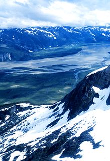
The Nakina River is a river in northwestern British Columbia, Canada, rising southeast of Atlin Lake and flowing generally southeast to its confluence with the Inklin River at the locality of Inklin, where the two rivers combine to form the Taku River.

British Columbia Province of Canada

British Columbia is the westernmost province of Canada, located between the Pacific Ocean and the Rocky Mountains. With an estimated population of 5.016 million as of 2018, it is Canada's third-most populous province.

Canada Country in North America

Canada is a country in the northern part of North America. Its ten provinces and three territories extend from the Atlantic to the Pacific and northward into the Arctic Ocean, covering 9.98 million square kilometres, making it the world's second-largest country by total area. Canada's southern border with the United States, stretching some 8,891 kilometres (5,525 mi), is the world's longest bi-national land border. Its capital is Ottawa, and its three largest metropolitan areas are Toronto, Montreal, and Vancouver. As a whole, Canada is sparsely populated, the majority of its land area being dominated by forest and tundra. Consequently, its population is highly urbanized, with over 80 percent of its inhabitants concentrated in large and medium-sized cities, with 70% of citizens residing within 100 kilometres (62 mi) of the southern border. Canada's climate varies widely across its vast area, ranging from arctic weather in the north, to hot summers in the southern regions, with four distinct seasons.

Atlin Lake lake in British Columbia, Yukon, Canada

Atlin Lake is the largest natural lake in the Canadian province of British Columbia. The northern tip of the lake is in Yukon, as is Little Atlin Lake. However, most of the lake lies within the Atlin District of British Columbia. Atlin Lake is believed to be the source of the Yukon River although it is drained via the short Atlin River into Tagish Lake.

A major tributary of the Nakina is the Sloko River, which runs Northeast to meet it from the area of the Llewellyn Glacier of the Juneau Icefield.

Juneau Icefield glacier in Canada

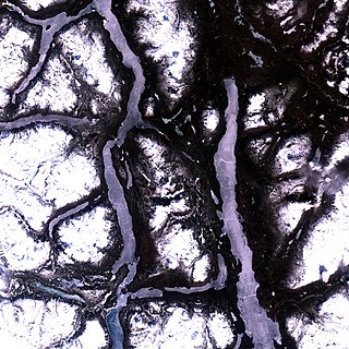
The Juneau Icefield is an ice field located just north of Juneau, Alaska, continuing north through the border with British Columbia, extending through an area of 3,900 square kilometres (1,500 sq mi) in the Coast Range ranging 140 km (87 mi) north to south and 75 km (47 mi) east to west. The icefield is the source of many glaciers including the Mendenhall Glacier and the Taku Glacier. The icefield is home to over 40 large valley glaciers and 100 smaller ones. The Icefield serves as a tourist attraction with many travellers flown in by helicopter for quick walks on the 240-to-1,400-metre deep ice and the massive, awe-inspiring moist crevasses. The icefield, like many of its glaciers, reached its maximum glaciation point around 1700 and has been in retreat since. In fact, of the icefield's 19 notable glaciers, the Taku Glacier is the only one presently advancing. Much of the icefield is contained within the Tongass National Forest. Since 1948, the Juneau Icefield Research Program has monitored glaciers of the Juneau Icefield. On the west side of the icefield, from 1946-2009, the terminus of the Mendenhall Glacier has retreated over 700 metres (0.43 mi).

Related Research Articles

Taku River river in United States of America

The Taku River is a river running from British Columbia, Canada, to the northwestern coast of North America, at Juneau, Alaska. The river basin spreads across 27,500 square kilometres (10,600 sq mi). The Taku is a very productive salmon river and its drainage basin is primarily wilderness.

Kluskoil Lake Provincial Park is a provincial park in British Columbia, Canada, located on the West Road River downstream from the Euchiniko Lakes.

Swan Lake Kispiox River Provincial Park is a provincial park in British Columbia, Canada. It lies within the territories of the Gitanyow and Gitxsan First Nations. The park and the area surrounding it are important to First Nations people for cultural activities. There are trumpeter swans known to be on Club Creek in the winter.

The Lower Similkameen Indian Band or Lower Smelqmix, is a First Nations band government in the Canadian province of British Columbia. Their office is located in the village of Keremeos in the Similkameen region. They are a member of the Okanagan Nation Alliance.

The Stone First Nation or Yunesit'in First Nation is a band government of the Yunesit'in subgroup of the Tsilhqot'in people, whose territory is the Chilcotin District in the western Central Interior region of the Canadian province of British Columbia. It is a member of the Tsilhqot'in Tribal Council. The people of the Stone First Nation are known as the Yunesit'in in the Chilcotin language.

Kumaka is a village in the East Berbice–Corentyne region of Guyana. It stands on the right bank of the upper Essequibo River, about 35 km above Apoteri and the confluence of the Rupununi River with the Essequibo, at an elevation of 105 metres. Kumaka has a population of about 2190 as of 2007.

The Sheslay River is a river in far northwestern British Columbia in the southeast portion of the basin of the Taku River. The river is 85 kilometres (53 mi) long from the confluence of the Hackett River to the junction of the Nahlin River, which is the commencement of the Inklin River, the main southeast fork of the Taku.

The Beaver River is a river in the central-northern Yukon Territory in Canada. It is a tributary of the Stewart River.

The Inklin River is a river in northern British Columbia, Canada. It flows northwest into the head of the Taku River, which is formed by the convergence of the Inklin with the Nakina River, which flows southwest to meet it at the uninhabited locality of Inklin, which is located at the confluence.

Inklin Place in British Columbia, Canada

Inklin is a locality situated at the confluence of the Inklin and Nakina Rivers in far northwestern British Columbia, Canada, which is the commencement of the Taku River.

The Stikine Plateau is a plateau in northern British Columbia, Canada. It lies between the Boundary Ranges of the Coast Mountains on the west and southwest and the Cassiar Mountains along its northeast, and between the Skeena Mountains on its south and southeast and the Jennings and Nakina Rivers on the north.

The Tahltan First Nation, also known as the Tahltan Indian Band, is a band government of the Tahltan people. Their main community and reserves are located at Telegraph Creek, British Columbia. Their language is the Tahltan language, which is an Athabaskan language also known as Nahanni, is closely related to Kaska and Dunneza. Their Indian and Northern Affairs Canada band number is 682. The Tahltan First Nation is joined with the Iskut First Nation in a combined tribal council-type organization known as the Tahltan Nation.

The Firesteel River is the uppermost left tributary of the Finlay River in the Northern Interior of British Columbia, Canada. The river originates at Tatlatui Lake, while the Finlay originates at the outlet of Thutade Lake, to the southeast, which is considered the ultimate source of the Mackenzie River.

The Taku Plateau is a sub-plateau of the Stikine Plateau in the far northwestern Interior of British Columbia, Canada. It lies to the south of the Teslin Plateau, part of the Yukon Plateau and to the southeast of the Yukon Plateau's other major sub-area within British Columbia, the Tagish Highland. Immediately northeast is the Kawdy Plateau and to the northwest of the Nahlin Plateau. The Inklin River forms the plateau's southwestern boundary with the northwestern extremities of the Tahltan Highland, beyond which are the Boundary Ranges. Very mountainous, its highest summit is Nahlin Mountain.

The Taku River Tlingit First Nation are the band government of the Inland Tlinkit in far northern British Columbia, Canada and also in Yukon. They comprise two ḵwaan (tribes) of the Tlingit people, who are otherwise coastal, the Áa Tlein Ḵwáan of the Atlin Lake area and the Deisleen Ḵwáan of Teslin Lake, whose main focus is the Teslin Tlingit Council in Teslin, Yukon. Their band offices are in Atlin, British Columbia.

Keeley Lake, Saskatchewan

Keeley Lake is a hamlet in Saskatchewan.

Sestrimo Glacier glacier in Antarctica

Sestrimo Glacier is the 11 km long and 4 km wide glacier on the northwest side of Trinity Peninsula in Graham Land on the Antarctic Peninsula. Situated southwest of Ogoya Glacier, west-northwest of Broad Valley and north of Cugnot Ice Piedmont. Draining the north slopes of Windy Gap, and flowing northwards east of Mount D'Urville and west of Argentino (Guerrero) Peak to enter Lafond Bay in Bransfield Strait south of Cockerell Peninsula.

The Hackett River is a river in far northwestern British Columbia. It is a tributary of the Sheslay River, which is a feeder-stream of the Inklin River, the main southeast fork of the Taku. The locality of Sheslay is located at its confluence with the river of that name.

The Nahlin River is a river in far northwestern British Columbia, Canada, flowing northwest to meet the Sheslay River, forming there the commencement of the Inklin River, the main southeast fork of the Taku.

The Leq' a: mel First Nation, formerly known as the Lakahahmen First Nation, is a First Nations band government whose community and offices are located in the area near Deroche, British Columbia, Canada, about 12 kilometres east of the District of Mission. They are a member government of the Sto:lo Nation tribal council, which is one of two tribal councils of the Sto:lo.

References

Coordinates: 58°54′00″N133°08′00″W / 58.90000°N 133.13333°W / 58.90000; -133.13333

Geographic coordinate system Coordinate system

A geographic coordinate system is a coordinate system that enables every location on Earth to be specified by a set of numbers, letters or symbols. The coordinates are often chosen such that one of the numbers represents a vertical position and two or three of the numbers represent a horizontal position; alternatively, a geographic position may be expressed in a combined three-dimensional Cartesian vector. A common choice of coordinates is latitude, longitude and elevation. To specify a location on a plane requires a map projection.