Related Research Articles

The Salween is a Southeast Asian river, about 3,289 kilometres (2,044 mi) long, flowing from the Tibetan Plateau south into the Andaman Sea. The Salween flows primarily within southwest China and eastern Myanmar (Burma), with a short section forming the border of Burma and Thailand. Throughout most of its course, it runs swiftly through rugged mountain canyons. Despite the river's great length, only the last 90 km (56 mi) are navigable, where it forms a modest estuary and delta at Mawlamyine. The river is known by various names along its course, including Thanlwin in Burma and Nu River in China. The commonly used spelling "Salween" is an anglicisation of the Burmese name dating from 19th-century British maps.
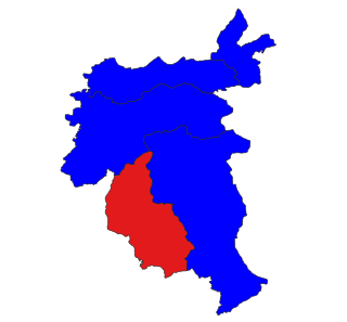
Mae Hong Son province, also spelled Maehongson, Mae Hong Sorn or Maehongsorn, is one of Thailand's seventy-six provinces (changwat) lies in upper northern Thailand and is the westernmost province. Neighboring provinces are Shan State of Myanmar, Chiang Mai and Tak. To the west, the province borders Kayin State and Kayah State of Myanmar.

Theinni or Hsenwi is a town in northern Shan State of Burma, situated near the north bank of the Nam Tu River and now the centre of Hsenwi Township in Lashio District. It is 28 miles (45 km) north of Lashio. It is 2,100 feet (640 m) above sea level.

Kunlong is the capital town of Kunlong Township in Shan State. its coordination is 23 25' 00" N and 98 39' 00" E.

Laihka State was a state in the central division of the Southern Shan States of Burma, with an area of 3711 km².
Mong Ton also known historically as Möngtung and Maington, is a town and seat of Mong Tong Township in Mong Hsat District, Shan State in eastern Myanmar near the border with Thailand. Mong is equivalent to [Township or land]."Ton"is equivalent to [Royal City]. It is located in the Daen Lao Range, in the eastern part of the Shan State, east of the Salween River. Mong Ton lies on the National Highway 45 and connected to Nar Kaung Mu and Pone Par Kyin, is also connected to Mong Hsat by National Highway 49 which begins to the north-east of the town.

Mong Hsu Township is a township of Loilen District in the Shan State of Myanmar. The principal town is Mong Hsu. Om-pu waterfall on Nam Parng River of Mong Hsu is the second largest waterfall of Shan State. The nearest commercial airport to Mong Hsu is Lashio Airport.
Mongyai Township is a township of Lashio District in the Shan State of eastern Burma. The principal town is Mongyai. Mount Loi Leng of Mongyai is the highest point in Shan State.

Tangyan Township is a township of Lashio District in the Shan State of eastern Burma. The principal town is Tangyan. Tangyan emerged as an important centre for Panthay people in the mid-20th century, especially after the destruction of Panglong during World War II.
Kengtung Township is a township of Kengtung District in the Shan State of Myanmar. The principal town is Kengtung. It lies almost entirely east of the Salween River and its area is over 12,000 square miles (31,000 km2). It is bounded on the north by the states of Mang Lon, Mong Lem and Keng Hung ; east by the Mekong River, south by the Siamese Shan States, and west in a general way by the Salween River, though it overlaps it in some places. The state is known to the Chinese as Mhng Khng, and was frequently called by the Burmese the 32 cities of the Gn (HkOn). The classical name of the state is Khemarata or Khemarata Tungkapuri.
Kunhing (Kunhein) is located in Kunhing Township in the middle part of southern Shan state, Myanmar. The name Kunhein refers to "a thousand island" in the local Shan language.
Laukkai is the capital of Kokang in the northern part of Shan State, Burma. It is situated on the Salween River, which forms Myanmar's border with the People's Republic of China. It is about 10 miles away from Nansan, China. In Laukkai, the south-western dialect of Mandarin and Chinese characters are widely used, and the Chinese renminbi is in circulation. It is the main town of Laukkaing Township of the Kokang Self-Administered Zone. It is 117 miles and 7 furlongs from Lashio and 42 miles from Kongyan. Its population is 23,435.
Teng River or Nam Teng is a river of Shan State, eastern Burma. It is a tributary of the Salween River.
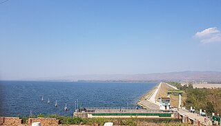
There are almost 200 large dams in Myanmar. Myanmar (Burma) has a large hydroelectric power potential of 39,000 megawatts (52,000,000 hp), although the economical exploitable potential is about 37,000 megawatts (50,000,000 hp). Between 1990 and 2002, the country tripled its installed capacity of hydro plants, increasing from 253 megawatts (339,000 hp) to 745 megawatts (999,000 hp). Total installed capacity in 2010 is at least 2,449 megawatts (3,284,000 hp) MW, 6% of potential. Several large dams are planned to increase future hydro utilization.

Mongnawng was a large Shan state in what is today Burma.
Nā-hki-lek or Na-hkilek is a river village on the Salween River in Shan State of eastern Burma. It lies on the confluence of the Salween and the Nam Pang River. A few miles north beyond the junction is said to be "a strange whirlpool, at the place the river is in a gorge between limestone cliffs, which fall smooth and precipitous to the water's edge."
South Hsenwi was a Shan state in the Northern Shan States in what is today Burma. The capital was Mongyai town which had a population of about 2000 in the 19th century.
Monghsu or Maingshu was a Shan state in what is today Burma. It belonged to the Eastern Division of the Southern Shan States. The main river in the area was the Nam Pang.
Mongpan, also known as Maingpan was a Shan state in what is today Burma. It belonged to the Eastern Division of the Southern Shan States.
Hka River or Nam Hka is a river of Shan State, Burma. It is a left hand tributary of the Salween.
References
- ↑ Beach, Frederick Converse; Rines, George Edwin (1908). The Americana: a universal reference library, comprising the arts and sciences, literature, history, biography, geography, commerce, etc., of the world (Now in the public domain. ed.). Scientific American compiling department. pp. 988–. Retrieved 29 September 2011.
- ↑ Grigson, Geoffrey; Gibbs-Smith, Charles Harvard (1957). Places: a volume of travel in space and time: places which have delighted, intrigued, and intimidated men. Hawthorn Books. Retrieved 28 September 2011.
- ↑ Current Status of Dam Projects on Burma’s Salween River
- ↑ Collis, Maurice (1938). Lords of the sunset: a tour in the Shan states. Dodd, Mead. Retrieved 28 September 2011.