This article concerns the systems of transportation in Laos. Laos is a country in Asia, which possesses a number of modern transportation systems, including several highways and a number of airports. As a landlocked country, Laos possesses no ports or harbours on the sea, and the difficulty of navigation on the Mekong means that this is also not a significant transport route.

Lan Xang or Lancang was a Lao kingdom that held the area of present-day Laos from 1353 to 1707. For three and a half centuries, Lan Xang was one of the largest kingdoms in Southeast Asia. The kingdom is the basis for Laos's national historic and cultural identity.

Luang Phabang, or Louangphabang, commonly transliterated into Western languages from the pre-1975 Lao spelling ຫຼວງພຣະບາງ as Luang Prabang, literally meaning "Royal Buddha Image", is a city in north central Laos, consisting of 58 adjacent villages, of which 33 comprise the UNESCO Town Of Luang Prabang World Heritage Site. It was listed in 1995 for unique and "remarkably" well preserved architectural, religious and cultural heritage, a blend of the rural and urban developments over several centuries, including the French colonial influences during the 19th and 20th centuries.

Dams and reservoirs in Laos are the cornerstone of the Lao government's goal of becoming the "battery of Asia".

Vang Vieng is a town in the Vientiane Province in Laos. It is popular with tourists, specifically backpackers, seeking adventure sports as well as its karst topography. It is on the Nam Song River, 130km north of Vientiane.
The Nam Ngum Dam is a hydroelectric dam on the Nam Ngum River, a major tributary of the Mekong River in Laos. It was the first hydropower dam built in the Lao PDR.

Nam Ngum is a 354 km long river in Laos. It is a major tributary of the Mekong River.
The Nam Ou is one of the most important rivers of Laos. It runs 448 km from Phongsaly Province to Luang Prabang Province. The river rises in Muang Ou Nua near the Lao-Chinese border, and traverses the northern Laos mountains and gorges until meeting the Mekong River in Ban Pak Ou. Along with the Mekong, the Nam Ou is the only natural channel suitable for large-draft boat transportation. The Nam Ou is one of the 12 principal tributaries of the Mekong River. The river has a total area of nearly 26,000 km2. Near its confluence with the Mekong are the Pak Ou Caves, famous for their Buddha statues. The river is also surrounded by limestone karts, forests, and valleys. The river supports Lao rice cultivation. The Nam Ou placed in the top 80th percentile for river health according to the Mekong River Commission's aquatic health index.
Ban Pakpo, also Pak Pok or Pakpo, is a village in Vientiane Province, Laos. It is located north along Route 13 from Vang Vieng, not far from the eastern bank of the Nam Song River. To the northwest of the village is the Tham Pha Thao cave and the Tham Sang Triangle of four caves.
Ban Nampo is a village in Vientiane Province, Laos. It is located north along Route 13 from Vang Vieng, not far from the eastern bank of the Nam Song River. The Nam Po River flows into the Nam Song to the south. To the north is the village of Pak Pok.
Ban Pha Tang or Ban Phatang is a small town in Vientiane Province, Laos. It is located 10.2 kilometres (6.3 mi) north along Route 13 from Vang Vieng, north of Ban Pakpo, on the bank of the Nam Song River. From Ban Pha Tang, the road climbs steeply to Ban Phahom, Ban Thieng and Muang Kasi. Lonely Planet describes it as a "pretty riverside village named after Pha Tang, a towering limestone cliff. The town's bridge offers a very photogenic view of its namesake." Phatang Resort lies to the south of the settlement.
Tham Non is a cave to the north of Vang Vieng, Laos. It is located in close proximity to the Nam Song River.

Tham Jang is a cave just to the southwest of Vang Vieng, Laos. Approached by a bridge over the Nam Song River and then a long flight of steps, a spring is located about 50 metres (160 ft) inside the cave. The cave was used as a bunker in the early 19th century during the Chinese-Ho invasion.

Vientiane province is a province of Laos in the country's northwest. As of 2015 the province had a population of 419,090. Vientiane province covers an area of 15,610 square kilometres (6,030 sq mi) composed of 11 districts. The principal towns are Vang Vieng and Muang Phôn-Hông.
The Battle of Vientiane was the decisive action of the 1960 Laotian coups. Fought between 13 and 16 December 1960, the battle ended with General Phoumi Nosavan winning control of the Kingdom of Laos with the aid of the Royal Thai Government and the U.S. Central Intelligence Agency. Vientiane was left devastated by the fighting, with about 600 civilians dead, about the same number of homes destroyed, and 7,000 left homeless. The losing Forces Armées Neutralistes under Captain Kong Le retreated onto the strategic Plain of Jars, to begin an uneasy coexistence with the Pathet Lao and the invading People's Army of Vietnam.
Cannabis is illegal in Laos but a cannabis culture still exists.

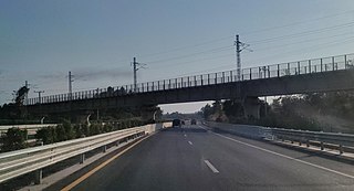
The Vientiane–Boten Expressway is a partially completed expressway between Boten, on the China–Laos border, and Vientiane, the capital of Laos. It roughly parallels Route 13.

Tham Pha Ka, or Tham Phaka, is a karst limestone river cave in Vientiane Province, Laos, located roughly 22 kilometres (14 mi) north of Muang Met. The Nam Fuang River, a tributary of the Mekong River, flows through the cave.
